See Bourne Abbey Church, South Kesteven, on the map
Directions to Bourne Abbey Church (South Kesteven) with public transport
The following transport lines have routes that pass near Bourne Abbey Church
 Bus:
Bus:
How to get to Bourne Abbey Church by bus?
Click on the bus route to see step by step directions with maps, line arrival times and updated time schedules.
Bus stations near Bourne Abbey Church in South Kesteven
- Post Office, Bourne,6 min walk,
- Austerby, Bourne,7 min walk,
- Grammar School Exit Gate, Bourne,7 min walk,
- Bus Station, Bourne,8 min walk,
Bus lines to Bourne Abbey Church in South Kesteven
- 201,Stamford,
- 202,Peterborough,
- 404,Bourne,
- 101,Bourne - Market Deeping - Peterborough,
- 102,Bourne - Deeping St James - Peterborough,
- 302,Spalding - Bourne,
- 403,Bourne - Wilsthorpe,
- 402,Bourne,
- 401,Bourne,
- 15B,Bourne,
- 16S,Spalding,
- 33,Lincoln,
- 37S,Bourne,
What are the nearest stations to Bourne Abbey Church?
The nearest stations to Bourne Abbey Church are:
- Post Office, Bourne is 399 meters away, 6 min walk.
- Austerby, Bourne is 472 meters away, 7 min walk.
- Grammar School Exit Gate, Bourne is 531 meters away, 7 min walk.
- Bus Station, Bourne is 578 meters away, 8 min walk.
Which bus lines stop near Bourne Abbey Church?
These bus lines stop near Bourne Abbey Church: 101, 201.
What’s the nearest bus stop to Bourne Abbey Church in South Kesteven?
The nearest bus stop to Bourne Abbey Church in South Kesteven is Post Office, Bourne. It’s a 6 min walk away.
See Bourne Abbey Church, South Kesteven, on the map
Public Transit to Bourne Abbey Church in South Kesteven
Wondering how to get to Bourne Abbey Church in South Kesteven, United Kingdom? Moovit helps you find the best way to get to Bourne Abbey Church with step-by-step directions from the nearest public transit station.
Moovit provides free maps and live directions to help you navigate through your city. View schedules, routes, timetables, and find out how long does it take to get to Bourne Abbey Church in real time.
Looking for the nearest stop or station to Bourne Abbey Church? Check out this list of stops closest to your destination: Post Office; Austerby; Grammar School Exit Gate; Bus Station.
Bus:
Want to see if there’s another route that gets you there at an earlier time? Moovit helps you find alternative routes or times. Get directions from and directions to Bourne Abbey Church easily from the Moovit App or Website.
We make riding to Bourne Abbey Church easy, which is why over 1.5 million users, including users in South Kesteven, trust Moovit as the best app for public transit. You don’t need to download an individual bus app or train app, Moovit is your all-in-one transit app that helps you find the best bus time or train time available.
For information on prices of bus, costs and ride fares to Bourne Abbey Church, please check the Moovit app.
Use the app to navigate to popular places including to the airport, hospital, stadium, grocery store, mall, coffee shop, school, college, and university.
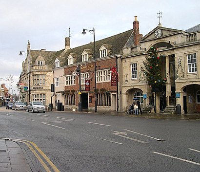
Bourne Abbey Church Address: Church Walk street in South Kesteven
Attractions near Bourne Abbey Church
Fenland Carpets & Flooring,Minster Fine Foods,Bourne United Charities,Lincolnshire County Council,Salvation Army,Abbey Road Kitchen,The Fenland Shops,Nfu Mutual,Krushr,The Barn,Chelseajim,Hospitality Inns,Uk Shalimar 1,Shalimar Balti House (Shalimar Garden),John Francis,Go & Catch Tackle Shop,Ats Euromaster,Domino's Pizza - Bourne,The,The Wellhead PracticeHow to get to popular attractions in South Kesteven with public transportation
Ikea, Broxtowe,Leicester Royal Infirmary, Leicester,Kettering General Hospital, Kettering,Virgin Active, Northampton,Billing Aquadrome, Northampton,Peterborough Power Signal Box, Peterborough,University Of Nottingham, Nottingham,Chesterfield College, Chesterfield,Kingsway Hospital, Derby,Burton Latimer, Kettering,Asda, Derby,Nettleham, West Lindsey,The Samuel Hall (Wetherspoon), Nottingham,Tesco Hamilton Petrol Station, Leicester,Hucknall Tram Stop, Ashfield,Sport Park Loughborough University, Charnwood,Outwood Academy Newbold, Chesterfield,Linney Group Ltd., Mansfield,Lidl, Peterborough,RAF Wittering, PeterboroughGet around South Kesteven by public transport!
Travelling around South Kesteven has never been so easy. See step by step directions as you travel to any attraction, street or major public transport station. View bus and train timetables, arrival times, service alerts and detailed routes on a map, so you know exactly how to get to anywhere in South Kesteven.
When travelling to any destination around South Kesteven use Moovit's Live Directions with Get Off Notifications to know exactly where and how far to walk, how long to wait for your line , and how many stops are left. Moovit will alert you when it’s time to get off — no need to constantly re-check whether yours is the next stop.
Wondering how to use public transport in South Kesteven or how to pay for public transport in South Kesteven? Moovit public transport app can help you navigate your way with public transport easily, and at minimum cost. It includes public transport fees, ticket prices, and costs. Looking for a map of South Kesteven public transport lines? Moovit public transport app shows all public transport maps in South Kesteven with all bus routes and stops on an interactive map.
South Kesteven has 1 transport type(s), including: bus, operated by several transport agencies, including National Rail, Ashbourne Community Transport, Delaine Buses, Arriva Midlands, Centrebus, Our Centre, Hulleys of Baslow, D & G Bus, Stagecoach East Midlands, North Lincolnshire Council, National Rail, Roberts Coaches, Lawson's of Corby, Hawkes Coaches and East Yorkshire