The Most Popular Urban Mobility App in Bowen Hills.
All local mobility options in one app
The following transport lines have routes that pass near Bowen Hills
Click on the bus route to see step by step directions with maps, line arrival times and updated time schedules.
Click on the train route to see step by step directions with maps, line arrival times and updated time schedules.
The nearest stations to Bowen Hills are:
These bus lines stop near Bowen Hills: 300, 301, 340
These train lines stop near Bowen Hills: AIRP, BNSH, CLEV, FERN, IPSW, REDC
The nearest train station to Bowen Hills is Bowen Hills Station. It’s a 12 min walk away.
The nearest bus stops to Bowen Hills are Breakfast Creek Rd at Riverpark Stop 9 and Skyring Tce Near Cunningham St. The closest one is a 3 min walk away.
The nearest ferry station to Bowen Hills is Teneriffe Ferry Terminal. It’s a 27 min walk away.
The AIRP is the first train that goes to Bowen Hills. It stops nearby at 03:42.
The BEEN is the last train that goes to Bowen Hills. It stops nearby at 00:18.
The R591 is the first bus that goes to Bowen Hills. It stops nearby at 03:01.
The R296 is the last bus that goes to Bowen Hills. It stops nearby at 01:06.
The BULIMBA TO TENERIFFE CROSS RIVER FERRY is the first ferry that goes to Bowen Hills. It stops nearby at 06:10.
The BULIMBA TO TENERIFFE CROSS RIVER FERRY is the last ferry that goes to Bowen Hills. It stops nearby at 23:50.
The bus fare to Bowen Hills costs about $2.84 - $4.34.
The train fare to Bowen Hills costs about $2.84 - $43.94.
Wondering how to get to Bowen Hills, Australia? Moovit helps you find the best way to get to Bowen Hills with step-by-step directions from the nearest public transit station.
Moovit provides free maps and live directions to help you navigate through your city. View schedules, routes, timetables, and find out how long does it take to get to Bowen Hills in real time.
Looking for the nearest stop or station to Bowen Hills? Check out this list of stops closest to your destination: Breakfast Creek Rd at Riverpark Stop 9; Skyring Tce Near Cunningham St; Abbotsford Rd at Montpelier Road Stop 12/13; Abbotsford Rd At Bowen Hills Near Edgar St; Bowen Hills Station; Teneriffe Ferry Terminal.
Bus:Train:Ferry:
Want to see if there’s another route that gets you there at an earlier time? Moovit helps you find alternative routes or times. Get directions from and directions to Bowen Hills easily from the Moovit App or Website.
We make riding to Bowen Hills easy, which is why over 1.5 million users, including users in Bowen Hills, trust Moovit as the best app for public transit. You don’t need to download an individual bus app or train app, Moovit is your all-in-one transit app that helps you find the best bus time or train time available.
For information on prices of bus and train, costs and ride fares to Bowen Hills, please check the Moovit app.
Use the app to navigate to popular places including to the airport, hospital, stadium, grocery store, mall, coffee shop, school, college, and university.
Bowen Hills Address: Boyd Street street in Bowen Hills
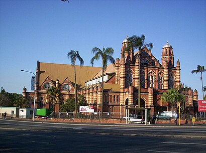
Bowen Hills is an inner north-eastern suburb in the City of Brisbane, Queensland, Australia. In the 2021 census, Bowen Hills had a population of 4,898 people.Wiki
Travelling around Bowen Hills has never been so easy. See step by step directions as you travel to any attraction, street or major public transport station. View bus and train timetables, arrival times, service alerts and detailed routes on a map, so you know exactly how to get to anywhere in Bowen Hills.
When travelling to any destination around Bowen Hills use Moovit's Live Directions with Get Off Notifications to know exactly where and how far to walk, how long to wait for your line , and how many stops are left. Moovit will alert you when it’s time to get off — no need to constantly re-check whether yours is the next stop.
Wondering how to use public transport in Bowen Hills or how to pay for public transport in Bowen Hills? Moovit public transport app can help you navigate your way with public transport easily, and at minimum cost. It includes public transport fees, ticket prices, and costs. Looking for a map of Bowen Hills public transport lines? Moovit public transport app shows all public transport maps in Bowen Hills with all bus or train routes and stops on an interactive map.
Bowen Hills has 2 transport type(s), including: bus or train, operated by several transport agencies, including TransLink SEQ, TransLink, TransLink, TransLink, Christensens Bus and Coach, North Stradbroke Island Buses and Griffith Uni Intercampus bus