Directions to Bridgend Station with public transportation
The following transport lines have routes that pass near Bridgend Station
How to get to Bridgend Station by bus?
Click on the bus route to see step by step directions with maps, line arrival times and updated time schedules.
How to get to Bridgend Station by train?
Click on the train route to see step by step directions with maps, line arrival times and updated time schedules.
Bus stops near Bridgend Station
- Station Hill, Bridgend, 3 min walk,
- Nolton Street, Bridgend, 4 min walk,
- Bus Station, Bridgend, 5 min walk,
Bus routes to Bridgend Station
- 64, Bridgend - Talbot Green,
- 404, Pontypridd - Bridgend,
- 404, Pontypridd - Bridgend via Royal Glamorgan Hospital,
- 303, Bridgend,
- X1, Bridgend,
- X2, Cardiff,
- 68, Bridgend,
- 69, Bridgend,
- 72, Blaengarw,
- 70, Maesteg,
- 71, Bridgend,
- 73, Bridgend,
- 74, Bridgend,
What are the nearest stations to Bridgend Station?
The nearest stations to Bridgend Station are:
- Station Hill, Bridgend is 210 meters away, 3 min walk.
- Nolton Street, Bridgend is 269 meters away, 4 min walk.
- Bus Station, Bridgend is 355 meters away, 5 min walk.
Which bus lines stop near Bridgend Station?
These bus lines stop near Bridgend Station: 404, T1C.
Which train lines stop near Bridgend Station?
These train lines stop near Bridgend Station: GREAT WESTERN RAILWAY, TRANSPORT FOR WALES.
What’s the nearest bus stop to Bridgend Station?
The nearest bus stop to Bridgend Station is Station Hill, Bridgend. It’s a 3 min walk away.
What time is the first bus to Bridgend Station?
The 303 is the first bus that goes to Bridgend Station. It stops nearby at 06:00.
What time is the last bus to Bridgend Station?
The 303 is the last bus that goes to Bridgend Station. It stops nearby at 23:35.
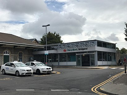
See Bridgend Station on the map
Public Transportation to Bridgend Station
Wondering how to get to Bridgend Station, United Kingdom? Moovit helps you find the best way to get to Bridgend Station with step-by-step directions from the nearest public transit station.
Moovit provides free maps and live directions to help you navigate through your city. View schedules, routes, timetables, and find out how long does it take to get to Bridgend Station in real time.
Looking for the nearest stop or station to Bridgend Station? Check out this list of stops closest to your destination: Station Hill; Nolton Street; Bus Station.
Bus: 404, T1C, 64, 303, X1, X2, 70, 71, 73, 74, 68, 69, 72.Train: GREAT WESTERN RAILWAY, TRANSPORT FOR WALES.
Want to see if there’s another route that gets you there at an earlier time? Moovit helps you find alternative routes or times. Get directions from and directions to Bridgend Station easily from the Moovit App or Website.
We make riding to Bridgend Station easy, which is why over 1.5 million users, including users in Bridgend, trust Moovit as the best app for public transit. You don’t need to download an individual bus app or train app, Moovit is your all-in-one transit app that helps you find the best bus time or train time available.
For information on prices of train and bus, costs and ride fares to Bridgend Station, please check the Moovit app.
Use the app to navigate to popular places including to the airport, hospital, stadium, grocery store, mall, coffee shop, school, college, and university.
Location: Bridgend, Wales
Attractions near Bridgend Station
Pen-y-Bont/Bridgend,Cf31 1bb,Bridgend Railway Station (BGN),Bridgend Station Car Park,Sax,Motability Scheme At Sinclair Volkswagen Bridgend,Ace Roofing Services,P.J. Extractions Wales,Homestyle Interiors,Media Wales,A J Guttridge,Xin an Limited,Regenerate,Brackla House,SM Contractors RTD Limited,Valley Windows and Repairs,GREGGS,Saphire Brigend,Phoenix,Pen-y-bont ar OgwrHow to get to popular attractions in Bridgend with public transportation
Canton, Cardiff,St Asaph Business Park, Denbighshire,Costco, Cardiff,Alexandra Gate, Cardiff,Penarth Pier, The Vale Of Glamorgan,Morriston, Swansea,Infinity trampoline park, Cardiff,Clarach Bay,St Brides, Pembrokeshire,Denbighshire Memorial Park And Crematorium, Denbighshire,Millennium Stadium, Cardiff,Llandudno Hospital, Conwy,Ysbyty Gwynedd, Gwynedd,Solva, Pembrokeshire,Cardigan Health Centre, Ceredigion,Kenfig Industrial Estate, Neath Port Talbot,Pentrebychan Crematorium, Wrexham,Newport Stadium, Newport,Tresaith, Ceredigion,Withybush Hospital, PembrokeshireGet around Wales by public transport!
Travelling around Wales has never been so easy. See step by step directions as you travel to any attraction, street or major public transport station. View bus and train timetables, arrival times, service alerts and detailed routes on a map, so you know exactly how to get to anywhere in Wales.
When travelling to any destination around Wales use Moovit's Live Directions with Get Off Notifications to know exactly where and how far to walk, how long to wait for your line , and how many stops are left. Moovit will alert you when it’s time to get off — no need to constantly re-check whether yours is the next stop.
Wondering how to use public transport in Wales or how to pay for public transport in Wales? Moovit public transport app can help you navigate your way with public transport easily, and at minimum cost. It includes public transport fees, ticket prices, and costs. Looking for a map of Wales public transport lines? Moovit public transport app shows all public transport maps in Wales with all Bus and Train routes and stops on an interactive map.
Wales has 2 transport type(s), including: Bus and Train, operated by several transport agencies, including National Rail, O R Jones, M & H Coaches, Peyton Travel, Gwynfor Coaches, Nefyn, Edwards Coaches, Cardiff Bus, Pembrokeshire County Council, Crickhowell Taxis, Village & Valleys Travel, South Wales Transport, Sarah Bell, Forge Travel, Phil Anslow Travel