See Brisbane Cricket Ground, Woolloongabba, on the map
Directions to Brisbane Cricket Ground (Woolloongabba) with public transport
The following transport lines have routes that pass near Brisbane Cricket Ground
 Bus:
Bus: - Train:
- Ferry:
How to get to Brisbane Cricket Ground by bus?
Click on the bus route to see step by step directions with maps, line arrival times and updated time schedules.
How to get to Brisbane Cricket Ground by train?
Click on the train route to see step by step directions with maps, line arrival times and updated time schedules.
Bus stations near Brisbane Cricket Ground in Woolloongabba
- Wellington Rd at Linton Street, Stop 11,5 min walk,
- Main St at the Fiveways, Stop 9,6 min walk,
- Main St at Linton Street, Stop 8c,6 min walk,
- Vulture St at Kennedy Street, Stop 11,6 min walk,
- Woolloongabba Station, Platform 2,7 min walk,
- Ipswich Rd at Balaclava Street, Stop 10,10 min walk,
Train stations near Brisbane Cricket Ground in Woolloongabba
- Park Road Station,18 min walk,
Ferry stations near Brisbane Cricket Ground in Woolloongabba
- Dockside Ferry Terminal,25 min walk,
- Qut Gardens Point Ferry Terminal,29 min walk,
Bus lines to Brisbane Cricket Ground in Woolloongabba
- N226,Valley - Wynnum Nightlink Via Bulimba,
- 230,Balmoral - City Via Riding Road,
- 235,Balmoral - City/valley Via Thynne Road,
- 234,Woolloongabba To City Loop,
- N154,Browns Plains Station,
- 184,Garden City - City/valley Via Mt Gravatt Central,
- N184,Valley - Garden City Nightlink Via Cavendish Road,
- 185,Garden City - City/valley Via Mansfield,
- 210,Cannon Hill - City/valley,
- 212,Carindale - City/valley Via Seven Hills,
- 29,Woolloongabba - Uq Lakes Shuttle,
- 61,Ashgrove Shops - Coorparoo Via City,
- 100,Forest Lake/inala - City,
- N100,Valley - Forest Lake Nightlink,
- 110,Inala - City,
- 113,Mt Gravatt Central - City,
- 115,Calamvale - City Via Acacia Ridge Express,
- 117,Acacia Ridge - Woolloongabba,
- 124,Sunnybank - City/valley,
- 125,Garden City - City/valley Via Salisbury,
What are the nearest stations to Brisbane Cricket Ground?
The nearest stations to Brisbane Cricket Ground are:
- Wellington Rd at Linton Street, Stop 11 is 280 meters away, 5 min walk.
- Main St at the Fiveways, Stop 9 is 321 meters away, 6 min walk.
- Main St at Linton Street, Stop 8c is 326 meters away, 6 min walk.
- Vulture St at Kennedy Street, Stop 11 is 334 meters away, 6 min walk.
- Woolloongabba Station, Platform 2 is 438 meters away, 7 min walk.
- Ipswich Rd at Balaclava Street, Stop 10 is 652 meters away, 10 min walk.
- Park Road Station is 1365 meters away, 18 min walk.
- Dockside Ferry Terminal is 1816 meters away, 25 min walk.
- Qut Gardens Point Ferry Terminal is 2115 meters away, 29 min walk.
Which bus lines stop near Brisbane Cricket Ground?
These bus lines stop near Brisbane Cricket Ground: 125, 175, 185, 200, 204, 230, 235, 61.
Which train lines stop near Brisbane Cricket Ground?
These train lines stop near Brisbane Cricket Ground: BEEN, GOLD, SHOR.
What’s the nearest train station to Brisbane Cricket Ground in Woolloongabba?
The nearest train station to Brisbane Cricket Ground in Woolloongabba is Park Road Station. It’s a 18 min walk away.
What’s the nearest bus stop to Brisbane Cricket Ground in Woolloongabba?
The nearest bus stop to Brisbane Cricket Ground in Woolloongabba is Wellington Rd at Linton Street, Stop 11. It’s a 5 min walk away.
What’s the nearest ferry station to Brisbane Cricket Ground in Woolloongabba?
The nearest ferry station to Brisbane Cricket Ground in Woolloongabba is Dockside Ferry Terminal. It’s a 25 min walk away.
What time is the first train to Brisbane Cricket Ground in Woolloongabba?
The BEEN is the first train that goes to Brisbane Cricket Ground in Woolloongabba. It stops nearby at 04:17.
What time is the last train to Brisbane Cricket Ground in Woolloongabba?
The BEEN is the last train that goes to Brisbane Cricket Ground in Woolloongabba. It stops nearby at 00:42.
What time is the first bus to Brisbane Cricket Ground in Woolloongabba?
The 61 is the first bus that goes to Brisbane Cricket Ground in Woolloongabba. It stops nearby at 05:18.
What time is the last bus to Brisbane Cricket Ground in Woolloongabba?
The 234 is the last bus that goes to Brisbane Cricket Ground in Woolloongabba. It stops nearby at 00:11.
What time is the first ferry to Brisbane Cricket Ground in Woolloongabba?
The CITY HOPPER - NORTH QUAY is the first ferry that goes to Brisbane Cricket Ground in Woolloongabba. It stops nearby at 05:38.
What time is the last ferry to Brisbane Cricket Ground in Woolloongabba?
The CITY HOPPER - NORTH QUAY is the last ferry that goes to Brisbane Cricket Ground in Woolloongabba. It stops nearby at 00:14.
How much is the train fare to Brisbane Cricket Ground?
The train fare to Brisbane Cricket Ground costs about $2.84 - $6.98.
How much is the bus fare to Brisbane Cricket Ground?
The bus fare to Brisbane Cricket Ground costs about $2.84 - $4.34.
See Brisbane Cricket Ground, Woolloongabba, on the map
Public Transit to Brisbane Cricket Ground in Woolloongabba
Wondering how to get to Brisbane Cricket Ground in Woolloongabba, Australia? Moovit helps you find the best way to get to Brisbane Cricket Ground with step-by-step directions from the nearest public transit station.
Moovit provides free maps and live directions to help you navigate through your city. View schedules, routes, timetables, and find out how long does it take to get to Brisbane Cricket Ground in real time.
Looking for the nearest stop or station to Brisbane Cricket Ground? Check out this list of stops closest to your destination: Wellington Rd at Linton Street; Main St at the Fiveways; Main St at Linton Street; Vulture St at Kennedy Street; Woolloongabba Station; Ipswich Rd at Balaclava Street; Park Road Station; Dockside Ferry Terminal; Qut Gardens Point Ferry Terminal.
Bus:Train:Ferry:
Want to see if there’s another route that gets you there at an earlier time? Moovit helps you find alternative routes or times. Get directions from and directions to Brisbane Cricket Ground easily from the Moovit App or Website.
We make riding to Brisbane Cricket Ground easy, which is why over 1.5 million users, including users in Woolloongabba, trust Moovit as the best app for public transit. You don’t need to download an individual bus app or train app, Moovit is your all-in-one transit app that helps you find the best bus time or train time available.
For information on prices of bus and train, costs and ride fares to Brisbane Cricket Ground, please check the Moovit app.
Use the app to navigate to popular places including to the airport, hospital, stadium, grocery store, mall, coffee shop, school, college, and university.
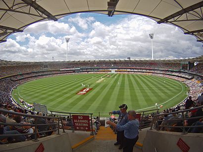
Brisbane Cricket Ground Address: Vulture Street street in Woolloongabba
Popular routes to Brisbane Cricket Ground, Woolloongabba
Attractions near Brisbane Cricket Ground
The Gabba,The Gabba ,Gabba,The Gabba Stadium,Queensland Cricketers' Club,Matt Mosh,Brisbane German Club,Secure Parking,Trafalgar Lane,Cushway Blackford & Associates,Clem 7 Southern Ventilation Structure,Substation No. 5,Uniting Church in Australia,Battery World,Thyssenkrupp Elevator Queensland,Jurgens Street Park,Telstra Woolloongabba Exchange,Gabba Market Korean Asian Grocery,Atmx Gabba Central 1,Moos 'n' Clucks Burger BarHow to get to popular attractions in Woolloongabba with public transportation
Brisbane City Hall, City,Brisbane Girls Grammar School, Spring Hill,Victoria Point Lakeside Shopping Centre, Victoria Point,Bulimba,Wynnum Plaza, Wynnum West,Browns Plains, Browns Plains,Lutwyche City, Lutwyche,Tower Of Terror II, Coomera,Griffith University Gold Coast, Southport,UQ Chancellors's Place, St Lucia,Stafford Heights, Stafford Heights,Kelvin Grove, Kelvin Grove,State Library Of Queensland, South Brisbane,Macleay Island,Cultural Centre Platform 1, South Brisbane,Broadwater Parklands, Southport,Toowong Village Shopping Centre, Toowong,Cavendish Road State High School, Holland Park,UQ Lakes Stop C, St Lucia,Clayfield College, ClayfieldGet around Woolloongabba by public transport!
Travelling around Woolloongabba has never been so easy. See step by step directions as you travel to any attraction, street or major public transport station. View bus and train timetables, arrival times, service alerts and detailed routes on a map, so you know exactly how to get to anywhere in Woolloongabba.
When travelling to any destination around Woolloongabba use Moovit's Live Directions with Get Off Notifications to know exactly where and how far to walk, how long to wait for your line , and how many stops are left. Moovit will alert you when it’s time to get off — no need to constantly re-check whether yours is the next stop.
Wondering how to use public transport in Woolloongabba or how to pay for public transport in Woolloongabba? Moovit public transport app can help you navigate your way with public transport easily, and at minimum cost. It includes public transport fees, ticket prices, and costs. Looking for a map of Woolloongabba public transport lines? Moovit public transport app shows all public transport maps in Woolloongabba with all bus or train routes and stops on an interactive map.
Woolloongabba has 2 transport type(s), including: bus or train, operated by several transport agencies, including TransLink SEQ, TransLink, TransLink, TransLink, Christensens Bus and Coach, North Stradbroke Island Buses and Griffith Uni Intercampus bus