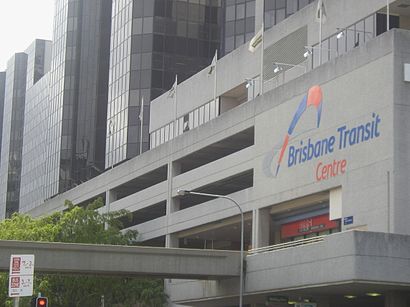
Directions to Brisbane Transit Centre (City) with public transport
The following transport lines have routes that pass near Brisbane Transit Centre
How to get to Brisbane Transit Centre by bus?
Click on the bus route to see step by step directions with maps, line arrival times and updated time schedules.
How to get to Brisbane Transit Centre by train?
Click on the train route to see step by step directions with maps, line arrival times and updated time schedules.
Bus stations near Brisbane Transit Centre in City
- Roma Street Busway, Platform 2,2 min walk,
- Roma Street Stop 121 at Police Hq,2 min walk,
- Roma Street Stop 122 Near Garrick St,3 min walk,
- North Quay Stop 106 Near Herschel St,5 min walk,
- Herschel Street Stop 1 Near North Quay,5 min walk,
- Roma St at Upper Roma Street, Stop 3,5 min walk,
- Countess Street Busway Holding,7 min walk,
- Wickham Terrace Stop 132 at Gazebo,10 min walk,
Ferry stations near Brisbane Transit Centre in City
- South Bank Ferry Terminal,18 min walk,
Train stations near Brisbane Transit Centre in City
- South Brisbane Station,27 min walk,
- Central Station,35 min walk,
Bus lines to Brisbane Transit Centre in City
- EK1,Herston - Woolloongabba Via City,
- 61,Ashgrove Shops - Coorparoo Via City,
- 66,Uq Lakes - Rbwh Via City,
- 111,Eight Mile Plains - City,
- 222,Carindale - City Express Via Eastern Busway,
- 325,Boondall - City Express,
- 330,Bracken Ridge - City Express,
- 333,Chermside - City,
- 340,Carseldine - Woolloongabba Express Via City,
- P343,Aspley - City Pre-paid Rocket,
- 345,Aspley - City Express Via Maundrell Terrace,
- 351,Aspley - City Rocket Via Bridgeman Downs,
- 357,Brendale - City Express,
- 359,Eatonvale - City Express Via Albany Village,
- 363,Herston - City,
- 376,Stafford - City Express,
- 377,Ashgrove - City Via Kennedy Terrace,
- 378,Ashgrove - City Via Arthur Terrace,
- 382,The Gap - City Rocket Via Settlement Road,
- 383,The Gap - City Rocket Via Payne Road,
What are the nearest stations to Brisbane Transit Centre?
The nearest stations to Brisbane Transit Centre are:
- Roma Street Busway, Platform 2 is 61 meters away, 2 min walk.
- Roma Street Stop 121 at Police Hq is 79 meters away, 2 min walk.
- Roma Street Stop 122 Near Garrick St is 147 meters away, 3 min walk.
- North Quay Stop 106 Near Herschel St is 279 meters away, 5 min walk.
- Herschel Street Stop 1 Near North Quay is 284 meters away, 5 min walk.
- Roma St at Upper Roma Street, Stop 3 is 336 meters away, 5 min walk.
- Countess Street Busway Holding is 483 meters away, 7 min walk.
- Wickham Terrace Stop 132 at Gazebo is 696 meters away, 10 min walk.
- South Bank Ferry Terminal is 1317 meters away, 18 min walk.
- South Brisbane Station is 2055 meters away, 27 min walk.
- Central Station is 2725 meters away, 35 min walk.
Which bus lines stop near Brisbane Transit Centre?
These bus lines stop near Brisbane Transit Centre: 222, 333, 385, 450, 61, 66, R591.
Which train lines stop near Brisbane Transit Centre?
These train lines stop near Brisbane Transit Centre: BEEN, DOOM, SPRI.
What’s the nearest train station to Brisbane Transit Centre in City?
The nearest train station to Brisbane Transit Centre in City is South Brisbane Station. It’s a 27 min walk away.
What’s the nearest bus stop to Brisbane Transit Centre in City?
The nearest bus stops to Brisbane Transit Centre in City are Roma Street Busway, Platform 2 and Roma Street Stop 121 at Police Hq. The closest one is a 2 min walk away.
What’s the nearest ferry station to Brisbane Transit Centre in City?
The nearest ferry station to Brisbane Transit Centre in City is South Bank Ferry Terminal. It’s a 18 min walk away.
What time is the first train to Brisbane Transit Centre in City?
The CABO is the first train that goes to Brisbane Transit Centre in City. It stops nearby at 03:42.
What time is the last train to Brisbane Transit Centre in City?
The SHOR is the last train that goes to Brisbane Transit Centre in City. It stops nearby at 00:21.
What time is the first bus to Brisbane Transit Centre in City?
The 61 is the first bus that goes to Brisbane Transit Centre in City. It stops nearby at 03:00.
What time is the last bus to Brisbane Transit Centre in City?
The 111 is the last bus that goes to Brisbane Transit Centre in City. It stops nearby at 23:51.
What time is the first ferry to Brisbane Transit Centre in City?
The CITY HOPPER - NORTH QUAY is the first ferry that goes to Brisbane Transit Centre in City. It stops nearby at 05:45.
What time is the last ferry to Brisbane Transit Centre in City?
The CITY HOPPER - NORTH QUAY is the last ferry that goes to Brisbane Transit Centre in City. It stops nearby at 00:20.
How much is the train fare to Brisbane Transit Centre?
The train fare to Brisbane Transit Centre costs about $2.84 - $6.63.
How much is the bus fare to Brisbane Transit Centre?
The bus fare to Brisbane Transit Centre costs about $2.84 - $4.34.
See Brisbane Transit Centre, City, on the map
Public Transit to Brisbane Transit Centre in City
Wondering how to get to Brisbane Transit Centre in City, Australia? Moovit helps you find the best way to get to Brisbane Transit Centre with step-by-step directions from the nearest public transit station.
Moovit provides free maps and live directions to help you navigate through your city. View schedules, routes, timetables, and find out how long does it take to get to Brisbane Transit Centre in real time.
Looking for the nearest stop or station to Brisbane Transit Centre? Check out this list of stops closest to your destination: Roma Street Busway; Roma Street Stop 121 at Police Hq; Roma Street Stop 122 Near Garrick St; North Quay Stop 106 Near Herschel St; Herschel Street Stop 1 Near North Quay; Roma St at Upper Roma Street; Countess Street Busway Holding; Wickham Terrace Stop 132 at Gazebo; South Bank Ferry Terminal; South Brisbane Station; Central Station.
Bus:2223333854506166R591EK1111375379380381N392470475476Train:BEENDOOMSPRIAIRPBRBRBRSHCLEVCABOIPSWREDCSUNSFerry:CITY CAT DOWNSTREAM - NORTHSHORE HAMILTONCITY CAT UPSTREAM - UQCITY HOPPER - NORTH QUAYCITY HOPPER - SYDNEY STREET
Want to see if there’s another route that gets you there at an earlier time? Moovit helps you find alternative routes or times. Get directions from and directions to Brisbane Transit Centre easily from the Moovit App or Website.
We make riding to Brisbane Transit Centre easy, which is why over 1.5 million users, including users in City, trust Moovit as the best app for public transit. You don’t need to download an individual bus app or train app, Moovit is your all-in-one transit app that helps you find the best bus time or train time available.
For information on prices of bus and train, costs and ride fares to Brisbane Transit Centre, please check the Moovit app.
Use the app to navigate to popular places including to the airport, hospital, stadium, grocery store, mall, coffee shop, school, college, and university.
Location: City, Brisbane
Attractions near Brisbane Transit Centre
Cross River Rail Construction Site,The Roma Trust,Brisbane Roma St Bus Stop,159 Roma Street Car Park,Thirsty Critters Microbrewery Tours,Unique Persian Taste,Sixteen Antlers Rooftop Bar,Shakas Adventure Tours,Crisps Coaches,Roma St Stop 121,Roma Street Busway Station,Roma Street busway, platform 1,Roma Street Stop 125 at Transit Centre,Bus Stop 125 Roma Street,DHL Express Roma Street,Roma St - Roma Street Stop 126,Brisbane Roma Street,Chez Nous Cafe,QLD Rail and Ticketing,Brisbane, Platform 3How to get to popular attractions in City with public transportation
Inala Plaza, Inala,Surfers Paradise,Carindale, Carindale,Chermside, Chermside,Toombul Shopping Centre, Nundah,Carindale Library, Carindale,Cultural Centre Platform 1, South Brisbane,Whites Hill State College, Camp Hill,Bracken Ridge, Bracken Ridge,State Library Of Queensland, South Brisbane,Burleigh Heads, Burleigh Heads,Pick'N Pay Hypermarket, Aspley,Myer Centre, City,Queensland Children's Hospital, South Brisbane,Logan Hyperdome, Shailer Park,Cavendish Road State High School, Holland Park,Broadwater Parklands, Southport,Snapper Rocks Beach,Belmont Tavern, Belmont,Macleay IslandGet around City by public transport!
Travelling around City has never been so easy. See step by step directions as you travel to any attraction, street or major public transport station. View bus and train timetables, arrival times, service alerts and detailed routes on a map, so you know exactly how to get to anywhere in City.
When travelling to any destination around City use Moovit's Live Directions with Get Off Notifications to know exactly where and how far to walk, how long to wait for your line , and how many stops are left. Moovit will alert you when it’s time to get off — no need to constantly re-check whether yours is the next stop.
Wondering how to use public transport in City or how to pay for public transport in City? Moovit public transport app can help you navigate your way with public transport easily, and at minimum cost. It includes public transport fees, ticket prices, and costs. Looking for a map of City public transport lines? Moovit public transport app shows all public transport maps in City with all bus or train routes and stops on an interactive map.
City has 2 transport type(s), including: bus or train, operated by several transport agencies, including TransLink SEQ, TransLink, TransLink, TransLink, Christensens Bus and Coach, North Stradbroke Island Buses and Griffith Uni Intercampus bus