See Britannia Pier, Great Yarmouth, on the map
Directions to Britannia Pier (Great Yarmouth) with public transport
The following transport lines have routes that pass near Britannia Pier
 Bus:
Bus: - Train:
How to get to Britannia Pier by bus?
Click on the bus route to see step by step directions with maps, line arrival times and updated time schedules.
How to get to Britannia Pier by train?
Click on the train route to see step by step directions with maps, line arrival times and updated time schedules.
Bus stations near Britannia Pier in Great Yarmouth
- Britannia Pier, Great Yarmouth,2 min walk,
- Marina Centre, Great Yarmouth,7 min walk,
- St George's Park, Great Yarmouth,8 min walk,
- Well Street, Great Yarmouth,8 min walk,
- Market Gates, Great Yarmouth,9 min walk,
Bus lines to Britannia Pier in Great Yarmouth
- 1C,Great Yarmouth,
- 100,Great Yarmouth,
- TS21,Thetford,
- 2,James Paget Hospital,
- 3,Great Yarmouth,
- 3B,Great Yarmouth,
- BM11,Holton,
- TS11,Great Yarmouth,
- 271,Caister-On-Sea,
- X1,Norwich City Centre,
- 7,James Paget Hospital,
- X11,Great Yarmouth,
What are the nearest stations to Britannia Pier?
The nearest stations to Britannia Pier are:
- Britannia Pier, Great Yarmouth is 99 meters away, 2 min walk.
- Marina Centre, Great Yarmouth is 478 meters away, 7 min walk.
- St George's Park, Great Yarmouth is 548 meters away, 8 min walk.
- Well Street, Great Yarmouth is 590 meters away, 8 min walk.
- Market Gates, Great Yarmouth is 644 meters away, 9 min walk.
Which bus lines stop near Britannia Pier?
These bus lines stop near Britannia Pier: 1, 3, 983, X1, X11, X6.
Which train line stops near Britannia Pier?
GREATER ANGLIA
What’s the nearest bus stop to Britannia Pier in Great Yarmouth?
The nearest bus stop to Britannia Pier in Great Yarmouth is Britannia Pier, Great Yarmouth. It’s a 2 min walk away.
What time is the first bus to Britannia Pier in Great Yarmouth?
The BM11 is the first bus that goes to Britannia Pier in Great Yarmouth. It stops nearby at 03:00.
What time is the last bus to Britannia Pier in Great Yarmouth?
The BM11 is the last bus that goes to Britannia Pier in Great Yarmouth. It stops nearby at 03:00.
See Britannia Pier, Great Yarmouth, on the map
Public Transit to Britannia Pier in Great Yarmouth
Wondering how to get to Britannia Pier in Great Yarmouth, United Kingdom? Moovit helps you find the best way to get to Britannia Pier with step-by-step directions from the nearest public transit station.
Moovit provides free maps and live directions to help you navigate through your city. View schedules, routes, timetables, and find out how long does it take to get to Britannia Pier in real time.
Looking for the nearest stop or station to Britannia Pier? Check out this list of stops closest to your destination: Britannia Pier; Marina Centre; St George's Park; Well Street; Market Gates.
Bus:Train:
Want to see if there’s another route that gets you there at an earlier time? Moovit helps you find alternative routes or times. Get directions from and directions to Britannia Pier easily from the Moovit App or Website.
We make riding to Britannia Pier easy, which is why over 1.5 million users, including users in Great Yarmouth, trust Moovit as the best app for public transit. You don’t need to download an individual bus app or train app, Moovit is your all-in-one transit app that helps you find the best bus time or train time available.
For information on prices of bus and train, costs and ride fares to Britannia Pier, please check the Moovit app.
Use the app to navigate to popular places including to the airport, hospital, stadium, grocery store, mall, coffee shop, school, college, and university.
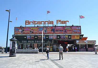
Britannia Pier Address: Marine Parade street in Great Yarmouth
Britannia Pier is a pier located at the seaside town of Great Yarmouth in the English county of Norfolk.Wiki
Attractions near Britannia Pier
Joyland,Dotto train,New Beach Hotel,Scroby Sands Wind Farm Visitor Centre,Scroby Sands Boat tour,Chico's Restaurant,The Prom Hotel,Darling Darlings Cat Lounge,The Jube,Something Different,Chopstix,Waverley Hotel Great Yarmouth,Mr Wobbles,Sky's House,Wellesley Road, Adj,Ooshi Bubble Tea World,The Sea Front,Jetty Refreshments,The Burger Bar,Pleasure & Leisure CorHow to get to popular attractions in Great Yarmouth with public transportation
The Range, Ipswich,Outwell, King'S Lynn And West Norfolk,Mulbarton, South Norfolk,Belstead Brook Hotel, Ipswich,Milsoms, Kesgrave Hall, Suffolk Coastal,GO Outdoors, Norwich,Woolpit, Mid Suffolk,Fat Cat Brewery Tap, Norwich,Assembly House, Norwich,Cringleford, South Norfolk,Gislingham, Mid Suffolk,Downham Market, King'S Lynn And West Norfolk,Cambridge School of Visual & Performing Arts, Cambridge,Sawtry community college, Huntingdonshire,Hellesdon, Norwich,John Lewis at Home, Ipswich,Harfreys Industrial Estate, Great Yarmouth,Aldi, Norwich,Oak Lane Car Park Woodbridge Suffolk, Suffolk Coastal,Burwash Manor, South CambridgeshireGet around Great Yarmouth by public transport!
Travelling around Great Yarmouth has never been so easy. See step by step directions as you travel to any attraction, street or major public transport station. View bus and train timetables, arrival times, service alerts and detailed routes on a map, so you know exactly how to get to anywhere in Great Yarmouth.
When travelling to any destination around Great Yarmouth use Moovit's Live Directions with Get Off Notifications to know exactly where and how far to walk, how long to wait for your line , and how many stops are left. Moovit will alert you when it’s time to get off — no need to constantly re-check whether yours is the next stop.
Wondering how to use public transport in Great Yarmouth or how to pay for public transport in Great Yarmouth? Moovit public transport app can help you navigate your way with public transport easily, and at minimum cost. It includes public transport fees, ticket prices, and costs. Looking for a map of Great Yarmouth public transport lines? Moovit public transport app shows all public transport maps in Great Yarmouth with all bus or train routes and stops on an interactive map.
Great Yarmouth has 2 transport type(s), including: bus or train, operated by several transport agencies, including National Rail, Ambassador Travel, Harwich Harbour Ferry, Stephensons of Essex, Villager Minibus Sharnbrook, The Voluntary Network, Dews Coaches, Lord's Travel, Felixstowe Ferry Boat Yard, Hadleigh Community Transport, Beestons, Fenland Association for Community Transport, First Norfolk & Suffolk, National Rail and Mulleys Motorways