See British Muslim Heritage Centre, Manchester, on the map
Directions to British Muslim Heritage Centre (Manchester) with public transport
The following transport lines have routes that pass near British Muslim Heritage Centre
 Bus:
Bus: - Train:
- Light rail:
How to get to British Muslim Heritage Centre by bus?
Click on the bus route to see step by step directions with maps, line arrival times and updated time schedules.
How to get to British Muslim Heritage Centre by train?
Click on the train route to see step by step directions with maps, line arrival times and updated time schedules.
How to get to British Muslim Heritage Centre by light rail?
Click on the light rail route to see step by step directions with maps, line arrival times and updated time schedules.
Light Rail stations near British Muslim Heritage Centre in Manchester
- St Werburgh's Road (Manchester Metrolink),4 min walk,
Bus stations near British Muslim Heritage Centre in Manchester
- St Werburgh's (Stop D),7 min walk,
- College Road,11 min walk,
Bus lines to British Muslim Heritage Centre in Manchester
- 85,Chorlton,
- 85A,Arrowfield Estate,
- 150,Gorton,
- 150,The Trafford Centre,
- 86,Sale,
What are the nearest stations to British Muslim Heritage Centre?
The nearest stations to British Muslim Heritage Centre are:
- St Werburgh's Road (Manchester Metrolink) is 258 meters away, 4 min walk.
- St Werburgh's (Stop D) is 506 meters away, 7 min walk.
- College Road is 778 meters away, 11 min walk.
Which bus line stops near British Muslim Heritage Centre?
86
Which train line stops near British Muslim Heritage Centre?
NORTHERN
Which light rail line stops near British Muslim Heritage Centre?
PINK LINE
What’s the nearest light rail station to British Muslim Heritage Centre in Manchester?
The nearest light rail station to British Muslim Heritage Centre in Manchester is St Werburgh's Road (Manchester Metrolink). It’s a 4 min walk away.
What’s the nearest bus stop to British Muslim Heritage Centre in Manchester?
The nearest bus stop to British Muslim Heritage Centre in Manchester is St Werburgh's (Stop D). It’s a 7 min walk away.
What time is the first light rail to British Muslim Heritage Centre in Manchester?
The NAVY LINE is the first light rail that goes to British Muslim Heritage Centre in Manchester. It stops nearby at 05:04.
What time is the last light rail to British Muslim Heritage Centre in Manchester?
The NAVY LINE is the last light rail that goes to British Muslim Heritage Centre in Manchester. It stops nearby at 00:55.
What time is the first bus to British Muslim Heritage Centre in Manchester?
The 86 is the first bus that goes to British Muslim Heritage Centre in Manchester. It stops nearby at 05:08.
What time is the last bus to British Muslim Heritage Centre in Manchester?
The 85 is the last bus that goes to British Muslim Heritage Centre in Manchester. It stops nearby at 00:35.
See British Muslim Heritage Centre, Manchester, on the map
Public Transit to British Muslim Heritage Centre in Manchester
Wondering how to get to British Muslim Heritage Centre in Manchester, United Kingdom? Moovit helps you find the best way to get to British Muslim Heritage Centre with step-by-step directions from the nearest public transit station.
Moovit provides free maps and live directions to help you navigate through your city. View schedules, routes, timetables, and find out how long does it take to get to British Muslim Heritage Centre in real time.
Looking for the nearest stop or station to British Muslim Heritage Centre? Check out this list of stops closest to your destination: St Werburgh's Road (Manchester Metrolink); St Werburgh's (Stop D); College Road.
Bus:Train:Light rail:
Want to see if there’s another route that gets you there at an earlier time? Moovit helps you find alternative routes or times. Get directions from and directions to British Muslim Heritage Centre easily from the Moovit App or Website.
We make riding to British Muslim Heritage Centre easy, which is why over 1.5 million users, including users in Manchester, trust Moovit as the best app for public transit. You don’t need to download an individual bus app or train app, Moovit is your all-in-one transit app that helps you find the best bus time or train time available.
For information on prices of bus, light rail and train, costs and ride fares to British Muslim Heritage Centre, please check the Moovit app.
Use the app to navigate to popular places including to the airport, hospital, stadium, grocery store, mall, coffee shop, school, college, and university.
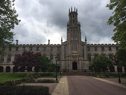
British Muslim Heritage Centre Address: College Road street in Manchester
Attractions near British Muslim Heritage Centre
M16 8bp,The Mylahore Marquee,College Road,Dessert Stop,A Delivery Services,JRLT Limited,Comms by Pear,British Muslim Heritage Centre,M16 8be,Brick House Developments Limited,Chand Superstore,Carlton Club,St Margaret's Ce Primary School,Tibetan Kitchen,Manley Park Primary School (Juniors),MHM Butchers,77 Manley Road,Upper Chorlton Road Army Reserve Centre,Whalley Range,New York New YorkHow to get to popular attractions in Manchester with public transportation
North Manchester General Hospital, Manchester,The Manchester Museum, Manchester,Withington, Manchester,Alder Hey Children's Hospital (Abandoned), Liverpool,Manchester Academy, Manchester,Lomeshaye Industrial Estate, Nelson,David Lloyd Liverpool Speke, Garston,Swinton, Swinton,Chorlton Street, Manchester,Clatterbridge Hospital, Bromborough,O2 Apollo Manchester, Manchester,Eccles College (Salford City College), Swinton,Chorlton High School, Manchester,Anchorage Metrolink Station, Salford,Merseyway Shopping Centre, Stockport,Cheetham Hill, Manchester,Stopford Building, Manchester,Boots, Trafford Park,Doubletree by Hilton Manchester Airport, Manchester,Bolton Town Hall, BoltonGet around Manchester by public transport!
Travelling around Manchester has never been so easy. See step by step directions as you travel to any attraction, street or major public transport station. View bus and train timetables, arrival times, service alerts and detailed routes on a map, so you know exactly how to get to anywhere in Manchester.
When travelling to any destination around Manchester use Moovit's Live Directions with Get Off Notifications to know exactly where and how far to walk, how long to wait for your line , and how many stops are left. Moovit will alert you when it’s time to get off — no need to constantly re-check whether yours is the next stop.
Wondering how to use public transport in Manchester or how to pay for public transport in Manchester? Moovit public transport app can help you navigate your way with public transport easily, and at minimum cost. It includes public transport fees, ticket prices, and costs. Looking for a map of Manchester public transport lines? Moovit public transport app shows all public transport maps in Manchester with all bus, light rail or train routes and stops on an interactive map.
Manchester has 3 transport type(s), including: bus, light rail or train, operated by several transport agencies, including Stagecoach Manchester, Arriva North West, Diamond Bus North West, Stagecoach Merseyside and South Lancashire, Stagecoach Cumbria and North Lancashire, First Greater Manchester, First Halifax, National Express, Warrington's Own Buses, First Potteries, Rosso, Blackpool Transport, Blackpool Transport, The Blackburn Bus Company and The Burnley Bus Company