Directions to Brockley Primary School (Bolsover) with public transport
The following transport lines have routes that pass near Brockley Primary School
How to get to Brockley Primary School by bus?
Click on the bus route to see step by step directions with maps, line arrival times and updated time schedules.
Bus stations near Brockley Primary School in Bolsover
- Wyandotte Farm, Shuttlewood, 2 min walk,
- Travellers Close, Shuttlewood, 4 min walk,
Bus lines to Brockley Primary School in Bolsover
- 53, Mansfield,
- 53A, Bolsover,
- 583A, Arkwright Town,
- 90, Chesterfield,
What are the nearest stations to Brockley Primary School?
The nearest stations to Brockley Primary School are:
- Wyandotte Farm, Shuttlewood is 90 meters away, 2 min walk.
- Travellers Close, Shuttlewood is 274 meters away, 4 min walk.
Which bus lines stop near Brockley Primary School?
These bus lines stop near Brockley Primary School: 1, 53A, 77A.
What’s the nearest bus stop to Brockley Primary School in Bolsover?
The nearest bus stop to Brockley Primary School in Bolsover is Wyandotte Farm, Shuttlewood. It’s a 2 min walk away.
What time is the first bus to Brockley Primary School in Bolsover?
The 53A is the first bus that goes to Brockley Primary School in Bolsover. It stops nearby at 08:32.
What time is the last bus to Brockley Primary School in Bolsover?
The 53A is the last bus that goes to Brockley Primary School in Bolsover. It stops nearby at 19:42.
See Brockley Primary School, Bolsover, on the map
Public Transit to Brockley Primary School in Bolsover
Wondering how to get to Brockley Primary School in Bolsover, United Kingdom? Moovit helps you find the best way to get to Brockley Primary School with step-by-step directions from the nearest public transit station.
Moovit provides free maps and live directions to help you navigate through your city. View schedules, routes, timetables, and find out how long does it take to get to Brockley Primary School in real time.
Looking for the nearest stop or station to Brockley Primary School? Check out this list of stops closest to your destination: Wyandotte Farm; Travellers Close.
Bus: 1, 53A, 77A, 53, 583A, 90.
Want to see if there’s another route that gets you there at an earlier time? Moovit helps you find alternative routes or times. Get directions from and directions to Brockley Primary School easily from the Moovit App or Website.
We make riding to Brockley Primary School easy, which is why over 1.5 million users, including users in Bolsover, trust Moovit as the best app for public transit. You don’t need to download an individual bus app or train app, Moovit is your all-in-one transit app that helps you find the best bus time or train time available.
For information on prices of bus, costs and ride fares to Brockley Primary School, please check the Moovit app.
Use the app to navigate to popular places including to the airport, hospital, stadium, grocery store, mall, coffee shop, school, college, and university.
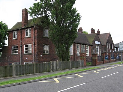
Brockley Primary School Address: Clowne Road street in Bolsover
Attractions near Brockley Primary School
Brockley Primary School,Geotechnix,Top Nosh,Chesterfield Gasco,Agar Soft Drinks,Be Sparkled Boutique,Gud Muzik,Travellers Close,Odds and Sods,Shuttlewood,Hasiats,Think Jessica,Shuttlewood Post Office,Post Office,Kings Newsagents,Wards Builders,Ruby Cleaning,Pretoria Street,Wyandotte Farm,S T FurnitureHow to get to popular attractions in Bolsover with public transportation
Chatsworth House, Derby,Moulton College, East Northamptonshire,Spalding Academy, South Holland,Chesterfield Magistrates Court, Chesterfield,Sundown Adventureland, Bassetlaw,King Power Stadium (Leicester City Football Club), Leicester,Nottingham Forest Training Ground, Rushcliffe,Boots, Nottingham,Thrapston, East Northamptonshire,Scunthorpe Hospital, North Lincolnshire,Games Workshop Warhammer World, Nottingham,Collingtree, Northampton,Round Spinney Industrial Estate, Northampton,Hellidon Lakes Golf and Spa Hotel, Northampton,Colwick Park, Nottingham,Kettering General Hospital, Kettering,Wootton, Northampton,Tesco leicester hamilton, Leicester,Woodthorpe Hospital, Gedling,Beaumont Leys Shopping Centre, LeicesterGet around East Midlands by public transport!
Travelling around East Midlands has never been so easy. See step by step directions as you travel to any attraction, street or major public transport station. View bus and train timetables, arrival times, service alerts and detailed routes on a map, so you know exactly how to get to anywhere in East Midlands.
When travelling to any destination around East Midlands use Moovit's Live Directions with Get Off Notifications to know exactly where and how far to walk, how long to wait for your line , and how many stops are left. Moovit will alert you when it’s time to get off — no need to constantly re-check whether yours is the next stop.
Wondering how to use public transport in East Midlands or how to pay for public transport in East Midlands? Moovit public transport app can help you navigate your way with public transport easily, and at minimum cost. It includes public transport fees, ticket prices, and costs. Looking for a map of East Midlands public transport lines? Moovit public transport app shows all public transport maps in East Midlands with all Bus, Train and Light rail routes and stops on an interactive map.
East Midlands has 3 transport type(s), including: Bus, Train and Light rail, operated by several transport agencies, including National Rail, Ashbourne Community Transport, Delaine Buses, Arriva Midlands, Centrebus, Our Centre, Hulleys of Baslow, D & G Bus, Stagecoach East Midlands, North Lincolnshire Council, Roberts Coaches, Lawson's of Corby, Hawkes Coaches, East Yorkshire, Soar Valley Community Bus