Directions to Brooks's (Westminster) with public transport
The following transport lines have routes that pass near Brooks's
How to get to Brooks's by bus?
Click on the bus route to see step by step directions with maps, line arrival times and updated time schedules.
How to get to Brooks's by train?
Click on the train route to see step by step directions with maps, line arrival times and updated time schedules.
How to get to Brooks's by Tube?
Click on the Tube route to see step by step directions with maps, line arrival times and updated time schedules.
Bus stations near Brooks's in Westminster
- Old Bond Street / Royal Academy (G),3 min walk,
- Green Park Station (H),5 min walk,
- Regent Street / St James's (Y),6 min walk,
- Regent Street / St James's (Z),6 min walk,
Tube stations near Brooks's in Westminster
- Piccadilly Circus,4 min walk,
- Leicester Square,4 min walk,
- Green Park,5 min walk,
- St James's Park,9 min walk,
- Oxford Circus,15 min walk,
Bus lines to Brooks's in Westminster
- 9,Hammersmith,
- N9,Heathrow Terminal 5,
- 14,Russell Square,
- 19,Battersea Bridge, South Side,
- N19,Clapham Junction,
- 23,Aldwych,
- 38,Clapton Pond,
- N38,Walthamstow Central,
- N97,Trafalgar Square,
- 22,Putney Common,
- N22,Fulwell,
- N3,Oxford Circus,
- 12,Dulwich Library,
- N15,Romford Market,
- 88,Parliament Hill Fields,
- 94,Piccadilly Circus,
- 453,Deptford Bridge,
- N18,Trafalgar Square - Harrow Weald, Bus Garage,
- N109,Oxford Circus - Croydon Town Centre,
- N113,Trafalgar Square - Edgware,
What are the nearest stations to Brooks's?
The nearest stations to Brooks's are:
- Old Bond Street / Royal Academy (G) is 217 meters away, 3 min walk.
- Piccadilly Circus is 275 meters away, 4 min walk.
- Leicester Square is 292 meters away, 4 min walk.
- Green Park is 302 meters away, 5 min walk.
- Green Park Station (H) is 322 meters away, 5 min walk.
- Regent Street / St James's (Y) is 412 meters away, 6 min walk.
- Regent Street / St James's (Z) is 437 meters away, 6 min walk.
- St James's Park is 641 meters away, 9 min walk.
- Oxford Circus is 1122 meters away, 15 min walk.
Which bus lines stop near Brooks's?
These bus lines stop near Brooks's: 159, 23, 38, 453, 9.
Which train lines stop near Brooks's?
These train lines stop near Brooks's: ELIZABETH, SOUTHEASTERN, SOUTHERN.
Which Tube lines stop near Brooks's?
These Tube lines stop near Brooks's: JUBILEE, PICCADILLY, VICTORIA.
What’s the nearest Tube station to Brooks's in Westminster?
The nearest Tube stations to Brooks's in Westminster are Piccadilly Circus and Leicester Square. The closest one is a 4 min walk away.
What’s the nearest bus stop to Brooks's in Westminster?
The nearest bus stop to Brooks's in Westminster is Old Bond Street / Royal Academy (G). It’s a 3 min walk away.
What time is the first Tube to Brooks's in Westminster?
The VICTORIA is the first Tube that goes to Brooks's in Westminster. It stops nearby at 03:17.
What time is the last Tube to Brooks's in Westminster?
The VICTORIA is the last Tube that goes to Brooks's in Westminster. It stops nearby at 00:39.
What time is the first bus to Brooks's in Westminster?
The N38 is the first bus that goes to Brooks's in Westminster. It stops nearby at 03:00.
What time is the last bus to Brooks's in Westminster?
The N15 is the last bus that goes to Brooks's in Westminster. It stops nearby at 04:19.
See Brooks's, Westminster, on the map
Public Transit to Brooks's in Westminster
Wondering how to get to Brooks's in Westminster, United Kingdom? Moovit helps you find the best way to get to Brooks's with step-by-step directions from the nearest public transit station.
Moovit provides free maps and live directions to help you navigate through your city. View schedules, routes, timetables, and find out how long does it take to get to Brooks's in real time.
Looking for the nearest stop or station to Brooks's? Check out this list of stops closest to your destination: Old Bond Street / Royal Academy (G); Piccadilly Circus; Leicester Square; Green Park; Green Park Station (H); Regent Street / St James's (Y); Regent Street / St James's (Z); St James's Park; Oxford Circus.
Bus:15923384539N91419N19Train:ELIZABETHSOUTHEASTERNSOUTHERNTube:JUBILEEPICCADILLYVICTORIABAKERLOONORTHERNCIRCLEDISTRICTCENTRAL
Want to see if there’s another route that gets you there at an earlier time? Moovit helps you find alternative routes or times. Get directions from and directions to Brooks's easily from the Moovit App or Website.
We make riding to Brooks's easy, which is why over 1.5 million users, including users in Westminster, trust Moovit as the best app for public transit. You don’t need to download an individual bus app or train app, Moovit is your all-in-one transit app that helps you find the best bus time or train time available.
For information on prices of Tube, bus and train, costs and ride fares to Brooks's, please check the Moovit app.
Use the app to navigate to popular places including to the airport, hospital, stadium, grocery store, mall, coffee shop, school, college, and university.
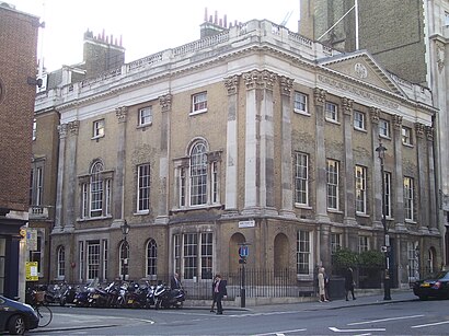
Brooks's Address: 60 St James's Street St James's London SW1A 1LE street in Westminster
Brooks's is a gentlemen's club in St James's Street, London. It is one of the oldest and most exclusive gentlemen's clubs in the world.Wiki
Attractions near Brooks's
Pratt's Club,Boodle s,Cafe Murano St James's,The Agatha Christie Walk at Green Park,James J.Fox,Royal Overseas League,Skarstedt Gallery,Locket's,Green Park,The Beretta Gallery,Korn Ferry International,The Stafford London Hotel,Quaglino's,King Street Street St James's Street,10 St James's Place,The Carlton Club,Truefitt & Hill,The Wolseley,Taylor Of Old Bond Street,Quaglino's BarHow to get to popular attractions in Westminster with public transportation
Croydon University Hospital, Broad Green,St Thomas' Hospital, Waterloo,Sands, High Wycombe,Stoke Poges, South Bucks,Queens Hospital, Romford,Imperial War Museum, Elephant & Castle,Bluewater, Greenhithe,Winnersh, Wokingham,Homerton University Hospital, Clapton,Cineworld, Chichester (Town),North Middlesex University Hospital, Edmonton,Northwick Park Hospital, Kenton,Bicester North Railway Station (BCS), Bicester,Stansted Airport, Stansted,Portobello Road Market, Notting Hill,Lewisham, Lewisham,IKEA, Bletchley (M Keynes),Brent Cross Shopping Centre, Brent Cross,Barking Station, Barking,Camden Market Hall, Camden TownGet around Westminster by public transport!
Travelling around Westminster has never been so easy. See step by step directions as you travel to any attraction, street or major public transport station. View bus and train timetables, arrival times, service alerts and detailed routes on a map, so you know exactly how to get to anywhere in Westminster.
When travelling to any destination around Westminster use Moovit's Live Directions with Get Off Notifications to know exactly where and how far to walk, how long to wait for your line , and how many stops are left. Moovit will alert you when it’s time to get off — no need to constantly re-check whether yours is the next stop.
Wondering how to use public transport in Westminster or how to pay for public transport in Westminster? Moovit public transport app can help you navigate your way with public transport easily, and at minimum cost. It includes public transport fees, ticket prices, and costs. Looking for a map of Westminster public transport lines? Moovit public transport app shows all public transport maps in Westminster with all Tube, bus or train routes and stops on an interactive map.
Westminster has 3 transport type(s), including: Tube, bus or train, operated by several transport agencies, including London Underground, London Buses, Transport for London, London Tramlink, Transport for London, National Rail, Bluestar, Berry's Coaches, Oxford Bus Company, Stagecoach West, Community First Wessex, Cresta Coaches, D & P Boat Hire, First Portsmouth, Fareham & Gosport and FYTbus