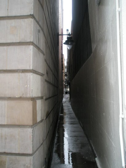
Directions to Brydges Place station (Covent Garden) with public transport
The following transport lines have routes that pass near Brydges Place
How to get to Brydges Place station by bus?
Click on the bus route to see step by step directions with maps, line arrival times and updated time schedules.
How to get to Brydges Place station by train?
Click on the train route to see step by step directions with maps, line arrival times and updated time schedules.
How to get to Brydges Place station by Tube?
Click on the Tube route to see step by step directions with maps, line arrival times and updated time schedules.
Bus stops near Brydges Place in Covent Garden
- St Martin's Place (K), 1 min walk,
- Trafalgar Square / Charing Cross Stn (G), 3 min walk,
- Bedford Street (J), 3 min walk,
- Northumberland Avenue / Trafalgar Square (W), 4 min walk,
- Embankment (40b), 7 min walk,
Tube stations near Brydges Place in Covent Garden
- Charing Cross, 2 min walk,
- Leicester Square, 3 min walk,
- Embankment, 7 min walk,
Train stations near Brydges Place in Covent Garden
- Charing Cross, 4 min walk,
Bus lines to Brydges Place station in Covent Garden
- N5, Trafalgar Square - Edgware,
- N20, Trafalgar Square - Barnet Church,
- 24, Hampstead Heath - Pimlico,
- 29, Trafalgar Square - Wood Green,
- N29, Trafalgar Square - Enfield,
- N41, Tottenham Hale - Trafalgar Square,
- 176, Tottenham Court Road - Penge,
- N279, Trafalgar Square - Waltham Cross,
- N21, Trafalgar Square,
- N89, Erith,
- 139, Waterloo,
- N199, St Mary Cray Station,
- N343, New Cross Gate,
- 9, Hammersmith - Aldwych,
- N9, Heathrow Terminal 5 - Aldwych,
- 15, Trafalgar Square - Blackwall,
- N15, Trafalgar Square - Romford Market,
- 23, Aldwych - Westbourne Park,
- 26, Victoria - Hackney Wick,
- N26, Chingford Station - Victoria,
What are the nearest stations to Brydges Place?
The nearest stations to Brydges Place are:
- St Martin's Place (K) is 39 meters away, 1 min walk.
- Charing Cross is 111 meters away, 2 min walk.
- Trafalgar Square / Charing Cross Stn (G) is 162 meters away, 3 min walk.
- Bedford Street (J) is 219 meters away, 3 min walk.
- Leicester Square is 230 meters away, 3 min walk.
- Northumberland Avenue / Trafalgar Square (W) is 270 meters away, 4 min walk.
- Embankment is 503 meters away, 7 min walk.
- Embankment (40b) is 520 meters away, 7 min walk.
Which bus lines stop near Brydges Place?
These bus lines stop near Brydges Place: 1, 11, 134, 245, 25, 26, 322, 368, 51, 53.
Which train lines stop near Brydges Place?
These train lines stop near Brydges Place: ELIZABETH, SOUTH WESTERN RAILWAY, SOUTHEASTERN.
Which Tube lines stop near Brydges Place?
These Tube lines stop near Brydges Place: NORTHERN, PICCADILLY.
What’s the nearest Tube station to Brydges Place in Covent Garden?
The nearest Tube station to Brydges Place in Covent Garden is Charing Cross. It’s a 2 min walk away.
What’s the nearest train station to Brydges Place in Covent Garden?
The nearest train station to Brydges Place in Covent Garden is Charing Cross. It’s a 4 min walk away.
What’s the nearest bus stop to Brydges Place in Covent Garden?
The nearest bus stop to Brydges Place in Covent Garden is St Martin's Place (K). It’s a 1 min walk away.
What time is the first Tube to Brydges Place in Covent Garden?
The DISTRICT is the first Tube that goes to Brydges Place in Covent Garden. It stops nearby at 05:27.
What time is the last Tube to Brydges Place in Covent Garden?
The DISTRICT is the last Tube that goes to Brydges Place in Covent Garden. It stops nearby at 00:40.
What time is the first train to Brydges Place in Covent Garden?
The SOUTHEASTERN is the first train that goes to Brydges Place in Covent Garden. It stops nearby at 05:20.
What time is the last train to Brydges Place in Covent Garden?
The SOUTHEASTERN is the last train that goes to Brydges Place in Covent Garden. It stops nearby at 23:20.
What time is the first bus to Brydges Place in Covent Garden?
The N279 is the first bus that goes to Brydges Place in Covent Garden. It stops nearby at 03:00.
What time is the last bus to Brydges Place in Covent Garden?
The N199 is the last bus that goes to Brydges Place in Covent Garden. It stops nearby at 07:07.
See Brydges Place, Covent Garden, on the map
Public Transit to Brydges Place in Covent Garden
How to get to Brydges Place in Covent Garden, United Kingdom?
It’s easy with Moovit. Type in your street address and Moovit’s route finder will locate the fastest way to get you there! Not sure where to get off on the street? Download the Moovit App to find live directions (including where to get off on Brydges Place), see timetables and get the estimated arrival times for your favourite train, bus or Tube lines.
Looking for the nearest stop or station to Brydges Place? Check out this list of closest stops available to your destination: St Martin's Place (K); Charing Cross; Trafalgar Square / Charing Cross Stn (G); Bedford Street (J); Leicester Square; Northumberland Avenue / Trafalgar Square (W); Embankment; Embankment (40b).
Bus: 1, 11, 134, 245, 25, 26, 322, 368, 51, 53, N5, N20, 24, 29, N29, N21, N89, 139, N199, N343.Train: ELIZABETH, SOUTH WESTERN RAILWAY, SOUTHEASTERN.Tube: NORTHERN, PICCADILLY, BAKERLOO, CIRCLE, DISTRICT.
Download the Moovit App to see the current schedule and routes available for Covent Garden. No need to install a special bus app to check the bus time or a train app to get train time. Moovit is the only all-in-one transport app that helps you get where you need to go.
We make riding on public transit to Brydges Place easy, which is why over 1.5 million users, including users in Covent Garden trust Moovit as the best app for public transport.
Use the app to navigate to popular places including to the airport, hospital, stadium, grocery store, mall, coffee shop, school, college, and university.
Location: Covent Garden, London
Streets near Brydges Place, Covent Garden
Get around Covent Garden by public transport!
Travelling around Covent Garden has never been so easy. See step by step directions as you travel to any attraction, street or major public transport station. View bus and train timetables, arrival times, service alerts and detailed routes on a map, so you know exactly how to get to anywhere in Covent Garden.
When travelling to any destination around Covent Garden use Moovit's Live Directions with Get Off Notifications to know exactly where and how far to walk, how long to wait for your line , and how many stops are left. Moovit will alert you when it’s time to get off — no need to constantly re-check whether yours is the next stop.
Wondering how to use public transport in Covent Garden or how to pay for public transport in Covent Garden? Moovit public transport app can help you navigate your way with public transport easily, and at minimum cost. It includes public transport fees, ticket prices, and costs. Looking for a map of Covent Garden public transport lines? Moovit public transport app shows all public transport maps in Covent Garden with all Bus, Train, Tube, Tramlink, River Bus and DLR routes and stops on an interactive map.
London has 6 transport type(s), including: Bus, Train, Tube, Tramlink, River Bus and DLR, operated by several transport agencies, including London Buses, Transport for London, London Underground, London River Services, National Rail, Luton Airport Shuttle, Bayliss Executive Travel, Edward Thomas, Metrobus, Coggeshall Community Bus, Tendring Community Transport, Sullivan Buses and Z & S Transport