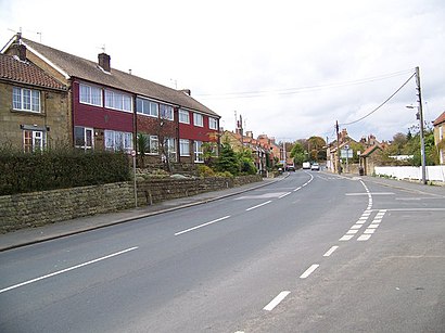
See Burniston on the map
Directions to Burniston with public transportation
The following transport lines have routes that pass near Burniston
 Bus:
Bus:
How to get to Burniston by bus?
Click on the bus route to see step by step directions with maps, line arrival times and updated time schedules.
Bus stations near Burniston
- Three Jolly Sailors Ph,4 min walk,
Bus routes to Burniston
- X93,Whitby - Scarborough,
- X94,Scarborough - Whitby,
- S115,Scarborough - Staintondale,
What are the nearest stations to Burniston?
The nearest stations to Burniston are:
- Three Jolly Sailors Ph is 214 meters away, 4 min walk.
Which bus lines stop near Burniston?
These bus lines stop near Burniston: S115, X93.
What’s the nearest bus stop to Burniston?
The nearest bus stop to Burniston is Three Jolly Sailors Ph. It’s a 4 min walk away.
What time is the first bus to Burniston?
The X93 is the first bus that goes to Burniston. It stops nearby at 06:56.
What time is the last bus to Burniston?
The X93 is the last bus that goes to Burniston. It stops nearby at 21:06.
How much is the train fare to Burniston?
The train fare to Burniston costs about £4.00.
See Burniston on the map
Public Transportation to Burniston
Wondering how to get to Burniston, United Kingdom? Moovit helps you find the best way to get to Burniston with step-by-step directions from the nearest public transit station.
Moovit provides free maps and live directions to help you navigate through your city. View schedules, routes, timetables, and find out how long does it take to get to Burniston in real time.
Looking for the nearest stop or station to Burniston? Check out this list of stops closest to your destination: Three Jolly Sailors Ph.
Bus:
Want to see if there’s another route that gets you there at an earlier time? Moovit helps you find alternative routes or times. Get directions from and directions to Burniston easily from the Moovit App or Website.
We make riding to Burniston easy, which is why over 1.5 million users, including users in Burniston, trust Moovit as the best app for public transit. You don’t need to download an individual bus app or train app, Moovit is your all-in-one transit app that helps you find the best bus time or train time available.
For information on prices of bus and train, costs and ride fares to Burniston, please check the Moovit app.
Use the app to navigate to popular places including to the airport, hospital, stadium, grocery store, mall, coffee shop, school, college, and university.
Burniston Address: Burniston street in Burniston
Attractions near Burniston
Yoga with Sarah,Laser Print,Yorkshire Fire Protection,Home Group,Adm Bathroom Services,Burniston Post Office and Stores,Burniston,Sparklers,Burniston Motor Works,Burniston & Cloughton Village Hall,Your Ceremony by Diana,Coast Gallery Tea Room,Burniston Household Waste & Recycling Centre,Andy Vasey Driver Training,Srufc Silver Royd Limited,Charlotte Hill - Arts, Design, Crafts,R J Valeting,Scarborough Ru,Cloughton Railway Station,Applegrove Country ParkHow to get to popular attractions in Burniston with public transportation
Market Square, Shipley,Sainsbury's Leeds Colton, Leeds,Asda, Morley,Merchant Gate, Wakefield,Thirsk Railway Station (THI), Thirsk,Clifton Green, York,Becketts Bank (Wetherspoon), Leeds,Ecclesfield School, Ecclesfield,Bradford Royal Infirmary, Bradford,Tadcaster, Tadcaster,Middlewood Tram Stop, Sheffield,Attercliffe, Sheffield,Whitby Harbour, Whitby,University Of Leeds (West Campus), Leeds,Moor Allerton, Leeds,Crookes, Sheffield,Halton Moor, Leeds,Cottingley Towers, Leeds,Ikea, Heckmondwike,St James's Hospital A&E, LeedsGet around Burniston by public transport!
Travelling around Burniston has never been so easy. See step by step directions as you travel to any attraction, street or major public transport station. View bus and train timetables, arrival times, service alerts and detailed routes on a map, so you know exactly how to get to anywhere in Burniston.
When travelling to any destination around Burniston use Moovit's Live Directions with Get Off Notifications to know exactly where and how far to walk, how long to wait for your line , and how many stops are left. Moovit will alert you when it’s time to get off — no need to constantly re-check whether yours is the next stop.
Wondering how to use public transport in Burniston or how to pay for public transport in Burniston? Moovit public transport app can help you navigate your way with public transport easily, and at minimum cost. It includes public transport fees, ticket prices, and costs. Looking for a map of Burniston public transport lines? Moovit public transport app shows all public transport maps in Burniston with all bus or train routes and stops on an interactive map.
Burniston has 2 transport type(s), including: bus or train, operated by several transport agencies, including First Leeds, First South Yorkshire, First York, First West Yorkshire Ltd, Arriva Yorkshire, Stagecoach Yorkshire, National Rail, First Bradford, First Halifax, Calder Valley & Huddersfield, East Yorkshire, The Keighley Bus Company, South Yorkshire Future Tram, The Harrogate Bus Company, National Rail and TM Travel