See Caldecott Park, Rugby, on the map
Directions to Caldecott Park (Rugby) with public transport
The following transport lines have routes that pass near Caldecott Park
 Bus:
Bus: - Train:
How to get to Caldecott Park by bus?
Click on the bus route to see step by step directions with maps, line arrival times and updated time schedules.
How to get to Caldecott Park by train?
Click on the train route to see step by step directions with maps, line arrival times and updated time schedules.
Bus stations near Caldecott Park in Rugby
- North Street, Rugby (G),4 min walk,
- Stand H, Rugby,4 min walk,
- Lancaster Road, Rugby,5 min walk,
Bus lines to Caldecott Park in Rugby
- 9,Woodlands,
- X84,Lutterworth,
- 99,Husbands Bosworth,
- 209,Princethorpe,
- 209,Lawford Heath,
- 1,Paddox - Coton And Boughton,
- D1,Daventry - Benn,
- 2,Paddox - Coton And Boughton,
- 4,Newbold And Brownsover - Bilton,
- 4A,Bilton - Coton And Boughton,
- 8,Eastlands - Newbold And Brownsover,
- 8A,Newbold And Brownsover - Benn,
- 25,Eastlands - St. Michael's,
- 25A,Dunsmore - St. Michael's,
- 25X,Eastlands - St. Michael's,
- 85,Eastlands - St. Michael's,
- 85A,St. Michael's - Eastlands,
- 85B,St. Michael's - Eastlands,
- 85S,Bilton - St. Michael's,
- 86,Eastlands - St. Michael's,
What are the nearest stations to Caldecott Park?
The nearest stations to Caldecott Park are:
- North Street, Rugby (G) is 254 meters away, 4 min walk.
- Stand H, Rugby is 272 meters away, 4 min walk.
- Lancaster Road, Rugby is 340 meters away, 5 min walk.
Which bus lines stop near Caldecott Park?
These bus lines stop near Caldecott Park: 4, 585, 585B, 86.
Which train line stops near Caldecott Park?
LONDON MIDLAND
What’s the nearest bus stop to Caldecott Park in Rugby?
The nearest bus stops to Caldecott Park in Rugby are North Street, Rugby (G) and Stand H, Rugby. The closest one is a 4 min walk away.
See Caldecott Park, Rugby, on the map
Public Transit to Caldecott Park in Rugby
Wondering how to get to Caldecott Park in Rugby, United Kingdom? Moovit helps you find the best way to get to Caldecott Park with step-by-step directions from the nearest public transit station.
Moovit provides free maps and live directions to help you navigate through your city. View schedules, routes, timetables, and find out how long does it take to get to Caldecott Park in real time.
Looking for the nearest stop or station to Caldecott Park? Check out this list of stops closest to your destination: North Street; Stand H; Lancaster Road.
Bus:Train:
Want to see if there’s another route that gets you there at an earlier time? Moovit helps you find alternative routes or times. Get directions from and directions to Caldecott Park easily from the Moovit App or Website.
We make riding to Caldecott Park easy, which is why over 1.5 million users, including users in Rugby, trust Moovit as the best app for public transit. You don’t need to download an individual bus app or train app, Moovit is your all-in-one transit app that helps you find the best bus time or train time available.
For information on prices of bus and train, costs and ride fares to Caldecott Park, please check the Moovit app.
Use the app to navigate to popular places including to the airport, hospital, stadium, grocery store, mall, coffee shop, school, college, and university.
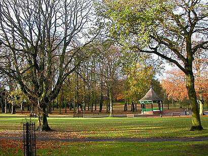
Caldecott Park Address: Park Road street in Rugby
Attractions near Caldecott Park
8 Park Road,Holbrook Park,John Dwyer Bakery,Cv21 2qn,Cv21 2qh,Chestnut Field,6 Holbrook Avenue,Gloria & Lil's,The Tool Shed Cafe,Rugby Insurance Services Ltd,Cv21 2qw,Poppy Promotions,Cv21 2ln,Cv21 2ld,Lupton Reddish,Cv21 2ql,John Lees Memorial Hall The,Town Hall,Benn Hall,Anne Hindmarch M.S.S.Ch M.B.Ch.AHow to get to popular attractions in Rugby with public transportation
Phoenix Group, Wythall West,Severn Valley Railway - Kidderminster Station, Aggborough & Spennells,National Exhibition Centre, Bickenhill,The Square Peg, Ladywood,Ormiston Forge Academy, Cradley Heath And Old Hill,Ricoh Arena, Longford,King Edward VI Camp Hill School For Girls, Brandwood & King's Heath,Mere Green, Sutton Mere Green,The Fort Shopping Park, Pype Hayes,Cineworld, Wednesfield South,Birmingham Coach Station, Bordesley & Highgate,Severn Valley Railway - Bridgnorth Station, Bridgnorth West And Tasley Ed,Cannon Hill Park, Moseley,Longton Bus Station, Broadway And Longton East,Newtown, Newtown,Birmingham Heartlands Hospital, Heartlands,Coleshill, Coleshill South,Staffordshire University, Milwich,Coventry Building Society Arena, Longford,Telford Forge Retail Park, Ketley & OverdaleGet around Rugby by public transport!
Travelling around Rugby has never been so easy. See step by step directions as you travel to any attraction, street or major public transport station. View bus and train timetables, arrival times, service alerts and detailed routes on a map, so you know exactly how to get to anywhere in Rugby.
When travelling to any destination around Rugby use Moovit's Live Directions with Get Off Notifications to know exactly where and how far to walk, how long to wait for your line , and how many stops are left. Moovit will alert you when it’s time to get off — no need to constantly re-check whether yours is the next stop.
Wondering how to use public transport in Rugby or how to pay for public transport in Rugby? Moovit public transport app can help you navigate your way with public transport easily, and at minimum cost. It includes public transport fees, ticket prices, and costs. Looking for a map of Rugby public transport lines? Moovit public transport app shows all public transport maps in Rugby with all bus or train routes and stops on an interactive map.
Rugby has 2 transport type(s), including: bus or train, operated by several transport agencies, including National Express West Midlands, National Express Coventry, National Express, Diamond Bus, Arriva Midlands, Stagecoach Midlands, West Midlands Metro, Stagecoach West, Stagecoach South Wales, First Potteries, First Worcestershire, LandFlight, trentbarton, D & G Bus and Flexibus