See Calvary Adelaide Hospital on the map
Directions to Calvary Adelaide Hospital with public transportation
The following transport lines have routes that pass near Calvary Adelaide Hospital
 Bus:
Bus: - Train:
- Light rail:
How to get to Calvary Adelaide Hospital by bus?
Click on the bus route to see step by step directions with maps, line arrival times and updated time schedules.
How to get to Calvary Adelaide Hospital by train?
Click on the train route to see step by step directions with maps, line arrival times and updated time schedules.
Light Rail stations near Calvary Adelaide Hospital
- Pirie St,1 min walk,
- University,50 min walk,
Bus stations near Calvary Adelaide Hospital
- Stop T1 Wakefield St - South side,3 min walk,
- Stop U1 Pulteney St - West side,4 min walk,
- Stop G2 Wakefield St - North side,4 min walk,
- Stop G1 Wakefield St - North side,6 min walk,
- Stop S1 Halifax St - South side,6 min walk,
- Stop H1 Halifax St - North side,6 min walk,
- Stop VS3 Victoria Sq - East side,8 min walk,
- Stop R1 Pulteney St - West side,9 min walk,
Bus routes to Calvary Adelaide Hospital
- 170,Urrbrae to City,
- 173,Blackwood Interchange to City,
- 174,Paradise Interchange to City,
- 178,Paradise Interchange to City,
- 178M,City to Athelstone,
- 178S,City to Newton,
- 178X,Paradise Interchange to City,
- 190,Glenelg Interchange to City,
- 195F,Blackwood Interchange to City,
- 196F,Blackwood Interchange to City,
- 197X,Coromandel Station to City,
- 230,Port Adelaide Interchange to City,
- 232,Port Adelaide Interchange to City,
- 232R,City to Rosewater,
- 632,Urrbrae Agricultural High School to City,
- 637,Unley High School to City,
- 674,Blackwood High School to City,
- 820,Burnside to City,
- 821,Carey Gully to City,
- 822,Stirling to City,
What are the nearest stations to Calvary Adelaide Hospital?
The nearest stations to Calvary Adelaide Hospital are:
- Pirie St is 47 meters away, 1 min walk.
- Stop T1 Wakefield St - South side is 145 meters away, 3 min walk.
- Stop U1 Pulteney St - West side is 273 meters away, 4 min walk.
- Stop G2 Wakefield St - North side is 279 meters away, 4 min walk.
- Stop G1 Wakefield St - North side is 401 meters away, 6 min walk.
- Stop S1 Halifax St - South side is 426 meters away, 6 min walk.
- Stop H1 Halifax St - North side is 469 meters away, 6 min walk.
- Stop VS3 Victoria Sq - East side is 595 meters away, 8 min walk.
- Stop R1 Pulteney St - West side is 688 meters away, 9 min walk.
- University is 3876 meters away, 50 min walk.
Which bus lines stop near Calvary Adelaide Hospital?
These bus lines stop near Calvary Adelaide Hospital: 195F, 861, 864F, G10.
Which train lines stop near Calvary Adelaide Hospital?
These train lines stop near Calvary Adelaide Hospital: BEL, GLAN.
Which light rail line stops near Calvary Adelaide Hospital?
GLNELG
What’s the nearest light rail station to Calvary Adelaide Hospital?
The nearest light rail station to Calvary Adelaide Hospital is Pirie St. It’s a 1 min walk away.
What’s the nearest bus stop to Calvary Adelaide Hospital?
The nearest bus stop to Calvary Adelaide Hospital is Stop T1 Wakefield St - South side. It’s a 3 min walk away.
What time is the first light rail to Calvary Adelaide Hospital?
The GLNELG is the first light rail that goes to Calvary Adelaide Hospital. It stops nearby at 05:06.
What time is the last light rail to Calvary Adelaide Hospital?
The GLNELG is the last light rail that goes to Calvary Adelaide Hospital. It stops nearby at 00:53.
What time is the first bus to Calvary Adelaide Hospital?
The 190B is the first bus that goes to Calvary Adelaide Hospital. It stops nearby at 05:50.
What time is the last bus to Calvary Adelaide Hospital?
The 228 is the last bus that goes to Calvary Adelaide Hospital. It stops nearby at 00:01.
How much is the bus fare to Calvary Adelaide Hospital?
The bus fare to Calvary Adelaide Hospital costs about $2.40 - $4.25.
How much is the train fare to Calvary Adelaide Hospital?
The train fare to Calvary Adelaide Hospital costs about $2.40.
See Calvary Adelaide Hospital on the map
Public Transportation to Calvary Adelaide Hospital
Wondering how to get to Calvary Adelaide Hospital, Australia? Moovit helps you find the best way to get to Calvary Adelaide Hospital with step-by-step directions from the nearest public transit station.
Moovit provides free maps and live directions to help you navigate through your city. View schedules, routes, timetables, and find out how long does it take to get to Calvary Adelaide Hospital in real time.
Looking for the nearest stop or station to Calvary Adelaide Hospital? Check out this list of stops closest to your destination: Pirie St; Stop T1 Wakefield St - South side; Stop U1 Pulteney St - West side; Stop G2 Wakefield St - North side; Stop G1 Wakefield St - North side; Stop S1 Halifax St - South side; Stop H1 Halifax St - North side; Stop VS3 Victoria Sq - East side; Stop R1 Pulteney St - West side; University.
Bus:Train:Light rail:
Want to see if there’s another route that gets you there at an earlier time? Moovit helps you find alternative routes or times. Get directions from and directions to Calvary Adelaide Hospital easily from the Moovit App or Website.
We make riding to Calvary Adelaide Hospital easy, which is why over 1.5 million users, including users in Adelaide, trust Moovit as the best app for public transit. You don’t need to download an individual bus app or train app, Moovit is your all-in-one transit app that helps you find the best bus time or train time available.
For information on prices of bus, train and light rail, costs and ride fares to Calvary Adelaide Hospital, please check the Moovit app.
Use the app to navigate to popular places including to the airport, hospital, stadium, grocery store, mall, coffee shop, school, college, and university.
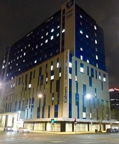
Calvary Adelaide Hospital Address: Angas Street street in Adelaide
Popular routes to Calvary Adelaide Hospital
- From Stop 1 King William Rd - North West sideFrom Zone A Golden Grove InterchangeFrom Stop X1 King William St - West sideFrom Stop 2 King William Rd - South East sideFrom Stop F1 North Tce - North sideFrom Stop X2 King William St - West sideFrom GoodwoodFrom Stop X1 Pulteney St - West sideFrom Royal Adelaide HospitalFrom Rundle Mall
Attractions near Calvary Adelaide Hospital
South Australia Police,Angas Street,Pulteney Street,Adelaide City Seventh-Day Adventist Church,Hut and Soul Eatery,144 Wakefield Street,The Gurkha's Restaurant,Coopers Alehouse,Angas Street Snackbar,St Aloysius College,The Magdalene Centre,188 Carrington Street,St Aloysius College,barossa valley,The Cancer Council Shop,Bus Stop I1 Pulteney St,Adelaide Police Station,Dr Neil Gehan,Adabco Boutique Hotel Adelaide,Adabco Boutique HotelHow to get to popular attractions in Adelaide with public transportation
Blackwood Interchange, Blackwood,Mawson Interchange, Mawson Lakes,Castle Plaza, Edwardstown,Blackwood Fitness, Blackwood,Alma Tavern, Norwood,Wayville Pavilion, Goodwood,Rundle Mall Tram Stop (To Moseley Square Glenelg), Adelaide,Old Reynella Interchange, Old Reynella,Moseley Square, Glenelg,Emu Hotel, Morphett Vale,Pullman Hotels, Adelaide,Adelaide High School, Adelaide,Adelaide Show Grounds, Goodwood,Flinders Medical Centre, Bedford Park,Sacred Heart College, Somerton Park,Golden Grove, Golden Grove,Marion Shopping Centre, Oaklands Park,Light Square, Adelaide,Unley High School, Netherby,SkyCity Adelaide, AdelaideGet around Adelaide by public transport!
Travelling around Adelaide has never been so easy. See step by step directions as you travel to any attraction, street or major public transport station. View bus and train timetables, arrival times, service alerts and detailed routes on a map, so you know exactly how to get to anywhere in Adelaide.
When travelling to any destination around Adelaide use Moovit's Live Directions with Get Off Notifications to know exactly where and how far to walk, how long to wait for your line , and how many stops are left. Moovit will alert you when it’s time to get off — no need to constantly re-check whether yours is the next stop.
Wondering how to use public transport in Adelaide or how to pay for public transport in Adelaide? Moovit public transport app can help you navigate your way with public transport easily, and at minimum cost. It includes public transport fees, ticket prices, and costs. Looking for a map of Adelaide public transport lines? Moovit public transport app shows all public transport maps in Adelaide with all bus, train or light rail routes and stops on an interactive map.
Adelaide has 3 transport type(s), including: bus, train or light rail, operated by several transport agencies, including Adelaide Metro (Busways), SouthLink, Torrens Transit, Adelaide Metro Train, Adelaide Metro (Torrens Connect), Adelaide Metro (Industrial Service - Torrens Transit), Adelaide Metro (School Service - SouthLink), Adelaide Metro (School Service - Torrens Transit) and Adelaide Metro (School Service - Busways)