Directions to Camden Town with public transportation
The following transport lines have routes that pass near Camden Town
How to get to Camden Town by bus?
Click on the bus route to see step by step directions with maps, line arrival times and updated time schedules.
How to get to Camden Town by train?
Click on the train route to see step by step directions with maps, line arrival times and updated time schedules.
How to get to Camden Town by Tube?
Click on the Tube route to see step by step directions with maps, line arrival times and updated time schedules.
Bus stations near Camden Town
- Camden Town Station (X),2 min walk,
- Camden High Street (CX),2 min walk,
- Camden Town Station (Y),3 min walk,
- Pratt Street (J),6 min walk,
Tube stations near Camden Town
- Camden Town,2 min walk,
Bus routes to Camden Town
- 1,Canada Water - Hampstead Heath,
- N5,Trafalgar Square - Edgware,
- 24,Hampstead Heath - Pimlico,
- 27,Chalk Farm - Hammersmith Grove,
- N27,Chalk Farm - Hammersmith,
- N28,Wandsworth - Camden Town,
- 31,White City - Camden Town,
- N31,Clapham Junction - Camden Town,
- 88,Parliament Hill Fields,
- 274,Lancaster Gate,
- N20,Trafalgar Square - Barnet Church,
- 29,Trafalgar Square - Wood Green,
- N29,Trafalgar Square - Enfield,
- 134,Warren Street - North Finchley,
- 214,Moorgate, Finsbury Square - Highgate Village,
- 253,Euston - Hackney Central,
- N253,Tottenham Court Road - Aldgate,
- N279,Trafalgar Square - Waltham Cross,
- 46,Bart's Hospital,
What are the nearest stations to Camden Town?
The nearest stations to Camden Town are:
- Camden Town Station (X) is 96 meters away, 2 min walk.
- Camden Town is 96 meters away, 2 min walk.
- Camden High Street (CX) is 103 meters away, 2 min walk.
- Camden Town Station (Y) is 148 meters away, 3 min walk.
- Pratt Street (J) is 401 meters away, 6 min walk.
Which bus lines stop near Camden Town?
These bus lines stop near Camden Town: 1, 134, 24, 27, 274, 29, 31.
Which train line stops near Camden Town?
OVERGROUND
Which Tube line stops near Camden Town?
NORTHERN
What’s the nearest Tube station to Camden Town?
The nearest Tube station to Camden Town is Camden Town. It’s a 2 min walk away.
What’s the nearest bus stop to Camden Town?
The nearest bus stops to Camden Town are Camden Town Station (X) and Camden High Street (CX). The closest one is a 2 min walk away.
What time is the first Tube to Camden Town?
The NORTHERN is the first Tube that goes to Camden Town. It stops nearby at 03:20.
What time is the last Tube to Camden Town?
The NORTHERN is the last Tube that goes to Camden Town. It stops nearby at 23:56.
What time is the first bus to Camden Town?
The 214 is the first bus that goes to Camden Town. It stops nearby at 03:00.
What time is the last bus to Camden Town?
The N279 is the last bus that goes to Camden Town. It stops nearby at 03:52.
See Camden Town on the map
Public Transportation to Camden Town
Wondering how to get to Camden Town, United Kingdom? Moovit helps you find the best way to get to Camden Town with step-by-step directions from the nearest public transit station.
Moovit provides free maps and live directions to help you navigate through your city. View schedules, routes, timetables, and find out how long does it take to get to Camden Town in real time.
Looking for the nearest stop or station to Camden Town? Check out this list of stops closest to your destination: Camden Town Station (X); Camden Town; Camden High Street (CX); Camden Town Station (Y); Pratt Street (J).
Bus:113424272742931N5N2788N20N2921446Train:OVERGROUNDTube:NORTHERN
Want to see if there’s another route that gets you there at an earlier time? Moovit helps you find alternative routes or times. Get directions from and directions to Camden Town easily from the Moovit App or Website.
We make riding to Camden Town easy, which is why over 1.5 million users, including users in Camden Town, trust Moovit as the best app for public transit. You don’t need to download an individual bus app or train app, Moovit is your all-in-one transit app that helps you find the best bus time or train time available.
For information on prices of Tube, bus and train, costs and ride fares to Camden Town, please check the Moovit app.
Use the app to navigate to popular places including to the airport, hospital, stadium, grocery store, mall, coffee shop, school, college, and university.
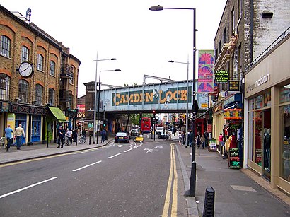
Camden Town Address: Camden High Street street in Camden Town
Attractions near Camden Town
Camden Town Underground Station,Camden Town London Underground Station,Underground-Camden Town,Camden Market Hall,Parkway Camden High Street,The Zipper Store,Camden Town Station,Jd Sports,Supersave,The Jazz Café,Jazz Cafe,Nw1 8qp,Odeon Camden,Simmons,Electric Ballroom,Mamak Don,KOKO,Hell To Pay,The Underworld,NW1 7PGHow to get to popular attractions in Camden Town with public transportation
London Waterloo Station, Waterloo,Sands, High Wycombe,Waitrose, Surbiton,Ferney Road, East Barnet,West Middlesex Hospital, Isleworth,Westfield Stratford City, Stratford,Science Museum, Kensington,Southall, Southall,National Gallery, Charing Cross,Nuffield Health, Kingston,Woolwich, Woolwich,Emirates Stadium, Highbury,Ealing Hospital, Hanwell,Departure Lounge, Stansted,Bicester North Railway Station (BCS), Bicester,Harpenden, Harpenden,Terminal 4, Heathrow,Arlesey Railway Station (ARL), Central Bedfordshire,Wembley Stadium, Wembley,Churchill Square Shopping Centre, Brighton And HoveGet around Camden Town by public transport!
Travelling around Camden Town has never been so easy. See step by step directions as you travel to any attraction, street or major public transport station. View bus and train timetables, arrival times, service alerts and detailed routes on a map, so you know exactly how to get to anywhere in Camden Town.
When travelling to any destination around Camden Town use Moovit's Live Directions with Get Off Notifications to know exactly where and how far to walk, how long to wait for your line , and how many stops are left. Moovit will alert you when it’s time to get off — no need to constantly re-check whether yours is the next stop.
Wondering how to use public transport in Camden Town or how to pay for public transport in Camden Town? Moovit public transport app can help you navigate your way with public transport easily, and at minimum cost. It includes public transport fees, ticket prices, and costs. Looking for a map of Camden Town public transport lines? Moovit public transport app shows all public transport maps in Camden Town with all Tube, bus or train routes and stops on an interactive map.
Camden Town has 3 transport type(s), including: Tube, bus or train, operated by several transport agencies, including London Underground, London Buses, Transport for London, London Tramlink, Transport for London, National Rail, Bluestar, Berry's Coaches, Oxford Bus Company, Stagecoach West, Community First Wessex, Cresta Coaches, D & P Boat Hire, First Portsmouth, Fareham & Gosport and FYTbus