See Canley Vale Station on the map
Own work
Directions to Canley Vale Station with public transportation
The following transport lines have routes that pass near Canley Vale Station
 Bus:
Bus: - Train:
How to get to Canley Vale Station by bus?
Click on the bus route to see step by step directions with maps, line arrival times and updated time schedules.
How to get to Canley Vale Station by train?
Click on the train route to see step by step directions with maps, line arrival times and updated time schedules.
Bus stations near Canley Vale Station
- Railway Pde Opp Canley Vale Station,1 min walk,
- Canley Vale Station Railway Pde,2 min walk,
- Canley Vale Rd Before Clifford Ave,3 min walk,
Bus routes to Canley Vale Station
- N50,Town Hall Park St,
- 817,Cabramatta to Fairfield via Edensor Park,
- 9502,Westfields Sports High School to Canley Vale,
- 9548,Our Lady of the Rosary Catholic Primary School Fairfield to Cabramatta via Wakeley,
- 9557,Mary MacKillop Catholic College to Cabramatta,
- 9026,Mary Mackillop Coll Bus Bay,
- 9050,Our Lady of The Rosary Primary,
- 9052,Our Lady of Mount Carmel Primary,
What are the nearest stations to Canley Vale Station?
The nearest stations to Canley Vale Station are:
- Railway Pde Opp Canley Vale Station is 22 meters away, 1 min walk.
- Canley Vale Station Railway Pde is 85 meters away, 2 min walk.
- Canley Vale Rd Before Clifford Ave is 152 meters away, 3 min walk.
Which bus lines stop near Canley Vale Station?
These bus lines stop near Canley Vale Station: 804, 817, N50.
Which train lines stop near Canley Vale Station?
These train lines stop near Canley Vale Station: T2, T5.
What’s the nearest bus stop to Canley Vale Station?
The nearest bus stop to Canley Vale Station is Railway Pde Opp Canley Vale Station. It’s a 1 min walk away.
See Canley Vale Station on the map
Own work
Public Transportation to Canley Vale Station
Wondering how to get to Canley Vale Station, Australia? Moovit helps you find the best way to get to Canley Vale Station with step-by-step directions from the nearest public transit station.
Moovit provides free maps and live directions to help you navigate through your city. View schedules, routes, timetables, and find out how long does it take to get to Canley Vale Station in real time.
Looking for the nearest stop or station to Canley Vale Station? Check out this list of stops closest to your destination: Railway Pde Opp Canley Vale Station; Canley Vale Station Railway Pde; Canley Vale Rd Before Clifford Ave.
Bus:Train:
Want to see if there’s another route that gets you there at an earlier time? Moovit helps you find alternative routes or times. Get directions from and directions to Canley Vale Station easily from the Moovit App or Website.
We make riding to Canley Vale Station easy, which is why over 1.5 million users, including users in Canley Vale, trust Moovit as the best app for public transit. You don’t need to download an individual bus app or train app, Moovit is your all-in-one transit app that helps you find the best bus time or train time available.
For information on prices of bus and train, costs and ride fares to Canley Vale Station, please check the Moovit app.
Use the app to navigate to popular places including to the airport, hospital, stadium, grocery store, mall, coffee shop, school, college, and university.
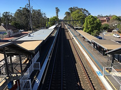
Canley Vale Station Address: Railway Pde. street in Canley Vale
Canley Vale railway station is located on the Main South line, serving the Sydney suburb of Canley Vale. It is served by Sydney Trains T2 Inner West & Leppington Line and T5 Cumberland line services.Wiki
Own work
Attractions near Canley Vale Station
Canley Vale Station (Platform 2),14 First Avenue,The Weston Eatery,Kim J.J Hair & Beauty,Dragon Bowl Seafood Restaurant,Tuk Tuk Lao & Thai Restaurant,Passion Cafe,Henry Steam Buns,Cafe Bosa,Canley Vale Post Office,Canley Vale International,Veggie House,Canley Vale,Tien Hau Temple,Goddess Indulgence Beauty & Spa,Hải Dương Quán,Australian Chinese Association Temple,SummitCare Canley Vale,Kuan Yin Temple,Australian Chin Lien Chinese AssociationHow to get to popular attractions in Canley Vale with public transportation
Westfield Eastgardens, Eastgardens,Charlestown Square Shopping Centre, Charlestown (NSW),Manly Wharf Bar,The Dolphin Hotel, Surry Hills,Petersham Station, Petersham,The Sheaf, Double Bay,Parramatta, Parramatta,Chatswood Station (Main Concourse), Chatswood,Sydney Airport (SYD), Mascot,Lidcombe Station (Concourse), Lidcombe,Dee Why, Dee Why,Turramurra Station, Turramurra,Riverwood Station, Riverwood,The Beresford Hotel, Surry Hills,The Bathers' Pavilion, Mosman,Revesby Station, Revesby,Dove & Olive Hotel, Surry Hills,The Eight Modern Chinese Restaurant, Haymarket,St Vincents Hospital, Darlinghurst,Quakers Hill Station, Quakers HillGet around Canley Vale by public transport!
Travelling around Canley Vale has never been so easy. See step by step directions as you travel to any attraction, street or major public transport station. View bus and train timetables, arrival times, service alerts and detailed routes on a map, so you know exactly how to get to anywhere in Canley Vale.
When travelling to any destination around Canley Vale use Moovit's Live Directions with Get Off Notifications to know exactly where and how far to walk, how long to wait for your line , and how many stops are left. Moovit will alert you when it’s time to get off — no need to constantly re-check whether yours is the next stop.
Wondering how to use public transport in Canley Vale or how to pay for public transport in Canley Vale? Moovit public transport app can help you navigate your way with public transport easily, and at minimum cost. It includes public transport fees, ticket prices, and costs. Looking for a map of Canley Vale public transport lines? Moovit public transport app shows all public transport maps in Canley Vale with all bus or train routes and stops on an interactive map.
Canley Vale has 2 transport type(s), including: bus or train, operated by several transport agencies, including Sydney Metro, Sydney Trains, Sydney Light Rail, Sydney Ferries, Intercity Trains, Intercity Train, NSW TrainLink, CDC NSW R14, U-Go Mobility, Keolis Downer Northern Beaches, Manly Fast Ferry, Transdev John Holland Buses, Busways, Busways North West and Dysons Buslines