Directions to Cape Town City Hall (Cape Town) with public transport
The following transport lines have routes that pass near Cape Town City Hall
Directions to Cape Town City Hall (Cape Town) with public transport
The following transport lines have routes that pass near Cape Town City Hall
How to get to Cape Town City Hall by bus?
Click on the bus route to see step by step directions with maps, line arrival times and updated time schedules.
How to get to Cape Town City Hall by train?
Click on the train route to see step by step directions with maps, line arrival times and updated time schedules.
Bus lines to Cape Town City Hall in Cape Town
- 103,Civic Centre,
- 102,Salt River Rail,
- BAYVIEW - CAPE TOWN,Bayview - Cape Town,
- BAYVIEW - SOMERSET HOSP,Bayview - Somerset Hosp,
- BEACON VALLEY - CAPE TOWN,Beacon Valley - Cape Town,
- BELLVILLE - CAPE TOWN,Bellville - Cape Town,
- BISHOP LAVIS - CAPE TOWN,Bishop Lavis - Cape Town,
- AIRPORT IND 2 - CAPE TOWN,Airport Ind 2 - Cape Town,
What are the nearest stations to Cape Town City Hall?
The nearest stations to Cape Town City Hall are:
- Lower Buitenkant is 107 meters away, 2 min walk.
- Darling is 125 meters away, 2 min walk.
- Cape Town is 326 meters away, 5 min walk.
Which bus lines stop near Cape Town City Hall?
These bus lines stop near Cape Town City Hall: 107, BAYVIEW - SOMERSET HOSP.
Which train line stops near Cape Town City Hall?
CAPE FLATS
What’s the nearest bus stop to Cape Town City Hall in Cape Town?
The nearest bus stops to Cape Town City Hall in Cape Town are Lower Buitenkant and Darling. The closest one is a 2 min walk away.
See Cape Town City Hall, Cape Town, on the map
Public Transit to Cape Town City Hall in Cape Town
Wondering how to get to Cape Town City Hall in Cape Town, South Africa? Moovit helps you find the best way to get to Cape Town City Hall with step-by-step directions from the nearest public transit station.
Moovit provides free maps and live directions to help you navigate through your city. View schedules, routes, timetables, and find out how long does it take to get to Cape Town City Hall in real time.
Looking for the nearest stop or station to Cape Town City Hall? Check out this list of stops closest to your destination: Lower Buitenkant; Darling; Cape Town.
Bus: 107, BAYVIEW - SOMERSET HOSP, 103, 102, BAYVIEW - CAPE TOWN, BEACON VALLEY - CAPE TOWN, BELLVILLE - CAPE TOWN, BISHOP LAVIS - CAPE TOWN.Train: CAPE FLATS.
Want to see if there’s another route that gets you there at an earlier time? Moovit helps you find alternative routes or times. Get directions from and directions to Cape Town City Hall easily from the Moovit App or Website.
We make riding to Cape Town City Hall easy, which is why over 1.5 million users, including users in Cape Town, trust Moovit as the best app for public transit. You don’t need to download an individual bus app or train app, Moovit is your all-in-one transit app that helps you find the best bus time or train time available.
For information on prices of bus and train, costs and ride fares to Cape Town City Hall, please check the Moovit app.
Use the app to navigate to popular places including to the airport, hospital, stadium, grocery store, mall, coffee shop, school, college, and university.
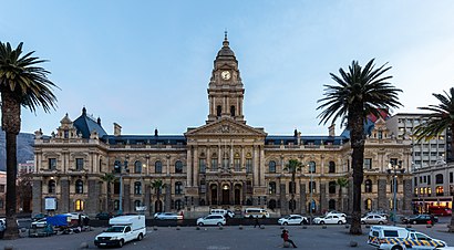
Cape Town City Hall Address: Darling Street street in Cape Town
Attractions near Cape Town City Hall
City Hall Cape Town,City Hall,KFC,Nedbank,KFC-Parade Cape Town CBD,Kfc,Darling Street,Cape Town Central Library,Chicken Licken,Cape Town,Кейптаун,కేప్ టౌన్,കേപ് ടൗൺ,Sità dël Cap,Kapsztad,Fokváros,Altepetl In Cabo,CPT,Cidade do Cabo,Kabe UrbeHow to get to popular attractions in Cape Town with public transportation
Cloetesville, Stellenbosch,Bishopscourt, Wynberg,Northlink College, Bellville,Proteus Technical High School, Malmesbury,Brugstraat Sport Fields, Paarl,Myciti Bus Station Atlantis, Malmesbury,Durbanville, Bellville,Simons Town Waterfront, Simon Town,Vergelegen Plein Shopping Centre, Somerset West,Lourensia Park, Somerset West,Department Of Home Affairs, Wynberg,Makro, Cape,Cape Town International Airport (CPT) (Cape Town International Airport), Kuils River,Elgin Grabouw, Somerset West,Richwood,Chukker Road Sports Fields, Wynberg,The Shop - House of Monatic, Goodwood,Montague gardens SABC, Cape,Welgemoed, Bellville,Cape Times Fresh Air Camp, Simon TownGet around Cape Town by public transport!
Travelling around Cape Town has never been so easy. See step by step directions as you travel to any attraction, street or major public transport station. View bus and train timetables, arrival times, service alerts and detailed routes on a map, so you know exactly how to get to anywhere in Cape Town.
When travelling to any destination around Cape Town use Moovit's Live Directions with Get Off Notifications to know exactly where and how far to walk, how long to wait for your line , and how many stops are left. Moovit will alert you when it’s time to get off — no need to constantly re-check whether yours is the next stop.
Wondering how to use public transport in Cape Town or how to pay for public transport in Cape Town? Moovit public transport app can help you navigate your way with public transport easily, and at minimum cost. It includes public transport fees, ticket prices, and costs. Looking for a map of Cape Town public transport lines? Moovit public transport app shows all public transport maps in Cape Town with all Bus, Train and Funicular routes and stops on an interactive map.
Cape Town has 3 transport type(s), including: Bus, Train and Funicular, operated by several transport agencies, including Golden Arrow, MyCiTi, Metrorail Western Cape, Intercape, City Sightseeing Cpt