Directions to Capitol Shopping Centre (Cardiff) with public transport
The following transport lines have routes that pass near Capitol Shopping Centre
How to get to Capitol Shopping Centre by bus?
Click on the bus route to see step by step directions with maps, line arrival times and updated time schedules.
How to get to Capitol Shopping Centre by train?
Click on the train route to see step by step directions with maps, line arrival times and updated time schedules.
Bus stops near Capitol Shopping Centre in Cardiff
- Dumfries Place Hv, Cardiff, 2 min walk,
- Dumfries Place Hc, Cardiff, 3 min walk,
- Dumfries Place Hx, Cardiff, 3 min walk,
- Fitzalan Place, Adamsdown, 4 min walk,
- Greyfriars Road Stop Gj, Cardiff, 5 min walk,
- Cardiff Queen Street, 8 min walk,
Train station near Capitol Shopping Centre in Cardiff
- Cardiff Central, 30 min walk,
Bus lines to Capitol Shopping Centre in Cardiff
- 9, Grangetown,
- X3, Cardiff,
- 11, Cardiff City Centre - Pengam Green via Splott, Tremorfa,
- 28, Cardiff - Llanishen - Cardiff,
- 29, Cardiff - Llanishen,
- 30, Cardiff - Newport via Old St Mellons, Castleton, Tredegar Park,
- 44, Cardiff City Centre - St Mellons,
- 45, Cardiff City Centre - St Mellons,
- 49, Cardiff City Centre - Llanrumney via Broadway, Newport Road, Llanrumney Avenue,
- 50, Cardiff City Centre - Llanrumney via Broadway, Newport Road, Ball Road, Burnham Avenue,
- 52, Cardiff City Centre - Cyncoed via Cardiff Met Cyncoed Campus,
- 57, Cardiff City Centre - Pontprennau via Albany Road, Llanedeyrn, Hollybush, Pentwyn,
- 58, Cardiff City Centre - Pontprennau via Albany Road, Llanedeyrn, Pentwyn, Holiday Inn,
- C1, Culverhouse Cross,
- T4, Dowlais Top,
- T14, Merthyr Tydfil,
- 26, Blackwood,
- TRANSPORT FOR WALES, Hereford,
- TRANSPORT FOR WALES, Bus Replacement: Maesteg,
What are the nearest stations to Capitol Shopping Centre?
The nearest stations to Capitol Shopping Centre are:
- Dumfries Place Hv, Cardiff is 108 meters away, 2 min walk.
- Dumfries Place Hc, Cardiff is 149 meters away, 3 min walk.
- Dumfries Place Hx, Cardiff is 161 meters away, 3 min walk.
- Fitzalan Place, Adamsdown is 232 meters away, 4 min walk.
- Greyfriars Road Stop Gj, Cardiff is 370 meters away, 5 min walk.
- Cardiff Queen Street is 560 meters away, 8 min walk.
- Cardiff Central is 2300 meters away, 30 min walk.
Which bus lines stop near Capitol Shopping Centre?
These bus lines stop near Capitol Shopping Centre: 26, 28, 44, 49, 52, 57, 58, 63.
Which train line stops near Capitol Shopping Centre?
TRANSPORT FOR WALES (Barry Island)
What’s the nearest train station to Capitol Shopping Centre in Cardiff?
The nearest train station to Capitol Shopping Centre in Cardiff is Cardiff Central. It’s a 30 min walk away.
What’s the nearest bus station to Capitol Shopping Centre in Cardiff?
The nearest bus station to Capitol Shopping Centre in Cardiff is Dumfries Place Hv, Cardiff. It’s a 2 min walk away.
What time is the first train to Capitol Shopping Centre in Cardiff?
The TRANSPORT FOR WALES is the first train that goes to Capitol Shopping Centre in Cardiff. It stops nearby at 07:44.
What time is the last train to Capitol Shopping Centre in Cardiff?
The TRANSPORT FOR WALES is the last train that goes to Capitol Shopping Centre in Cardiff. It stops nearby at 00:31.
What time is the first bus to Capitol Shopping Centre in Cardiff?
The 57 is the first bus that goes to Capitol Shopping Centre in Cardiff. It stops nearby at 05:44.
What time is the last bus to Capitol Shopping Centre in Cardiff?
The 50 is the last bus that goes to Capitol Shopping Centre in Cardiff. It stops nearby at 23:50.
See Capitol Shopping Centre, Cardiff, on the map
Public Transit to Capitol Shopping Centre in Cardiff
Wondering how to get to Capitol Shopping Centre in Cardiff, United Kingdom? Moovit helps you find the best way to get to Capitol Shopping Centre with step-by-step directions from the nearest public transit station.
Moovit provides free maps and live directions to help you navigate through your city. View schedules, routes, timetables, and find out how long does it take to get to Capitol Shopping Centre in real time.
Looking for the nearest stop or station to Capitol Shopping Centre? Check out this list of stops closest to your destination: Dumfries Place Hv; Dumfries Place Hc; Dumfries Place Hx; Fitzalan Place; Greyfriars Road Stop Gj; Cardiff Queen Street; Cardiff Central.
Bus: 26, 28, 44, 49, 52, 57, 58, 63, 9, X3, 11, 29, 30, C1, T4, T14.Train: TRANSPORT FOR WALES, CROSSCOUNTRY, GREAT WESTERN RAILWAY.
Want to see if there’s another route that gets you there at an earlier time? Moovit helps you find alternative routes or times. Get directions from and directions to Capitol Shopping Centre easily from the Moovit App or Website.
We make riding to Capitol Shopping Centre easy, which is why over 1.5 million users, including users in Cardiff, trust Moovit as the best app for public transit. You don’t need to download an individual bus app or train app, Moovit is your all-in-one transit app that helps you find the best bus time or train time available.
For information on prices of bus and train, costs and ride fares to Capitol Shopping Centre, please check the Moovit app.
Use the app to navigate to popular places including to the airport, hospital, stadium, grocery store, mall, coffee shop, school, college, and university.
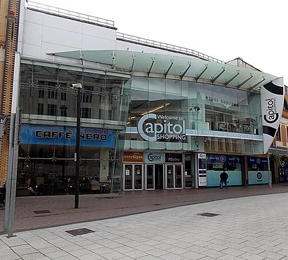
Capitol Shopping Centre Address: Queen St street in Cardiff
Places Near Capitol Shopping Centre (Cardiff)
How to get to popular places in Wales with public transport
Get around Cardiff by public transport!
Travelling around Cardiff has never been so easy. See step by step directions as you travel to any attraction, street or major public transport station. View bus and train timetables, arrival times, service alerts and detailed routes on a map, so you know exactly how to get to anywhere in Cardiff.
When travelling to any destination around Cardiff use Moovit's Live Directions with Get Off Notifications to know exactly where and how far to walk, how long to wait for your line , and how many stops are left. Moovit will alert you when it’s time to get off — no need to constantly re-check whether yours is the next stop.
Wondering how to use public transport in Cardiff or how to pay for public transport in Cardiff? Moovit public transport app can help you navigate your way with public transport easily, and at minimum cost. It includes public transport fees, ticket prices, and costs. Looking for a map of Cardiff public transport lines? Moovit public transport app shows all public transport maps in Cardiff with all Bus and Train routes and stops on an interactive map.
Wales has 2 transport type(s), including: Bus and Train, operated by several transport agencies, including National Rail, O.R.Jones, M & H Coaches, Peyton Travel, Gwynfor Coaches, Nefyn, Edwards Coaches, Cardiff Bus, Pembrokeshire County Council, Crickhowell Taxis, Village & Valleys Travel, South Wales Transport, Forge Travel, Sarah Bell and Phil Anslow Travel