See Carmyle Station, Scotland, on the map
Directions to Carmyle Station (Scotland) with public transport
The following transport lines have routes that pass near Carmyle Station
 Bus:
Bus: - Train:
How to get to Carmyle Station by bus?
Click on the bus route to see step by step directions with maps, line arrival times and updated time schedules.
How to get to Carmyle Station by train?
Click on the train route to see step by step directions with maps, line arrival times and updated time schedules.
Bus stations near Carmyle Station in Scotland
- Carmyle,1 min walk,
- Carmyle Station, Carmyle,2 min walk,
Bus lines to Carmyle Station in Scotland
- SCOTRAIL,Whifflet,
- 64,City Centre, Osborne St - Carmyle, River Road,
- 64,Glasgow - Halfway,
- 164,Glasgow - Halfway,
What are the nearest stations to Carmyle Station?
The nearest stations to Carmyle Station are:
- Carmyle is 49 meters away, 1 min walk.
- Carmyle Station, Carmyle is 74 meters away, 2 min walk.
Which bus line stops near Carmyle Station?
64
Which train line stops near Carmyle Station?
SCOTRAIL
What’s the nearest bus stop to Carmyle Station in Scotland?
The nearest bus stop to Carmyle Station in Scotland is Carmyle. It’s a 1 min walk away.
See Carmyle Station, Scotland, on the map
Public Transit to Carmyle Station in Scotland
Wondering how to get to Carmyle Station in Scotland, United Kingdom? Moovit helps you find the best way to get to Carmyle Station with step-by-step directions from the nearest public transit station.
Moovit provides free maps and live directions to help you navigate through your city. View schedules, routes, timetables, and find out how long does it take to get to Carmyle Station in real time.
Looking for the nearest stop or station to Carmyle Station? Check out this list of stops closest to your destination: Carmyle; Carmyle Station.
Bus:Train:
Want to see if there’s another route that gets you there at an earlier time? Moovit helps you find alternative routes or times. Get directions from and directions to Carmyle Station easily from the Moovit App or Website.
We make riding to Carmyle Station easy, which is why over 1.5 million users, including users in Scotland, trust Moovit as the best app for public transit. You don’t need to download an individual bus app or train app, Moovit is your all-in-one transit app that helps you find the best bus time or train time available.
For information on prices of train and bus, costs and ride fares to Carmyle Station, please check the Moovit app.
Use the app to navigate to popular places including to the airport, hospital, stadium, grocery store, mall, coffee shop, school, college, and university.
Carmyle Station Address: Carmyle Avenue Mount Vernon Glasgow G32 8JJ street in Scotland
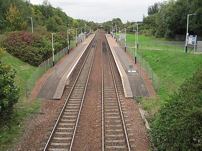
Carmyle railway station is located in the Carmyle area of Glasgow. It is on the Argyle Line, 5½ miles (9 km) east of Glasgow Central railway station. Train services are provided by Abellio ScotRail.Wiki
Attractions near Carmyle Station
The Take Away @ 103,Carmyle Station, Glasgow,Carmyle Railway Station (CML),Carmyle (CML) to Glasgow Queen St (GLQ) Train,9 Inzievar Terrace,Gopal General Store,Buckingham Drive, Glasgow,Carmyle Shops,M74 Junction 3,Douglas Avenue, Glasgow,Precise Audio,Outdoor Gym,UIN Foods,IMO Car Wash,Carmyle Community Centre,Cross Street,Carmyle,Freddy's Newsagents,16 Clydeview Terrace,Comboni Missionaries - Verona FathersHow to get to popular attractions in Scotland with public transportation
Edinburgh Zoo, Edinburgh,Scottish National Gallery, Edinburgh,Bearsden, Bearsden,Scottish Event Campus (SEC), Glasgow,Stirling Railway Station (STG), Stirling,IKEA, Loanhead,Edinburgh Castle, Edinburgh,Clyde Arc (Squinty Bridge), Glasgow City,Asda, Glasgow,Fir Park Stadium, Motherwell,The Standing Order (Wetherspoon), Edinburgh,The Queens Arms, Edinburgh,St Andrews University Library, St Andrews,Glasgow Airport, Paisley,Perth Railway Station (PTH), Perth,Partick Railway Station (PTK), Glasgow,Inverness Railway Station (INV), Inverness,Peebles, Peebles,Queen's Park, Glasgow,Bruntsfield Links, EdinburghGet around Scotland by public transport!
Travelling around Scotland has never been so easy. See step by step directions as you travel to any attraction, street or major public transport station. View bus and train timetables, arrival times, service alerts and detailed routes on a map, so you know exactly how to get to anywhere in Scotland.
When travelling to any destination around Scotland use Moovit's Live Directions with Get Off Notifications to know exactly where and how far to walk, how long to wait for your line , and how many stops are left. Moovit will alert you when it’s time to get off — no need to constantly re-check whether yours is the next stop.
Wondering how to use public transport in Scotland or how to pay for public transport in Scotland? Moovit public transport app can help you navigate your way with public transport easily, and at minimum cost. It includes public transport fees, ticket prices, and costs. Looking for a map of Scotland public transport lines? Moovit public transport app shows all public transport maps in Scotland with all train or bus routes and stops on an interactive map.
Scotland has 2 transport type(s), including: train or bus, operated by several transport agencies, including First Greater Glasgow, First Aberdeen, Lothian Buses, McGill's Bus Service, Stagecoach East Scotland, Stagecoach Bluebird, Xplore Dundee, Community Transport Glasgow, Prentice Westwood, McCall's Coaches, J P Minibus, National Rail, R Robertson & Son, Burnbrae Garage and Ember