See Carrow Road, Norwich, on the map
Directions to Carrow Road (Norwich) with public transport
The following transport lines have routes that pass near Carrow Road
 Bus:
Bus: - Train:
How to get to Carrow Road by bus?
Click on the bus route to see step by step directions with maps, line arrival times and updated time schedules.
How to get to Carrow Road by train?
Click on the train route to see step by step directions with maps, line arrival times and updated time schedules.
Bus stations near Carrow Road in Norwich
- Carrow Park, Norwich,2 min walk,
- Big Yellow Storage, Norwich,3 min walk,
- Barton Way, Norwich,6 min walk,
- Morrisons, Riverside,6 min walk,
- Cotman Road, Norwich,8 min walk,
- Rosary Road, Norwich,9 min walk,
- Corton Road, Norwich,11 min walk,
- Outside County Hall, Norwich,13 min walk,
- King Street, Norwich,13 min walk,
Bus lines to Carrow Road in Norwich
- 35,Hellesdon,
- 6B,Riverside Retail Park - Newmarket Road - Eaton,
- 25,Riverside & Rail Station - University,
- 26,Rail Station - Norfolk & Norwich Hospital,
- 26A,Rail Station - Bowthorpe,
- 132,Keswick,
- 23,Horningtoft,
- 24,Riverside,
- 32,Norwich City Centre,
- 5B,Eaton - Norwich - Dussindale - Wroxham - Stalham,
- 7,Norwich - Great Yarmouth,
- 14,Dussindale - Wymondham,
- 14A,Dussindale - Silfield,
- 15,Blofield Heath - Silfield,
- 15A,Silfield - Blofield Heath,
- 16,Lingwood - Wymondham,
- 16A,Wymondham - Lingwood,
- 17,Broadland Gate - Norwich City Centre,
- 31,Origin - Destination,
- 33,Pilson Green - City Centre,
What are the nearest stations to Carrow Road?
The nearest stations to Carrow Road are:
- Carrow Park, Norwich is 108 meters away, 2 min walk.
- Big Yellow Storage, Norwich is 168 meters away, 3 min walk.
- Barton Way, Norwich is 369 meters away, 6 min walk.
- Morrisons, Riverside is 386 meters away, 6 min walk.
- Cotman Road, Norwich is 513 meters away, 8 min walk.
- Rosary Road, Norwich is 596 meters away, 9 min walk.
- Corton Road, Norwich is 790 meters away, 11 min walk.
- Outside County Hall, Norwich is 935 meters away, 13 min walk.
- King Street, Norwich is 948 meters away, 13 min walk.
Which bus lines stop near Carrow Road?
These bus lines stop near Carrow Road: 14, 15, 16, 17, 33, 35, 5B.
Which train lines stop near Carrow Road?
These train lines stop near Carrow Road: EAST MIDLANDS RAILWAY, GREATER ANGLIA.
What’s the nearest bus stop to Carrow Road in Norwich?
The nearest bus stop to Carrow Road in Norwich is Carrow Park, Norwich. It’s a 2 min walk away.
What time is the first bus to Carrow Road in Norwich?
The TS24 is the first bus that goes to Carrow Road in Norwich. It stops nearby at 04:45.
What time is the last bus to Carrow Road in Norwich?
The 7 is the last bus that goes to Carrow Road in Norwich. It stops nearby at 23:28.
See Carrow Road, Norwich, on the map
Public Transit to Carrow Road in Norwich
Wondering how to get to Carrow Road in Norwich, United Kingdom? Moovit helps you find the best way to get to Carrow Road with step-by-step directions from the nearest public transit station.
Moovit provides free maps and live directions to help you navigate through your city. View schedules, routes, timetables, and find out how long does it take to get to Carrow Road in real time.
Looking for the nearest stop or station to Carrow Road? Check out this list of stops closest to your destination: Carrow Park; Big Yellow Storage; Barton Way; Morrisons; Cotman Road; Rosary Road; Corton Road; Outside County Hall; King Street.
Bus:Train:
Want to see if there’s another route that gets you there at an earlier time? Moovit helps you find alternative routes or times. Get directions from and directions to Carrow Road easily from the Moovit App or Website.
We make riding to Carrow Road easy, which is why over 1.5 million users, including users in Norwich, trust Moovit as the best app for public transit. You don’t need to download an individual bus app or train app, Moovit is your all-in-one transit app that helps you find the best bus time or train time available.
For information on prices of bus and train, costs and ride fares to Carrow Road, please check the Moovit app.
Use the app to navigate to popular places including to the airport, hospital, stadium, grocery store, mall, coffee shop, school, college, and university.
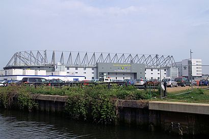
Carrow Road Address: Canaryfields street in Norwich
Attractions near Carrow Road
Holiday Inn Norwich City,Holiday Inn Norwich City an IHG Hotel,Carrow Road,Carrow Road Stadium,Carrow Road Football Stadium,Geoffrey Watling City Stand,Norwich City Football Club,Joma Community Stand,A F A,Geoffrey Watling Way,Regency Security Stand,Carrow Road Stadium (Norwich City Football Club),Koblenz Avenue Cctv Camera,Morrisons Norwich,Nr1 1hb,Nike Factory Store,Morrisons Norwich,Morrisons,Argos,Carrow RoadHow to get to popular attractions in Norwich with public transportation
Holiday Inn Ipswich - Orwell, Ipswich,Gislingham, Mid Suffolk,Wickham Market, Suffolk Coastal,Morston Quay, North Norfolk,Ibis Hotel, Cambridge,Saxmundham Railway Station (SAX), Suffolk Coastal,Goals Soccer Centre, Norwich,Wicken Fen National Nature Reserve, East Cambridgeshire,Hunstanton,Bluntisham, Huntingdonshire,John Lewis at Home, Ipswich,Sir Harry Smith Community College, Fenland,Cambridge School of Visual & Performing Arts, Cambridge,Bespak, King'S Lynn And West Norfolk,Sawtry community college, Huntingdonshire,Haslingfield, South Cambridgeshire,Norfolk & Norwich Millennium Library, Norwich,Hunstanton Beach, King'S Lynn And West Norfolk,Halesworth, Waveney,RAF Mildenhall Child Development Programs (CDC), Forest HeathGet around Norwich by public transport!
Travelling around Norwich has never been so easy. See step by step directions as you travel to any attraction, street or major public transport station. View bus and train timetables, arrival times, service alerts and detailed routes on a map, so you know exactly how to get to anywhere in Norwich.
When travelling to any destination around Norwich use Moovit's Live Directions with Get Off Notifications to know exactly where and how far to walk, how long to wait for your line , and how many stops are left. Moovit will alert you when it’s time to get off — no need to constantly re-check whether yours is the next stop.
Wondering how to use public transport in Norwich or how to pay for public transport in Norwich? Moovit public transport app can help you navigate your way with public transport easily, and at minimum cost. It includes public transport fees, ticket prices, and costs. Looking for a map of Norwich public transport lines? Moovit public transport app shows all public transport maps in Norwich with all bus or train routes and stops on an interactive map.
Norwich has 2 transport type(s), including: bus or train, operated by several transport agencies, including National Rail, Ambassador Travel, Harwich Harbour Ferry, Stephensons of Essex, Villager Minibus Sharnbrook, The Voluntary Network, Dews Coaches, Lord's Travel, Felixstowe Ferry Boat Yard, Hadleigh Community Transport, Beestons, Fenland Association for Community Transport, First Norfolk & Suffolk, National Rail and Mulleys Motorways