Directions to Ceres Scotland with public transportation
The following transport lines have routes that pass near Ceres Scotland
 Bus:
Bus: - Train:
How to get to Ceres Scotland by bus?
Click on the bus route to see step by step directions with maps, line arrival times and updated time schedules.
How to get to Ceres Scotland by train?
Click on the train route to see step by step directions with maps, line arrival times and updated time schedules.
Bus stations near Ceres Scotland
- Main Street, Ceres,1 min walk,
- Bow Butts, Ceres,1 min walk,
Bus routes to Ceres Scotland
- BB13,Cupar,
- 64,Letham,
- BB15,Leven,
- 41,Kirkcaldy,
- 41,Cupar,
- 41B,Dundee City Centre,
- 41B,Cupar,
- 46,Dundee City Centre,
- 41A,Kirkcaldy or Leven - Dundee,
- 41A,Kirkcaldy or Leven - Cupar,
What are the nearest stations to Ceres Scotland?
The nearest stations to Ceres Scotland are:
- Main Street, Ceres is 43 meters away, 1 min walk.
- Bow Butts, Ceres is 53 meters away, 1 min walk.
Which bus lines stop near Ceres Scotland?
These bus lines stop near Ceres Scotland: 46, 64.
Which train line stops near Ceres Scotland?
SCOTRAIL
What’s the nearest bus stop to Ceres Scotland?
The nearest bus stops to Ceres Scotland are Main Street, Ceres and Bow Butts, Ceres. The closest one is a 1 min walk away.
What time is the first bus to Ceres Scotland?
The 64 is the first bus that goes to Ceres Scotland. It stops nearby at 06:37.
What time is the last bus to Ceres Scotland?
The 64 is the last bus that goes to Ceres Scotland. It stops nearby at 23:48.
See Ceres Scotland on the map
Public Transportation to Ceres Scotland
Wondering how to get to Ceres Scotland, United Kingdom? Moovit helps you find the best way to get to Ceres Scotland with step-by-step directions from the nearest public transit station.
Moovit provides free maps and live directions to help you navigate through your city. View schedules, routes, timetables, and find out how long does it take to get to Ceres Scotland in real time.
Looking for the nearest stop or station to Ceres Scotland? Check out this list of stops closest to your destination: Main Street; Bow Butts.
Bus:Train:
Want to see if there’s another route that gets you there at an earlier time? Moovit helps you find alternative routes or times. Get directions from and directions to Ceres Scotland easily from the Moovit App or Website.
We make riding to Ceres Scotland easy, which is why over 1.5 million users, including users in Ceres, trust Moovit as the best app for public transit. You don’t need to download an individual bus app or train app, Moovit is your all-in-one transit app that helps you find the best bus time or train time available.
For information on prices of bus and train, costs and ride fares to Ceres Scotland, please check the Moovit app.
Use the app to navigate to popular places including to the airport, hospital, stadium, grocery store, mall, coffee shop, school, college, and university.
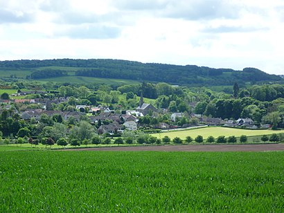
Location: Ceres, Scotland
Attractions near Ceres Scotland
Ceres,Paypoint,Loch Garage,Tarvaig Holdings,Crating Eden,Velvet & Lace,Ceres Highland Games,Robertson & smart - Builders,Opera Scotland,The Little Red Drum,Walker Partnership,D H Machinery Ceres,Ceres Memorial Hall,Iced Magic,Becoming Productive International,Hill City,Wemyss Ware,Fife Council,Ian Taylor Paving & Ground Works,Taylor Made PavingHow to get to popular attractions in Ceres with public transportation
East Kilbride Shopping Centre, East Kilbride,Edinburgh Zoo, Edinburgh,Peebles, Peebles,Edinburgh Airport (EDI), Ratho Station,IKEA, Loanhead,EICC, Edinburgh,River Clyde, Glasgow City,The Queen Elizabeth University Hospital Campus, Glasgow,Glasgow Airport, Paisley,Edinburgh Castle, Edinburgh,The Three Sisters, Edinburgh,Altens Industrial Estate, Aberdeen,Virgin Active, Glasgow,Paisley Gilmour Street Railway Station (PYG), Paisley,Glasgow Central Railway Station (GLC), Glasgow,Dalry, Edinburgh,Aberdeen International Airport (ABZ), Dyce,McEwan Square, Edinburgh,Costco Wholesale, Glasgow,Drumgelloch Railway Station (DRU), AirdrieGet around Ceres by public transport!
Travelling around Ceres has never been so easy. See step by step directions as you travel to any attraction, street or major public transport station. View bus and train timetables, arrival times, service alerts and detailed routes on a map, so you know exactly how to get to anywhere in Ceres.
When travelling to any destination around Ceres use Moovit's Live Directions with Get Off Notifications to know exactly where and how far to walk, how long to wait for your line , and how many stops are left. Moovit will alert you when it’s time to get off — no need to constantly re-check whether yours is the next stop.
Wondering how to use public transport in Ceres or how to pay for public transport in Ceres? Moovit public transport app can help you navigate your way with public transport easily, and at minimum cost. It includes public transport fees, ticket prices, and costs. Looking for a map of Ceres public transport lines? Moovit public transport app shows all public transport maps in Ceres with all bus or train routes and stops on an interactive map.
Ceres has 2 transport type(s), including: bus or train, operated by several transport agencies, including First Greater Glasgow, First Aberdeen, Lothian Buses, McGill's Bus Service, Stagecoach East Scotland, Stagecoach Bluebird, Xplore Dundee, Community Transport Glasgow, Prentice Westwood, McCall's Coaches, J P Minibus, National Rail, R Robertson & Son, Burnbrae Garage and Ember