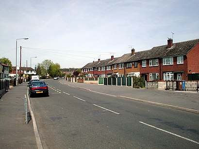
See Chaddesden, Derby, on the map
Directions to Chaddesden (Derby) with public transport
The following transport lines have routes that pass near Chaddesden
 Bus:
Bus:
How to get to Chaddesden by bus?
Click on the bus route to see step by step directions with maps, line arrival times and updated time schedules.
Bus stations near Chaddesden in Derby
- The Rocket, Breadsall Hilltop,6 min walk,
- Lychgate Close, Oakwood,8 min walk,
- Stratford Road, Breadsall Hilltop,9 min walk,
Bus lines to Chaddesden in Derby
- 22,Derby,
- 24,Oakwood,
- 302,Spondon,
- H1,Alfreton,
- 59A,Shipley View,
What are the nearest stations to Chaddesden?
The nearest stations to Chaddesden are:
- The Rocket, Breadsall Hilltop is 373 meters away, 6 min walk.
- Lychgate Close, Oakwood is 517 meters away, 8 min walk.
- Stratford Road, Breadsall Hilltop is 603 meters away, 9 min walk.
Which bus lines stop near Chaddesden?
These bus lines stop near Chaddesden: 24, H1.
What’s the nearest bus stop to Chaddesden in Derby?
The nearest bus stop to Chaddesden in Derby is The Rocket, Breadsall Hilltop. It’s a 6 min walk away.
What time is the first bus to Chaddesden in Derby?
The H1 is the first bus that goes to Chaddesden in Derby. It stops nearby at 05:14.
What time is the last bus to Chaddesden in Derby?
The 24 is the last bus that goes to Chaddesden in Derby. It stops nearby at 23:11.
See Chaddesden, Derby, on the map
Public Transit to Chaddesden in Derby
Wondering how to get to Chaddesden in Derby, United Kingdom? Moovit helps you find the best way to get to Chaddesden with step-by-step directions from the nearest public transit station.
Moovit provides free maps and live directions to help you navigate through your city. View schedules, routes, timetables, and find out how long does it take to get to Chaddesden in real time.
Looking for the nearest stop or station to Chaddesden? Check out this list of stops closest to your destination: The Rocket; Lychgate Close; Stratford Road.
Bus:
Want to see if there’s another route that gets you there at an earlier time? Moovit helps you find alternative routes or times. Get directions from and directions to Chaddesden easily from the Moovit App or Website.
We make riding to Chaddesden easy, which is why over 1.5 million users, including users in Derby, trust Moovit as the best app for public transit. You don’t need to download an individual bus app or train app, Moovit is your all-in-one transit app that helps you find the best bus time or train time available.
For information on prices of bus, costs and ride fares to Chaddesden, please check the Moovit app.
Use the app to navigate to popular places including to the airport, hospital, stadium, grocery store, mall, coffee shop, school, college, and university.
Chaddesden Address: Steeple Close street in Derby
Attractions near Chaddesden
Midland Building Inspections,Stonecover Kitchen,Masonsoft Technology,Swift React,Infinity Aesthetics by Sarah,Alium Books,Derby Music Academy,DB Groundworks,The Potty Plotters,Linutza's,Kevs Quality,Impero Homes,Le Strength & Conditioning,Corvus Collective,12 Sandringham Road,Westrad Limited,Omegas Enterprises,Sen-Fit,Conistin Crescent Community Room,Diamond PerformanceHow to get to popular attractions in Derby with public transportation
Currys PC World, Blaby,Hotel ibis Chesterfield Centre, Chesterfield,Market Warsop, Mansfield,Billing Aquadrome, Northampton,Ibis Hotel, Northampton,Asda, Derby,Hilton Leicester Hotel, Blaby,Tesco Extra, Leicester,RBS Kegworth Data Centre, North West Leicestershire,Ideal World Studios, Peterborough,Tesco Hamilton Petrol Station, Leicester,The Castlewood (Brewers Fayre), Bolsover,Sport Park Loughborough University, Charnwood,Burton Latimer, Kettering,Holiday Inn Express Peterborough, Peterborough,Hucknall Tram Stop, Ashfield,Sutton-In-Ashfield, Ashfield,Westwood Centre, Peterborough,YBS Group - Lynch Wood, Peterborough,RAF Wittering, PeterboroughGet around Derby by public transport!
Travelling around Derby has never been so easy. See step by step directions as you travel to any attraction, street or major public transport station. View bus and train timetables, arrival times, service alerts and detailed routes on a map, so you know exactly how to get to anywhere in Derby.
When travelling to any destination around Derby use Moovit's Live Directions with Get Off Notifications to know exactly where and how far to walk, how long to wait for your line , and how many stops are left. Moovit will alert you when it’s time to get off — no need to constantly re-check whether yours is the next stop.
Wondering how to use public transport in Derby or how to pay for public transport in Derby? Moovit public transport app can help you navigate your way with public transport easily, and at minimum cost. It includes public transport fees, ticket prices, and costs. Looking for a map of Derby public transport lines? Moovit public transport app shows all public transport maps in Derby with all bus routes and stops on an interactive map.
Derby has 1 transport type(s), including: bus, operated by several transport agencies, including National Rail, Ashbourne Community Transport, Delaine Buses, Arriva Midlands, Centrebus, Our Centre, Hulleys of Baslow, D & G Bus, Stagecoach East Midlands, North Lincolnshire Council, National Rail, Roberts Coaches, Lawson's of Corby, Hawkes Coaches and East Yorkshire