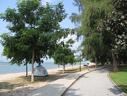
See Changi Beach Park, Southeast, on the map
Directions to Changi Beach Park (Southeast) with public transport
The following transport lines have routes that pass near Changi Beach Park
 Bus:
Bus: - Ferry:
How to get to Changi Beach Park by bus?
Click on the bus route to see step by step directions with maps, line arrival times and updated time schedules.
Bus stations near Changi Beach Park in Southeast
- Airline Rd - Airline Hse (95061),5 min walk,
- Alps Ave - Expeditors (95189),8 min walk,
Ferry stations near Changi Beach Park in Southeast
- Changi Point Ferry Terminal,46 min walk,
Bus lines to Changi Beach Park in Southeast
- 9,Bedok Int,
- 19,Tampines Int,
- 89,Hougang Ctrl Int,
- 89A,Airport Cargo Rd (Airfreight Ter Bldg),
- 9B,Airline Rd (3rd Cargo Agents),
- 89E,Airport Cargo Rd (Sats Cargo Ter),
- LCS1,Tampines Ave 9 (Blk 721),
- LCS2,Airline Rd (Bef Cargo Bldg D),
- 35,Bedok Int,
- ALPS SHUTTLE,Alps Shuttle,
What are the nearest stations to Changi Beach Park?
The nearest stations to Changi Beach Park are:
- Airline Rd - Airline Hse (95061) is 179 meters away, 5 min walk.
- Alps Ave - Expeditors (95189) is 487 meters away, 8 min walk.
- Changi Point Ferry Terminal is 3544 meters away, 46 min walk.
Which bus lines stop near Changi Beach Park?
These bus lines stop near Changi Beach Park: 19, 89, 9.
What’s the nearest bus stop to Changi Beach Park in Southeast?
The nearest bus stop to Changi Beach Park in Southeast is Airline Rd - Airline Hse (95061). It’s a 5 min walk away.
What time is the first bus to Changi Beach Park in Southeast?
The 19 is the first bus that goes to Changi Beach Park in Southeast. It stops nearby at 06:00.
What time is the last bus to Changi Beach Park in Southeast?
The 9 is the last bus that goes to Changi Beach Park in Southeast. It stops nearby at 00:54.
What time is the first ferry to Changi Beach Park in Southeast?
The PULAU UBIN BUMBOAT is the first ferry that goes to Changi Beach Park in Southeast. It stops nearby at 05:00.
What time is the last ferry to Changi Beach Park in Southeast?
The PULAU UBIN BUMBOAT is the last ferry that goes to Changi Beach Park in Southeast. It stops nearby at 01:02.
How much is the bus fare to Changi Beach Park?
The bus fare to Changi Beach Park costs about $1.09 - $2.24.
How much is the MRT & LRT fare to Changi Beach Park?
The MRT & LRT fare to Changi Beach Park costs about $1.09.
How much is the metro fare to Changi Beach Park?
The metro fare to Changi Beach Park costs about $0.49 - $2.37.
See Changi Beach Park, Southeast, on the map
Public Transit to Changi Beach Park in Southeast
How to get to Changi Beach Park in Southeast, Singapore?
It’s easy with Moovit. Type in your street address and Moovit’s route finder will locate the fastest way to get you there! Not sure where to get off on the street? Download the Moovit App to find live directions (including where to get off on Changi Beach Park), see timetables and get the estimated arrival times for your favourite bus, metro or MRT & LRT lines.
Looking for the nearest stop or station to Changi Beach Park? Check out this list of closest stops available to your destination: Airline Rd - Airline Hse (95061); Alps Ave - Expeditors (95189); Changi Point Ferry Terminal.
Bus:Ferry:
Download the Moovit App to see the current schedule and routes available for Southeast. No need to install a special bus app to check the bus time or a train app to get train time. Moovit is the only all-in-one transport app that helps you get where you need to go.
We make riding on public transit to Changi Beach Park easy, which is why over 1.5 million users, including users in Southeast trust Moovit as the best app for public transport.
Use the app to navigate to popular places including to the airport, hospital, stadium, grocery store, mall, coffee shop, school, college, and university.
Location: Southeast, Singapore
Streets near Changi Beach Park, Southeast
North Perimeter Road, Southeast,Carpark 3, Southeast,Changi Ferry Road, Southeast,Changi Coast Road, Southeast,Aviation Drive, Southeast,Telok Paku Road, Southeast,Nicoll Drive, Southeast,Felixstowe Road, Southeast,Tangmere Road, Southeast,Lor Bekukong, Southeast,Airline Cargo Road, Southeast,Changi Village Coastal Walk, Southeast,Digby Road, Southeast,Old Sarum Road, Southeast,Manston Road, Southeast,Biggin Hill Road, Southeast,Netheravon Road, Southeast,Upavon Road, Southeast,Cranwell Road, Southeast,Halton Road, SoutheastGet around Southeast by public transport!
Travelling around Southeast has never been so easy. See step by step directions as you travel to any attraction, street or major public transport station. View bus and train timetables, arrival times, service alerts and detailed routes on a map, so you know exactly how to get to anywhere in Southeast.
When travelling to any destination around Southeast use Moovit's Live Directions with Get Off Notifications to know exactly where and how far to walk, how long to wait for your line , and how many stops are left. Moovit will alert you when it’s time to get off — no need to constantly re-check whether yours is the next stop.
Wondering how to use public transport in Southeast or how to pay for public transport in Southeast? Moovit public transport app can help you navigate your way with public transport easily, and at minimum cost. It includes public transport fees, ticket prices, and costs. Looking for a map of Southeast public transport lines? Moovit public transport app shows all public transport maps in Southeast with all bus, metro or MRT & LRT routes and stops on an interactive map.
Southeast has 3 transport type(s), including: bus, metro or MRT & LRT, operated by several transport agencies, including SMRT, SBS Transit, SMRT, MRT/LRT Replacement Services, SBS Transit, SBS Transit, SMRT, Tower Transit, Go-Ahead Singapore, Premium Bus, City Direct Bus, Changi Airport, Sentosa Development Corporation, Sentosa Development Corporation and Cross Border Bus