Directions to Chesterfield Parish Church with public transportation
The following transport lines have routes that pass near Chesterfield Parish Church
How to get to Chesterfield Parish Church by bus?
Click on the bus route to see step by step directions with maps, line arrival times and updated time schedules.
How to get to Chesterfield Parish Church by train?
Click on the train route to see step by step directions with maps, line arrival times and updated time schedules.
Bus stops near Chesterfield Parish Church
- Church Way, Chesterfield (H2), 2 min walk,
- Cavendish Street, Chesterfield (U1), 3 min walk,
- Cavendish Street, Chesterfield (T2), 3 min walk,
- Lordsmill Street, Chesterfield, 3 min walk,
- Knifesmithgate, Chesterfield (L2), 4 min walk,
- Brewery Street, Chesterfield, 6 min walk,
- New Beetwell Street, Chesterfield (B4), 7 min walk,
- St Helena Centre, Chesterfield, 7 min walk,
- New Beetwell Street, Chesterfield, 8 min walk,
- Ravenside Retail Park, Chesterfield, 10 min walk,
- St Leonards Drive Bridge, Hasland, 16 min walk,
Bus routes to Chesterfield Parish Church
- 54, Clay Cross,
- 54A, Clay Cross,
- X17, Matlock - Sheffield,
- 77, Chesterfield - Worksop,
- 77A, Chesterfield - Worksop,
- 78, Hartington - Chesterfield,
- 5, Newbold,
- 15, Marsh Lane,
- 43, Dronfield,
- 44, Sheffield Centre,
- 1, Hillstown,
- 1A, Newbold,
- 51, Danesmoor,
- 16, Dronfield,
- BLUE, Chatsworth House (Chesterfield and Low Edges) - Blue John Cavern,
- RED, Chatsworth House (Chesterfield) - Chatsworth House,
- 55, Chesterfield Royal Hospital - Alfreton,
- 74, Chesterfield - Mastin Moor,
- 74A, Chesterfield - Mastin Moor,
- 170, Bakewell - Chesterfield,
What are the nearest stations to Chesterfield Parish Church?
The nearest stations to Chesterfield Parish Church are:
- Church Way, Chesterfield (H2) is 119 meters away, 2 min walk.
- Cavendish Street, Chesterfield (U1) is 169 meters away, 3 min walk.
- Cavendish Street, Chesterfield (T2) is 192 meters away, 3 min walk.
- Lordsmill Street, Chesterfield is 228 meters away, 3 min walk.
- Knifesmithgate, Chesterfield (L2) is 230 meters away, 4 min walk.
- Brewery Street, Chesterfield is 429 meters away, 6 min walk.
- New Beetwell Street, Chesterfield (B4) is 514 meters away, 7 min walk.
- St Helena Centre, Chesterfield is 528 meters away, 7 min walk.
- New Beetwell Street, Chesterfield is 552 meters away, 8 min walk.
- Ravenside Retail Park, Chesterfield is 751 meters away, 10 min walk.
- St Leonards Drive Bridge, Hasland is 1239 meters away, 16 min walk.
Which bus lines stop near Chesterfield Parish Church?
These bus lines stop near Chesterfield Parish Church: 54A, 56, 77, PRONTO, X1, X17, X71.
Which train lines stop near Chesterfield Parish Church?
These train lines stop near Chesterfield Parish Church: EAST MIDLANDS TRAINS, NORTHERN.
What’s the nearest bus stop to Chesterfield Parish Church?
The nearest bus stop to Chesterfield Parish Church is Church Way, Chesterfield (H2). It’s a 2 min walk away.
See Chesterfield Parish Church on the map
Public Transportation to Chesterfield Parish Church
Wondering how to get to Chesterfield Parish Church, United Kingdom? Moovit helps you find the best way to get to Chesterfield Parish Church with step-by-step directions from the nearest public transit station.
Moovit provides free maps and live directions to help you navigate through your city. View schedules, routes, timetables, and find out how long does it take to get to Chesterfield Parish Church in real time.
Looking for the nearest stop or station to Chesterfield Parish Church? Check out this list of stops closest to your destination: Church Way; Cavendish Street; Cavendish Street; Lordsmill Street; Knifesmithgate; Brewery Street; New Beetwell Street; St Helena Centre; New Beetwell Street; Ravenside Retail Park; St Leonards Drive Bridge.
Bus: 54A, 56, 77, PRONTO, X1, X17, X71, 54, 77A, 78, 5, 15, 43, 44, 1, 1A, 51, 16, BLUE, RED, 55, 74, 74A.Train: EAST MIDLANDS TRAINS, NORTHERN.
Want to see if there’s another route that gets you there at an earlier time? Moovit helps you find alternative routes or times. Get directions from and directions to Chesterfield Parish Church easily from the Moovit App or Website.
We make riding to Chesterfield Parish Church easy, which is why over 1.5 million users, including users in Chesterfield, trust Moovit as the best app for public transit. You don’t need to download an individual bus app or train app, Moovit is your all-in-one transit app that helps you find the best bus time or train time available.
For information on prices of bus and train, costs and ride fares to Chesterfield Parish Church, please check the Moovit app.
Use the app to navigate to popular places including to the airport, hospital, stadium, grocery store, mall, coffee shop, school, college, and university.
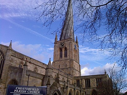
Chesterfield Parish Church Address: Church Way street in Chesterfield
Attractions near Chesterfield Parish Church
The Spire by Stephensons,Swan Yard,Top Shop,St Mary's Court,S41,Waikiki Beach,Crooked Spire,Newbold Designs,Chris's Taxis & Mini Coach Hire,The Thai Spa - Chesterfield,No 2a Bus Chesterfield To Walton (Circular),No 51 Bus Chesterfield to Danesmoor,Pomegranate Theatre (Chesterfield Panto),Vicar Lane Shopping Centre,Flash Express Beauty Bar,Ra&M Nowy Polski Sklep Chesterfield,Ciuri Ciuri Restaurant,54 bus stop,Scrapes,Heathcotes GroupHow to get to popular attractions in Chesterfield with public transportation
University of Nottingham Tram Stop, Nottingham,Duston Mill Car Boot Sale, Northampton,Corby Railway Station (COR), Corby,Chatsworth House, Derbyshire Dales,Highcross Shopping Centre, Leicester,Chesterfield College, Chesterfield,Lady Bay Retail Park, Nottingham,Nene Park, Peterborough,Lakeside Arts Centre, Nottingham,Hmp Five Wells, Wellingborough,Visitor Centre, Northampton,Nottingham Forest Football Club, Rushcliffe,John Lewis, Nottingham,Trowell, Broxtowe,Forest Fields, Nottingham,Bruntingthorpe, Harborough,Pronto Bus Stop Nottingham, Nottingham,Thorpe Wood Police Station, Peterborough,Market Bosworth, Hinckley And Bosworth,Trent Cardiac Centre, NottinghamGet around East Midlands by public transport!
Travelling around East Midlands has never been so easy. See step by step directions as you travel to any attraction, street or major public transport station. View bus and train timetables, arrival times, service alerts and detailed routes on a map, so you know exactly how to get to anywhere in East Midlands.
When travelling to any destination around East Midlands use Moovit's Live Directions with Get Off Notifications to know exactly where and how far to walk, how long to wait for your line , and how many stops are left. Moovit will alert you when it’s time to get off — no need to constantly re-check whether yours is the next stop.
Wondering how to use public transport in East Midlands or how to pay for public transport in East Midlands? Moovit public transport app can help you navigate your way with public transport easily, and at minimum cost. It includes public transport fees, ticket prices, and costs. Looking for a map of East Midlands public transport lines? Moovit public transport app shows all public transport maps in East Midlands with all Bus, Train and Light rail routes and stops on an interactive map.
East Midlands has 3 transport type(s), including: Bus, Train and Light rail, operated by several transport agencies, including National Rail, Ashbourne Community Transport, Delaine Buses, Arriva Midlands, Centrebus, Our Centre, Hulleys of Baslow, D & G Bus, Stagecoach East Midlands, North Lincolnshire Council, Roberts Coaches, Lawson's of Corby, Hawkes Coaches, East Yorkshire, Soar Valley Community Bus