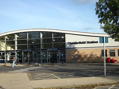
See Chesterfield Station on the map
Directions to Chesterfield Station with public transportation
The following transport lines have routes that pass near Chesterfield Station
 Bus:
Bus: - Train:
How to get to Chesterfield Station by bus?
Click on the bus route to see step by step directions with maps, line arrival times and updated time schedules.
How to get to Chesterfield Station by train?
Click on the train route to see step by step directions with maps, line arrival times and updated time schedules.
Bus stations near Chesterfield Station
- Brewery Street, Chesterfield,4 min walk,
- Stephenson Place, Chesterfield,6 min walk,
- Cavendish Street, Chesterfield,7 min walk,
Train stations near Chesterfield Station
- Chesterfield,51 min walk,
Bus routes to Chesterfield Station
- BLUE,Chatsworth,
- RED,Chatsworth,
- 55,Calow,
- 74,Staveley,
- 74A,Chesterfield,
- 77,Worksop,
- 77A,Chesterfield,
- 170,Bakewell,
- 170C,Chesterfield,
- 54,Clay Cross,
- 54A,Clay Cross,
- 170A,Chesterfield,
- 39,Chesterfield,
- 1,Hillstown,
- 1A,Hillstown,
- 16,Hasland,
- 90,Markham Vale,
- 90A,Walton,
- 90B,Chesterfield,
- 25,New Whittington,
What are the nearest stations to Chesterfield Station?
The nearest stations to Chesterfield Station are:
- Brewery Street, Chesterfield is 220 meters away, 4 min walk.
- Stephenson Place, Chesterfield is 440 meters away, 6 min walk.
- Cavendish Street, Chesterfield is 533 meters away, 7 min walk.
- Chesterfield is 3983 meters away, 51 min walk.
Which bus lines stop near Chesterfield Station?
These bus lines stop near Chesterfield Station: 55, 77, COMET, PRO, X17.
Which train lines stop near Chesterfield Station?
These train lines stop near Chesterfield Station: EAST MIDLANDS RAILWAY, NORTHERN.
What’s the nearest bus stop to Chesterfield Station?
The nearest bus stop to Chesterfield Station is Brewery Street, Chesterfield. It’s a 4 min walk away.
What time is the first train to Chesterfield Station?
The EAST MIDLANDS RAILWAY is the first train that goes to Chesterfield Station. It stops nearby at 05:10.
What time is the last train to Chesterfield Station?
The EAST MIDLANDS RAILWAY is the last train that goes to Chesterfield Station. It stops nearby at 00:27.
What time is the first bus to Chesterfield Station?
The 1 is the first bus that goes to Chesterfield Station. It stops nearby at 04:55.
What time is the last bus to Chesterfield Station?
The X17 is the last bus that goes to Chesterfield Station. It stops nearby at 00:03.
See Chesterfield Station on the map
Public Transportation to Chesterfield Station
Wondering how to get to Chesterfield Station, United Kingdom? Moovit helps you find the best way to get to Chesterfield Station with step-by-step directions from the nearest public transit station.
Moovit provides free maps and live directions to help you navigate through your city. View schedules, routes, timetables, and find out how long does it take to get to Chesterfield Station in real time.
Looking for the nearest stop or station to Chesterfield Station? Check out this list of stops closest to your destination: Brewery Street; Stephenson Place; Cavendish Street; Chesterfield.
Bus:Train:
Want to see if there’s another route that gets you there at an earlier time? Moovit helps you find alternative routes or times. Get directions from and directions to Chesterfield Station easily from the Moovit App or Website.
We make riding to Chesterfield Station easy, which is why over 1.5 million users, including users in Chesterfield, trust Moovit as the best app for public transit. You don’t need to download an individual bus app or train app, Moovit is your all-in-one transit app that helps you find the best bus time or train time available.
For information on prices of bus and train, costs and ride fares to Chesterfield Station, please check the Moovit app.
Use the app to navigate to popular places including to the airport, hospital, stadium, grocery store, mall, coffee shop, school, college, and university.
Location: Chesterfield, East Midlands
Attractions near Chesterfield Station
Chesterfield Railway Station (CHD),Chesterfield Rail Station,Chesterfield Railway Station,Chesterfield Railway Station (Railway Station, Chesterfield),Tapton Lane,Armisteads,CHESTER,Chesterfield Magistrates Court,Spire,Rose Cottage Doggy Day Care & Dog Hotel,Chesterfield Panto,Crooked Spire Soul,S41,Woodseats Sewing Machines,Chesterfield County Court,The Saints Parish Centre Cafe,The Artisan Café at Eyres Home,The Beach,Massage Clinique,Lennon's Pool and SnookerHow to get to popular attractions in Chesterfield with public transportation
The Mallard (Beefeater), Derby,Gedling, Gedling,Spider Bridge, Derby,Wyberton, Boston,Lakeside Arts Centre, Nottingham,Peterborough Power Signal Box, Peterborough,Southwell, Newark And Sherwood,Forest Fields, Nottingham,Kingsway Hospital, Derby,RAF Wittering, Peterborough,Morrisons Distribution Centre, Northampton,Queens Medical Centre, Nottingham,Campanile Hotel Northampton, South Northamptonshire,Sport Park Loughborough University, Charnwood,Peterborough Marriott Hotel, Peterborough,Premier Inn Nottingham West, Broxtowe,Tesco Extra, Leicester,Donut Roundabout Car Park, Chesterfield,Bracebridge Heath, North Kesteven,Currys PC World, LincolnGet around Chesterfield by public transport!
Travelling around Chesterfield has never been so easy. See step by step directions as you travel to any attraction, street or major public transport station. View bus and train timetables, arrival times, service alerts and detailed routes on a map, so you know exactly how to get to anywhere in Chesterfield.
When travelling to any destination around Chesterfield use Moovit's Live Directions with Get Off Notifications to know exactly where and how far to walk, how long to wait for your line , and how many stops are left. Moovit will alert you when it’s time to get off — no need to constantly re-check whether yours is the next stop.
Wondering how to use public transport in Chesterfield or how to pay for public transport in Chesterfield? Moovit public transport app can help you navigate your way with public transport easily, and at minimum cost. It includes public transport fees, ticket prices, and costs. Looking for a map of Chesterfield public transport lines? Moovit public transport app shows all public transport maps in Chesterfield with all bus or train routes and stops on an interactive map.
Chesterfield has 2 transport type(s), including: bus or train, operated by several transport agencies, including National Rail, Ashbourne Community Transport, Delaine Buses, Arriva Midlands, Centrebus, Our Centre, Hulleys of Baslow, D & G Bus, Stagecoach East Midlands, North Lincolnshire Council, National Rail, Roberts Coaches, Lawson's of Corby, Hawkes Coaches and East Yorkshire