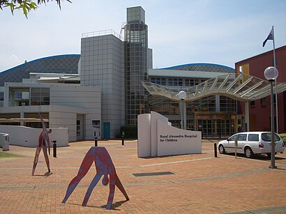
See Children's Hospital at Westmead on the map
Directions to Children's Hospital at Westmead with public transportation
The following transport lines have routes that pass near Children's Hospital at Westmead
 Bus:
Bus: - Train:
How to get to Children's Hospital at Westmead by bus?
Click on the bus route to see step by step directions with maps, line arrival times and updated time schedules.
How to get to Children's Hospital at Westmead by train?
Click on the train route to see step by step directions with maps, line arrival times and updated time schedules.
Bus stations near Children's Hospital at Westmead
- Westmead Station Alexandra Ave,2 min walk,
- Alexandra Ave Opp Westmead Station,3 min walk,
- Hospital T-Way,4 min walk,
Train stations near Children's Hospital at Westmead
- Westmead,3 min walk,
Bus routes to Children's Hospital at Westmead
- N70,Penrith to City Town Hall via Parramatta (Night Service),
- N71,Richmond to City Town Hall via Parramatta (Night Service),
- 660,Castlewood to Parramatta via Norwest,
- 661,Blacktown to Parramatta via Kings Langley & North West Twy,
- 662,Castle Hill to Parramatta via Bella Vista & North West Twy,
- 663,Rouse Hill Station to Parramatta via Glenwood,
- 664,Rouse Hill Station to Parramatta via Norwest,
- 665,Rouse Hill Station to Parramatta,
- 705,Blacktown to Parramatta via Pendle Hill,
- 708,Constitution Hill Retirement Community to Parramatta via Pendle Hill,
- 711,Blacktown to Parramatta via Constitution Hill,
- 712,Westmead Childrens Hospital to Parramatta,
- 2652,Darcy Rd PS to Westmead Station,
- 3650,Northmead HS to Westmead Station via Wentworthville,
- 2083,Darcy Rd Primary,
- 2540,Toongabbie,
- 818,Westmead Hospitals to Merrylands,
- 824,Westmead Hospitals to Parramatta via South Wentworthville,
What are the nearest stations to Children's Hospital at Westmead?
The nearest stations to Children's Hospital at Westmead are:
- Westmead Station Alexandra Ave is 135 meters away, 2 min walk.
- Westmead is 186 meters away, 3 min walk.
- Alexandra Ave Opp Westmead Station is 202 meters away, 3 min walk.
- Hospital T-Way is 232 meters away, 4 min walk.
Which bus lines stop near Children's Hospital at Westmead?
These bus lines stop near Children's Hospital at Westmead: T61, T62, T64.
Which train line stops near Children's Hospital at Westmead?
T1
What’s the nearest train station to Children's Hospital at Westmead?
The nearest train station to Children's Hospital at Westmead is Westmead. It’s a 3 min walk away.
What’s the nearest bus stop to Children's Hospital at Westmead?
The nearest bus stop to Children's Hospital at Westmead is Westmead Station Alexandra Ave. It’s a 2 min walk away.
See Children's Hospital at Westmead on the map
Public Transportation to Children's Hospital at Westmead
Wondering how to get to Children's Hospital at Westmead, Australia? Moovit helps you find the best way to get to Children's Hospital at Westmead with step-by-step directions from the nearest public transit station.
Moovit provides free maps and live directions to help you navigate through your city. View schedules, routes, timetables, and find out how long does it take to get to Children's Hospital at Westmead in real time.
Looking for the nearest stop or station to Children's Hospital at Westmead? Check out this list of stops closest to your destination: Westmead Station Alexandra Ave; Westmead; Alexandra Ave Opp Westmead Station; Hospital T-Way.
Bus:Train:
Want to see if there’s another route that gets you there at an earlier time? Moovit helps you find alternative routes or times. Get directions from and directions to Children's Hospital at Westmead easily from the Moovit App or Website.
We make riding to Children's Hospital at Westmead easy, which is why over 1.5 million users, including users in Westmead, trust Moovit as the best app for public transit. You don’t need to download an individual bus app or train app, Moovit is your all-in-one transit app that helps you find the best bus time or train time available.
For information on prices of train and bus, costs and ride fares to Children's Hospital at Westmead, please check the Moovit app.
Use the app to navigate to popular places including to the airport, hospital, stadium, grocery store, mall, coffee shop, school, college, and university.
Location: Westmead, Sydney
Attractions near Children's Hospital at Westmead
Westmeadow Child Care Centre,Psychological Consult,Association For The Welfare of Child Health,Westpac,Skyring Alan P,Koutts Jerry Dr,Skintology,Ong, Andrew,Westmead Public School,Clouston Paul D,Cass D,Video Conferencing Centre,Dorsch N W C Professor,Starbucks Coffee Company (Australia) Pty Ltd,Gayer Nalini Dr,Dorsch N W C Neurosurgeon,Ampol,Allied Health Recruitment,Ung O.A. Dr,DJ Troy THow to get to popular attractions in Westmead with public transportation
Petersham Station, Petersham,Bar Reggio, Darlinghurst,The M5/M7 Pyramid, Prestons,Ms. G's, Potts Point,North Ryde Station, North Ryde,The Star Casino, Pyrmont,Munich Brauhaus, The Rocks (Sydney - NSW),Turramurra Station, Turramurra,The Russian Club, Strathfield (NSW),Single O, Surry Hills,The Rose Hotel, Chippendale,Rose Of Australia Hotel, Erskineville,Carlingford Court, Carlingford,Manly Beach, Manly (NSW),The Orient Hotel, The Rocks (Sydney - NSW),Toko, Surry Hills,The Dolphin Hotel, Surry Hills,Lidcombe Station (Concourse), Lidcombe,Helm Bar, Sydney,UNSW, Kensington (NSW)Get around Westmead by public transport!
Travelling around Westmead has never been so easy. See step by step directions as you travel to any attraction, street or major public transport station. View bus and train timetables, arrival times, service alerts and detailed routes on a map, so you know exactly how to get to anywhere in Westmead.
When travelling to any destination around Westmead use Moovit's Live Directions with Get Off Notifications to know exactly where and how far to walk, how long to wait for your line , and how many stops are left. Moovit will alert you when it’s time to get off — no need to constantly re-check whether yours is the next stop.
Wondering how to use public transport in Westmead or how to pay for public transport in Westmead? Moovit public transport app can help you navigate your way with public transport easily, and at minimum cost. It includes public transport fees, ticket prices, and costs. Looking for a map of Westmead public transport lines? Moovit public transport app shows all public transport maps in Westmead with all train or bus routes and stops on an interactive map.
Westmead has 2 transport type(s), including: train or bus, operated by several transport agencies, including Sydney Metro, Sydney Trains, Sydney Light Rail, Sydney Ferries, Intercity Trains, Intercity Train, NSW TrainLink, CDC NSW R14, U-Go Mobility, Keolis Downer Northern Beaches, Manly Fast Ferry, Transdev John Holland Buses, Busways, Busways North West and Dysons Buslines