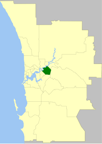
See City Of Belmont, Rivervale, on the map
Directions to City Of Belmont (Rivervale) with public transport
The following transport lines have routes that pass near City Of Belmont
 Bus:
Bus: - Train:
How to get to City Of Belmont by bus?
Click on the bus route to see step by step directions with maps, line arrival times and updated time schedules.
How to get to City Of Belmont by train?
Click on the train route to see step by step directions with maps, line arrival times and updated time schedules.
Bus stations near City Of Belmont in Rivervale
- Belmont Av After Ross St,2 min walk,
- Belmont Av Before Wright St,4 min walk,
- Wright St Before Belmont Av,4 min walk,
- Wright St After Belmont Av,5 min walk,
- Wright St - Belmont Forum Shopping Ctr,6 min walk,
Train stations near City Of Belmont in Rivervale
- Burswood Stn,38 min walk,
- Perth Stadium Stn,59 min walk,
Bus lines to City Of Belmont in Rivervale
- 270,High Wycombe Stn,
- 935,Perth,
- 37,Curtin University Bus Stn,
- 38,Perth Busport,
- 999,Belmont Forum / Wright St,
- 998,Fremantle Stn,
- 284,Curtin Central Bus Stn,
- 655,Kalamunda Bus Stn,
- 285,Welshpool,
What are the nearest stations to City Of Belmont?
The nearest stations to City Of Belmont are:
- Belmont Av After Ross St is 77 meters away, 2 min walk.
- Belmont Av Before Wright St is 258 meters away, 4 min walk.
- Wright St Before Belmont Av is 280 meters away, 4 min walk.
- Wright St After Belmont Av is 340 meters away, 5 min walk.
- Wright St - Belmont Forum Shopping Ctr is 454 meters away, 6 min walk.
- Burswood Stn is 2897 meters away, 38 min walk.
- Perth Stadium Stn is 4595 meters away, 59 min walk.
Which bus lines stop near City Of Belmont?
These bus lines stop near City Of Belmont: 38, 935, 998, 999.
Which train line stops near City Of Belmont?
ARMADALE LINE
What’s the nearest bus stop to City Of Belmont in Rivervale?
The nearest bus stop to City Of Belmont in Rivervale is Belmont Av After Ross St. It’s a 2 min walk away.
What time is the first train to City Of Belmont in Rivervale?
The ARMADALE LINE is the first train that goes to City Of Belmont in Rivervale. It stops nearby at 04:45.
What time is the last train to City Of Belmont in Rivervale?
The ARMADALE LINE is the last train that goes to City Of Belmont in Rivervale. It stops nearby at 00:21.
What time is the first bus to City Of Belmont in Rivervale?
The 935 is the first bus that goes to City Of Belmont in Rivervale. It stops nearby at 04:34.
What time is the last bus to City Of Belmont in Rivervale?
The 935 is the last bus that goes to City Of Belmont in Rivervale. It stops nearby at 00:34.
How much is the bus fare to City Of Belmont?
The bus fare to City Of Belmont costs about $2.07 - $4.59.
How much is the train fare to City Of Belmont?
The train fare to City Of Belmont costs about $2.07 - $4.59.
See City Of Belmont, Rivervale, on the map
Public Transit to City Of Belmont in Rivervale
Wondering how to get to City Of Belmont in Rivervale, Australia? Moovit helps you find the best way to get to City Of Belmont with step-by-step directions from the nearest public transit station.
Moovit provides free maps and live directions to help you navigate through your city. View schedules, routes, timetables, and find out how long does it take to get to City Of Belmont in real time.
Looking for the nearest stop or station to City Of Belmont? Check out this list of stops closest to your destination: Belmont Av After Ross St; Belmont Av Before Wright St; Wright St Before Belmont Av; Wright St After Belmont Av; Wright St - Belmont Forum Shopping Ctr; Burswood Stn; Perth Stadium Stn.
Bus:Train:
Want to see if there’s another route that gets you there at an earlier time? Moovit helps you find alternative routes or times. Get directions from and directions to City Of Belmont easily from the Moovit App or Website.
We make riding to City Of Belmont easy, which is why over 1.5 million users, including users in Rivervale, trust Moovit as the best app for public transit. You don’t need to download an individual bus app or train app, Moovit is your all-in-one transit app that helps you find the best bus time or train time available.
For information on prices of bus and train, costs and ride fares to City Of Belmont, please check the Moovit app.
Use the app to navigate to popular places including to the airport, hospital, stadium, grocery store, mall, coffee shop, school, college, and university.
City Of Belmont Address: 215 Wright St street in Rivervale
Attractions near City Of Belmont
Swan Settlers Market,Belmont Retravision,Yoshino Sushi,Sda Perth Driver Training,PI* Prestigepartners,Gold Lounge,Belmont Police Station,Proproperty,Emona Instruments,Belmont Bec,3m,Get Real Estate Agents,Llara Tax and Accounting,Trident Property Partners,Belmont Oasis Leisure Center,Belmont Avenue,Wow Factor Travel,Pemberton RG & Co,Illusion Gas Log Fires & Ultimate Wood Heaters,KmartHow to get to popular attractions in Rivervale with public transportation
Ace Cinemas, Rockingham,Tony Roma's Ribs, Seafood, & Steaks, Perth,Perth Zoo, South Perth,Springs Shopping Centre, Beechboro,Sir Charles Gairdner Hospital 8th Floor Cafeteria, Nedlands,Tafe - Thornlie Campus, Thornlie,The Flour Factory, Perth,Bullsbrook, Bullsbrook,Fremantle Train Station, Fremantle,QEII Medical Centre, Nedlands,Duende, Leederville,Elizabeth Quay Ferry Terminal, Perth,The Paddington Ale House, Mount Hawthorn,Shoalwater Bay, Shoalwater,OHCWA, Nedlands,The Quarie Bar And Brasserie, Hammond Park,Hanami Japanese Restaurant, Mount Lawley,Mt Claremont, City Beach,Mandurah Beach,Subiaco Hotel, SubiacoGet around Rivervale by public transport!
Travelling around Rivervale has never been so easy. See step by step directions as you travel to any attraction, street or major public transport station. View bus and train timetables, arrival times, service alerts and detailed routes on a map, so you know exactly how to get to anywhere in Rivervale.
When travelling to any destination around Rivervale use Moovit's Live Directions with Get Off Notifications to know exactly where and how far to walk, how long to wait for your line , and how many stops are left. Moovit will alert you when it’s time to get off — no need to constantly re-check whether yours is the next stop.
Wondering how to use public transport in Rivervale or how to pay for public transport in Rivervale? Moovit public transport app can help you navigate your way with public transport easily, and at minimum cost. It includes public transport fees, ticket prices, and costs. Looking for a map of Rivervale public transport lines? Moovit public transport app shows all public transport maps in Rivervale with all bus or train routes and stops on an interactive map.
Rivervale has 2 transport type(s), including: bus or train, operated by several transport agencies, including Transperth Rail, Transwa, Transperth Ferry, Transperth, TransBusselton, TransAlbany, TransGoldfields, TransEsperance, TransGeraldton, TransCarnarvon, TransHedland, TransKarratha, Transwa, TransBunbury and Mandurah Bus Charter