Directions to Clapham North with public transportation
The following transport lines have routes that pass near Clapham North
How to get to Clapham North by bus?
Click on the bus route to see step by step directions with maps, line arrival times and updated time schedules.
How to get to Clapham North by train?
Click on the train route to see step by step directions with maps, line arrival times and updated time schedules.
How to get to Clapham North by Tube?
Click on the Tube route to see step by step directions with maps, line arrival times and updated time schedules.
Bus stations near Clapham North
- Clapham High Street,3 min walk,
- Clapham North & High Street Stns (L),4 min walk,
- Clapham North & High Street Stns (G),5 min walk,
- Clapham Road / Bedford Road (C),6 min walk,
Tube stations near Clapham North
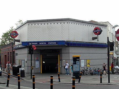
- Clapham North,5 min walk,
- Stockwell,30 min walk,
Bus routes to Clapham North
- OVERGROUND,Clapham Junction,
- OVERGROUND,Bus Replacement: Canada Water,
- 50,Stockwell,
- 88,Parliament Hill Fields,
- 155,Tooting, St. George's Hospital,
- N155,Aldwych,
- 322,Crystal Palace,
- 345,Peckham,
- P5,Elephant & Castle,
What are the nearest stations to Clapham North?
The nearest stations to Clapham North are:
- Clapham High Street is 145 meters away, 3 min walk.
- Clapham North & High Street Stns (G) is 264 meters away, 5 min walk.
- Clapham North & High Street Stns (L) is 278 meters away, 4 min walk.
- Clapham North is 284 meters away, 5 min walk.
- Clapham Road / Bedford Road (C) is 366 meters away, 6 min walk.
- Stockwell is 2247 meters away, 30 min walk.
Which bus lines stop near Clapham North?
These bus lines stop near Clapham North: 155, 345, 50, 88.
Which train line stops near Clapham North?
OVERGROUND
Which Tube line stops near Clapham North?
NORTHERN
What’s the nearest Tube station to Clapham North?
The nearest Tube station to Clapham North is Clapham North. It’s a 5 min walk away.
What’s the nearest bus stop to Clapham North?
The nearest bus stop to Clapham North is Clapham High Street. It’s a 3 min walk away.
What time is the first Tube to Clapham North?
The VICTORIA is the first Tube that goes to Clapham North. It stops nearby at 03:09.
What time is the last Tube to Clapham North?
The VICTORIA is the last Tube that goes to Clapham North. It stops nearby at 00:47.
What time is the first train to Clapham North?
The OVERGROUND is the first train that goes to Clapham North. It stops nearby at 07:35.
What time is the last train to Clapham North?
The OVERGROUND is the last train that goes to Clapham North. It stops nearby at 23:58.
What time is the first bus to Clapham North?
The 88 is the first bus that goes to Clapham North. It stops nearby at 03:00.
What time is the last bus to Clapham North?
The 88 is the last bus that goes to Clapham North. It stops nearby at 04:02.
See Clapham North on the map
Public Transportation to Clapham North
Wondering how to get to Clapham North, United Kingdom? Moovit helps you find the best way to get to Clapham North with step-by-step directions from the nearest public transit station.
Moovit provides free maps and live directions to help you navigate through your city. View schedules, routes, timetables, and find out how long does it take to get to Clapham North in real time.
Looking for the nearest stop or station to Clapham North? Check out this list of stops closest to your destination: Clapham High Street; Clapham North & High Street Stns (G); Clapham North & High Street Stns (L); Clapham North; Clapham Road / Bedford Road (C); Stockwell.
Bus:1553455088OVERGROUNDOVERGROUND322N155P5Train:OVERGROUNDTube:NORTHERNVICTORIA
Want to see if there’s another route that gets you there at an earlier time? Moovit helps you find alternative routes or times. Get directions from and directions to Clapham North easily from the Moovit App or Website.
We make riding to Clapham North easy, which is why over 1.5 million users, including users in Clapham, trust Moovit as the best app for public transit. You don’t need to download an individual bus app or train app, Moovit is your all-in-one transit app that helps you find the best bus time or train time available.
For information on prices of train, bus and Tube, costs and ride fares to Clapham North, please check the Moovit app.
Use the app to navigate to popular places including to the airport, hospital, stadium, grocery store, mall, coffee shop, school, college, and university.
Clapham North Address: London, Clapham North, UK street in Clapham
Attractions near Clapham North
Clapham High Street London Overground Station,Clapham High Street Station,Voltaire Road Junction,The Bread & Roses Theatre,Gauden Road,SW4 6DZ,Better Clapham Leisure Centre,Tropix,Sorella,Laura Phelan Well Limited,SW4 6BX,Clapham Family Practice,Roti Joupa,SW4 7ul,Lotus,25 Chelsham Road,Clapham High Street,Metro Bank,Clapham Road Bedford Road (Stop C), London,Clapham Manor Primary SchoolHow to get to popular attractions in Clapham with public transportation
Muswell Hill, Muswell Hill,Virgin Active, Chiswick,Bicester North Railway Station (BCS), Bicester,Departure Lounge, Stansted,Whipps Cross University Hospital, Upper Walthamstow,Virgin Active, Wimbledon,Friary Centre Bus Station Bay 19, Guildford,Heathrow Terminal 3, Heathrow,Lewisham, Lewisham,Hampstead, Hampstead,Peckham, Peckham,Queen Elizabeth Hospital, Woolwich,Wembley, Wembley,Covent Garden Station, Covent Garden,High Wycombe Bus Station, High Wycombe,Sands, High Wycombe,Bexleyheath, Bexleyheath,Northwick Park Hospital, Kenton,Kingston upon Thames, Kingston,Borough Market, BoroughGet around Clapham by public transport!
Travelling around Clapham has never been so easy. See step by step directions as you travel to any attraction, street or major public transport station. View bus and train timetables, arrival times, service alerts and detailed routes on a map, so you know exactly how to get to anywhere in Clapham.
When travelling to any destination around Clapham use Moovit's Live Directions with Get Off Notifications to know exactly where and how far to walk, how long to wait for your line , and how many stops are left. Moovit will alert you when it’s time to get off — no need to constantly re-check whether yours is the next stop.
Wondering how to use public transport in Clapham or how to pay for public transport in Clapham? Moovit public transport app can help you navigate your way with public transport easily, and at minimum cost. It includes public transport fees, ticket prices, and costs. Looking for a map of Clapham public transport lines? Moovit public transport app shows all public transport maps in Clapham with all train, bus or Tube routes and stops on an interactive map.
Clapham has 3 transport type(s), including: train, bus or Tube, operated by several transport agencies, including London Underground, London Buses, Transport for London, London Tramlink, Transport for London, National Rail, Bluestar, Berry's Coaches, Oxford Bus Company, Stagecoach West, Community First Wessex, Cresta Coaches, D & P Boat Hire, First Portsmouth, Fareham & Gosport and FYTbus