Directions to Clarkefield (Riddells Creek) with public transport
The following transport lines have routes that pass near Clarkefield
 Bus:
Bus: - Train:
How to get to Clarkefield by bus?
Click on the bus route to see step by step directions with maps, line arrival times and updated time schedules.
How to get to Clarkefield by train?
Click on the train route to see step by step directions with maps, line arrival times and updated time schedules.
Bus stations near Clarkefield in Riddells Creek
- Clarkefield Railway Station (Clarkefield),3 min walk,
Train stations near Clarkefield in Riddells Creek
- Clarkefield,3 min walk,
Bus lines to Clarkefield in Riddells Creek
- LANCEFIELD - SUNBURY VIA LANCEFIELD,Sunbury,
- MELBOURNE - BENDIGO VIA SUNBURY,Melbourne,
- MELBOURNE - ECHUCA/MOAMA VIA BENDIGO OR HEATHCOTE,Echuca/Moama,
What are the nearest stations to Clarkefield?
The nearest stations to Clarkefield are:
- Clarkefield Railway Station (Clarkefield) is 191 meters away, 3 min walk.
- Clarkefield is 191 meters away, 3 min walk.
Which bus lines stop near Clarkefield?
These bus lines stop near Clarkefield: KYNETON - SUNBURY VIA LANCEFIELD ROMSEY, LANCEFIELD - MELBOURNE VIA SUNBURY OR GISBORNE.
Which train lines stop near Clarkefield?
These train lines stop near Clarkefield: ECHUCA/MOAMA - MELBOURNE VIA BENDIGO OR HEATHCOTE, MELBOURNE - BENDIGO VIA SUNBURY.
What’s the nearest train station to Clarkefield in Riddells Creek?
The nearest train station to Clarkefield in Riddells Creek is Clarkefield. It’s a 3 min walk away.
What’s the nearest bus stop to Clarkefield in Riddells Creek?
The nearest bus stop to Clarkefield in Riddells Creek is Clarkefield Railway Station (Clarkefield). It’s a 3 min walk away.
See Clarkefield, Riddells Creek, on the map
Public Transit to Clarkefield in Riddells Creek
Wondering how to get to Clarkefield in Riddells Creek, Australia? Moovit helps you find the best way to get to Clarkefield with step-by-step directions from the nearest public transit station.
Moovit provides free maps and live directions to help you navigate through your city. View schedules, routes, timetables, and find out how long does it take to get to Clarkefield in real time.
Looking for the nearest stop or station to Clarkefield? Check out this list of stops closest to your destination: Clarkefield Railway Station (Clarkefield); Clarkefield.
Bus:Train:
Want to see if there’s another route that gets you there at an earlier time? Moovit helps you find alternative routes or times. Get directions from and directions to Clarkefield easily from the Moovit App or Website.
We make riding to Clarkefield easy, which is why over 1.5 million users, including users in Riddells Creek, trust Moovit as the best app for public transit. You don’t need to download an individual bus app or train app, Moovit is your all-in-one transit app that helps you find the best bus time or train time available.
For information on prices of bus, train and tram, costs and ride fares to Clarkefield, please check the Moovit app.
Use the app to navigate to popular places including to the airport, hospital, stadium, grocery store, mall, coffee shop, school, college, and university.
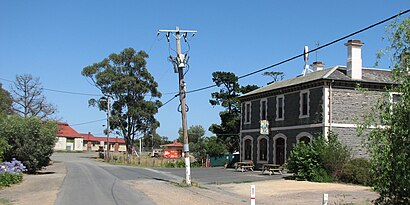
Clarkefield Address: Station Street street in Riddells Creek
Attractions near Clarkefield
Clarkefield Cfa,Tennis,Coach & Horses Inn,Clarkefield Coach & Horses Inn,Cricket,Clarkfield Station,Clarkefield Train Station,1 Station Street,1,2,Clarkefield Primary School,Black Hill Bridge,Bolinda Bridge,Riddell Airfield,Dave's Camair,Riddell Airport,Special Organic Soils,Hiram Pastoral Stud,Victoria,Riddell AirfieldHow to get to popular attractions in Riddells Creek with public transportation
Spotswood Station, Spotswood,Regent Station, Reservoir,Ballarat, Ballarat Central,Melbourne Girls College, Richmond,Doncaster Park And Ride, Doncaster,Melton Station, Melton South,Flinders Street Station Pharmacy, Melbourne,Stockland The Pines, Doncaster East,Melbourne High School, South Yarra,Belgrave Station, Belgrave,Corio Central, Corio,Cheltenham Secondary College, Cheltenham,Swanston Street - Flinders Street Station, Melbourne,John Cain Arena, Melbourne,Moorabbin Station, Moorabbin,Dfo Essendon, Strathmore,Tram Stop 128, Port Melbourne,Alfred Hospital, Melbourne,Cinema Nova, Carlton,Cbd, MelbourneGet around Riddells Creek by public transport!
Travelling around Riddells Creek has never been so easy. See step by step directions as you travel to any attraction, street or major public transport station. View bus and train timetables, arrival times, service alerts and detailed routes on a map, so you know exactly how to get to anywhere in Riddells Creek.
When travelling to any destination around Riddells Creek use Moovit's Live Directions with Get Off Notifications to know exactly where and how far to walk, how long to wait for your line , and how many stops are left. Moovit will alert you when it’s time to get off — no need to constantly re-check whether yours is the next stop.
Wondering how to use public transport in Riddells Creek or how to pay for public transport in Riddells Creek? Moovit public transport app can help you navigate your way with public transport easily, and at minimum cost. It includes public transport fees, ticket prices, and costs. Looking for a map of Riddells Creek public transport lines? Moovit public transport app shows all public transport maps in Riddells Creek with all bus, train or tram routes and stops on an interactive map.
Riddells Creek has 3 transport type(s), including: bus, train or tram, operated by several transport agencies, including PTV Metropolitan Trains, PTV Metropolitan Bus, Yarra Trams, PTV Regional Bus, SkyBus, Interstate Services, V/Line and V/Line (Coach)