Directions to Claythorpe (East Lindsey) with public transport
The following transport lines have routes that pass near Claythorpe
How to get to Claythorpe by bus?
Click on the bus route to see step by step directions with maps, line arrival times and updated time schedules.
Bus stations near Claythorpe in East Lindsey
- Demand Responsive Area, Claythorpe,2 min walk,
- Authorpe Hall Farm, Authorpe,37 min walk,
Bus lines to Claythorpe in East Lindsey
- 51E,Tetford,
- 59M,Withern,
- N106S,Louth,
What are the nearest stations to Claythorpe?
The nearest stations to Claythorpe are:
- Demand Responsive Area, Claythorpe is 134 meters away, 2 min walk.
- Authorpe Hall Farm, Authorpe is 2903 meters away, 37 min walk.
Which bus line stops near Claythorpe?
51S
What’s the nearest bus stop to Claythorpe in East Lindsey?
The nearest bus stop to Claythorpe in East Lindsey is Demand Responsive Area, Claythorpe. It’s a 2 min walk away.
See Claythorpe, East Lindsey, on the map
Public Transit to Claythorpe in East Lindsey
Wondering how to get to Claythorpe in East Lindsey, United Kingdom? Moovit helps you find the best way to get to Claythorpe with step-by-step directions from the nearest public transit station.
Moovit provides free maps and live directions to help you navigate through your city. View schedules, routes, timetables, and find out how long does it take to get to Claythorpe in real time.
Looking for the nearest stop or station to Claythorpe? Check out this list of stops closest to your destination: Demand Responsive Area; Authorpe Hall Farm.
Bus:51S51E59MN106S
Want to see if there’s another route that gets you there at an earlier time? Moovit helps you find alternative routes or times. Get directions from and directions to Claythorpe easily from the Moovit App or Website.
We make riding to Claythorpe easy, which is why over 1.5 million users, including users in East Lindsey, trust Moovit as the best app for public transit. You don’t need to download an individual bus app or train app, Moovit is your all-in-one transit app that helps you find the best bus time or train time available.
For information on prices of bus, costs and ride fares to Claythorpe, please check the Moovit app.
Use the app to navigate to popular places including to the airport, hospital, stadium, grocery store, mall, coffee shop, school, college, and university.
Claythorpe Address: 1 Troutbeck Farm Cottages, Claythorpe, Alford, Lincolnshire LN13 0DU, UK street in East Lindsey
Attractions near Claythorpe
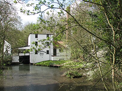
Ln13 0du,Claythorpe Water Mill & Wild Fowl Gardens,Claythorpe Watermill & Wildfowl Gardens,Claythrope Water Mill And Wild Fowl Resevre,Troutbeck Farm,Station Farm,Ln13 0dq,Methodist Church,Methodist Church,New Street,Ln13 0dh,Berwyn House,Postagestamp Cottage,Aby,Berwyn House,Ln13 0dj,Ln13 0ds,Aby C of E Controlled Primary School,Ln13 0dn,Ln13 0dtHow to get to popular attractions in East Lindsey with public transportation
Chesterfield College, Chesterfield,Icon Centre, Daventry,Holiday Inn Express Peterborough, Peterborough,Holiday Inn Nottingham, Nottingham,Donut Roundabout Car Park, Chesterfield,Nettleham, West Lindsey,Morrisons, Bassetlaw,University Of Nottingham, Nottingham,Oakham Railway Station (OKM), Rutland,Tottle Bakery, Nottingham,Matalan, Corby,Nottingham Station, Nottingham,Hucknall Tram Stop, Ashfield,Daventry Court Hotel, Daventry,The Lincolnshire Wolds, East Lindsey,Quorn & Woodhouse Railway Station (GC Railway), Charnwood,Ratcliffe Power Station, Rushcliffe,Lidl, Peterborough,Nottingham Council House, Nottingham,Westwood Centre, PeterboroughGet around East Lindsey by public transport!
Travelling around East Lindsey has never been so easy. See step by step directions as you travel to any attraction, street or major public transport station. View bus and train timetables, arrival times, service alerts and detailed routes on a map, so you know exactly how to get to anywhere in East Lindsey.
When travelling to any destination around East Lindsey use Moovit's Live Directions with Get Off Notifications to know exactly where and how far to walk, how long to wait for your line , and how many stops are left. Moovit will alert you when it’s time to get off — no need to constantly re-check whether yours is the next stop.
Wondering how to use public transport in East Lindsey or how to pay for public transport in East Lindsey? Moovit public transport app can help you navigate your way with public transport easily, and at minimum cost. It includes public transport fees, ticket prices, and costs. Looking for a map of East Lindsey public transport lines? Moovit public transport app shows all public transport maps in East Lindsey with all bus routes and stops on an interactive map.
East Lindsey has 1 transport type(s), including: bus, operated by several transport agencies, including National Rail, Ashbourne Community Transport, Delaine Buses, Arriva Midlands, Centrebus, Our Centre, Hulleys of Baslow, D & G Bus, Stagecoach East Midlands, North Lincolnshire Council, National Rail, Roberts Coaches, Lawson's of Corby, Hawkes Coaches and East Yorkshire