See Clifton Suspension Bridge, South West, on the map
Directions to Clifton Suspension Bridge (South West) with public transport
The following transport lines have routes that pass near Clifton Suspension Bridge
 Bus:
Bus: - Train:
- Ferry:
How to get to Clifton Suspension Bridge by bus?
Click on the bus route to see step by step directions with maps, line arrival times and updated time schedules.
How to get to Clifton Suspension Bridge by train?
Click on the train route to see step by step directions with maps, line arrival times and updated time schedules.
Ferry stations near Clifton Suspension Bridge in South West
- The Cottage Ferry Landing, Harbour,3 min walk,
- Bristol City Centre Ferry Landing, Bristol City Centre,35 min walk,
Bus stations near Clifton Suspension Bridge in South West
- Merchants Road, Hotwells,6 min walk,
- Christ Church, Clifton,8 min walk,
Bus lines to Clifton Suspension Bridge in South West
- X1,Weston-Super-Mare, Asda Store - Bristol Bus Station,
- U2,Bristol City Centre - Langford Campus,
- X4,Bristol Bus Station - Portishead, Combe Road,
- X6,Bristol Bus Station - Clevedon, Dial Hill Road,
- X7,Bristol Bus Station - Clevedon, Edward Road,
- X8,Bristol Bus Station - Nailsea, Link Road,
- 9,Portway P&R - Brislington P&R,
- X9,Bristol Bus Station - Nailsea, Ash Hayes Road,
- 41,Avonmouth - Kingswood,
- 505,Long Ashton P&R - Southmead Hospital,
- 5,Clifton,
- 8,Temple Meads,
What are the nearest stations to Clifton Suspension Bridge?
The nearest stations to Clifton Suspension Bridge are:
- The Cottage Ferry Landing, Harbour is 152 meters away, 3 min walk.
- Merchants Road, Hotwells is 439 meters away, 6 min walk.
- Christ Church, Clifton is 594 meters away, 8 min walk.
- Bristol City Centre Ferry Landing, Bristol City Centre is 2631 meters away, 35 min walk.
Which bus lines stop near Clifton Suspension Bridge?
These bus lines stop near Clifton Suspension Bridge: 505, 8, 9.
Which train line stops near Clifton Suspension Bridge?
GREAT WESTERN RAILWAY
What’s the nearest bus stop to Clifton Suspension Bridge in South West?
The nearest bus stop to Clifton Suspension Bridge in South West is Merchants Road, Hotwells. It’s a 6 min walk away.
What’s the nearest ferry station to Clifton Suspension Bridge in South West?
The nearest ferry station to Clifton Suspension Bridge in South West is The Cottage Ferry Landing, Harbour. It’s a 3 min walk away.
What time is the first bus to Clifton Suspension Bridge in South West?
The 41 is the first bus that goes to Clifton Suspension Bridge in South West. It stops nearby at 05:19.
What time is the last bus to Clifton Suspension Bridge in South West?
The 8 is the last bus that goes to Clifton Suspension Bridge in South West. It stops nearby at 00:39.
What time is the first ferry to Clifton Suspension Bridge in South West?
The NETHAM SERVICE is the first ferry that goes to Clifton Suspension Bridge in South West. It stops nearby at 08:35.
What time is the last ferry to Clifton Suspension Bridge in South West?
The NETHAM SERVICE is the last ferry that goes to Clifton Suspension Bridge in South West. It stops nearby at 17:15.
See Clifton Suspension Bridge, South West, on the map
Public Transit to Clifton Suspension Bridge in South West
Wondering how to get to Clifton Suspension Bridge in South West, United Kingdom? Moovit helps you find the best way to get to Clifton Suspension Bridge with step-by-step directions from the nearest public transit station.
Moovit provides free maps and live directions to help you navigate through your city. View schedules, routes, timetables, and find out how long does it take to get to Clifton Suspension Bridge in real time.
Looking for the nearest stop or station to Clifton Suspension Bridge? Check out this list of stops closest to your destination: The Cottage Ferry Landing; Merchants Road; Christ Church; Bristol City Centre Ferry Landing.
Bus:Train:Ferry:
Want to see if there’s another route that gets you there at an earlier time? Moovit helps you find alternative routes or times. Get directions from and directions to Clifton Suspension Bridge easily from the Moovit App or Website.
We make riding to Clifton Suspension Bridge easy, which is why over 1.5 million users, including users in South West, trust Moovit as the best app for public transit. You don’t need to download an individual bus app or train app, Moovit is your all-in-one transit app that helps you find the best bus time or train time available.
For information on prices of bus and train, costs and ride fares to Clifton Suspension Bridge, please check the Moovit app.
Use the app to navigate to popular places including to the airport, hospital, stadium, grocery store, mall, coffee shop, school, college, and university.
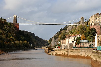
Clifton Suspension Bridge Address: Clifton Suspension Bridge, Bridge Rd, Bristol BS8 3PA, UK street in South West
Attractions near Clifton Suspension Bridge
Leigh Woods Tower,Hotwells Station,Homewatchers,25 Fremantle Square Management Company,Ancient Rock Slider,Stresstonic,The Lookout Lectern,Downslea Corporate Services Limited,Giants Cave, Clifton Suspension Bridge,Clifton Suspension Bridge Viewing Point,Bosano Consulting Limited,The Clifton Observatory,Heather Henderson,Sion Lane Workshops,Clifton Rocks Railway,Goram & Vincent,White Lion,White Lion Bar,Clifton Suspension Bridge Visitor Centre,Avon Gorge HotelHow to get to popular attractions in South West with public transportation
Falmouth University Penryn Campus (formerly UCF Tremough Campus), Cornwall,Poole Harbour, Poole,Poole Quay, Poole,Bridport, West Dorset,Cheltenham Town Hall, Cheltenham,Ilfracombe Harbour, North Devon,Active Lifestyle Centre, South Gloucestershire,Dorset County Council, West Dorset,Parkstone Railway Station (PKS), Poole,Sainsbury’s, Southampton,The Isambard Kingdom Brunel (Wetherspoon), Portsmouth,Stroud Railway Station (STD), Stroud,HMS Collingwood, Fareham,Paignton Zoo Environmental Park, Torbay,Pittville Park & Lake, Cheltenham,Penzance, Cornwall,St Austell Railway Station (SAU) (USX), Cornwall,Central Park, Plymouth,Port Of Poole, Poole,Avonmouth Docks, Bristol, City OfGet around South West by public transport!
Travelling around South West has never been so easy. See step by step directions as you travel to any attraction, street or major public transport station. View bus and train timetables, arrival times, service alerts and detailed routes on a map, so you know exactly how to get to anywhere in South West.
When travelling to any destination around South West use Moovit's Live Directions with Get Off Notifications to know exactly where and how far to walk, how long to wait for your line , and how many stops are left. Moovit will alert you when it’s time to get off — no need to constantly re-check whether yours is the next stop.
Wondering how to use public transport in South West or how to pay for public transport in South West? Moovit public transport app can help you navigate your way with public transport easily, and at minimum cost. It includes public transport fees, ticket prices, and costs. Looking for a map of South West public transport lines? Moovit public transport app shows all public transport maps in South West with all bus or train routes and stops on an interactive map.
South West has 2 transport type(s), including: bus or train, operated by several transport agencies, including National Rail, Stagecoach South, Padstow Harbour Commissioners, Royal Buses, Tavistock Community Transport, River Link, Beaminster Town Council, Yeos Contracts, MD Coaches, Newport Bus, First Bristol, Bath & the West, First Kernow, St Mawes Ferry, First Wessex, Dorset & South Somerset and Isles of Scilly Steamship Co