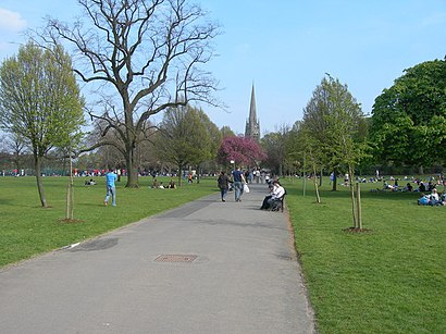
Directions to Clissold Park (Stoke Newington) with public transport
The following transport lines have routes that pass near Clissold Park
How to get to Clissold Park by bus?
Click on the bus route to see step by step directions with maps, line arrival times and updated time schedules.
How to get to Clissold Park by train?
Click on the train route to see step by step directions with maps, line arrival times and updated time schedules.
How to get to Clissold Park by Tube?
Click on the Tube route to see step by step directions with maps, line arrival times and updated time schedules.
Bus stations near Clissold Park in Stoke Newington
- Highbury Quadrant (PQ),3 min walk,
- Kings Crescent Estate (PJ),6 min walk,
- Stoke Newington Town Hall (W),7 min walk,
- Green Lanes (PE),8 min walk,
Tube stations near Clissold Park in Stoke Newington
- Arsenal,13 min walk,
- Finsbury Park,17 min walk,
Train stations near Clissold Park in Stoke Newington
- Drayton Park,18 min walk,
Bus lines to Clissold Park in Stoke Newington
- 393,Chalk Farm,
- 141,London Bridge,
- 341,Waterloo,
- 73,Stoke Newington,
- N73,Oxford Circus,
- 476,Northumberland Park,
- 106,Whitechapel,
What are the nearest stations to Clissold Park?
The nearest stations to Clissold Park are:
- Highbury Quadrant (PQ) is 201 meters away, 3 min walk.
- Kings Crescent Estate (PJ) is 400 meters away, 6 min walk.
- Stoke Newington Town Hall (W) is 522 meters away, 7 min walk.
- Green Lanes (PE) is 604 meters away, 8 min walk.
- Arsenal is 969 meters away, 13 min walk.
- Finsbury Park is 1283 meters away, 17 min walk.
- Drayton Park is 1395 meters away, 18 min walk.
Which bus lines stop near Clissold Park?
These bus lines stop near Clissold Park: 141, 341, 393, 73.
Which train lines stop near Clissold Park?
These train lines stop near Clissold Park: OVERGROUND, THAMESLINK.
Which Tube lines stop near Clissold Park?
These Tube lines stop near Clissold Park: PICCADILLY, VICTORIA.
What’s the nearest Tube station to Clissold Park in Stoke Newington?
The nearest Tube station to Clissold Park in Stoke Newington is Arsenal. It’s a 13 min walk away.
What’s the nearest train station to Clissold Park in Stoke Newington?
The nearest train station to Clissold Park in Stoke Newington is Drayton Park. It’s a 18 min walk away.
What’s the nearest bus stop to Clissold Park in Stoke Newington?
The nearest bus stop to Clissold Park in Stoke Newington is Highbury Quadrant (PQ). It’s a 3 min walk away.
What time is the first Tube to Clissold Park in Stoke Newington?
The VICTORIA is the first Tube that goes to Clissold Park in Stoke Newington. It stops nearby at 05:24.
What time is the last Tube to Clissold Park in Stoke Newington?
The PICCADILLY is the last Tube that goes to Clissold Park in Stoke Newington. It stops nearby at 00:53.
What time is the first train to Clissold Park in Stoke Newington?
The GREAT NORTHERN is the first train that goes to Clissold Park in Stoke Newington. It stops nearby at 05:45.
What time is the last train to Clissold Park in Stoke Newington?
The GREAT NORTHERN is the last train that goes to Clissold Park in Stoke Newington. It stops nearby at 00:38.
What time is the first bus to Clissold Park in Stoke Newington?
The 341 is the first bus that goes to Clissold Park in Stoke Newington. It stops nearby at 03:07.
What time is the last bus to Clissold Park in Stoke Newington?
The 341 is the last bus that goes to Clissold Park in Stoke Newington. It stops nearby at 03:24.
See Clissold Park, Stoke Newington, on the map
Public Transit to Clissold Park in Stoke Newington
Wondering how to get to Clissold Park in Stoke Newington, United Kingdom? Moovit helps you find the best way to get to Clissold Park with step-by-step directions from the nearest public transit station.
Moovit provides free maps and live directions to help you navigate through your city. View schedules, routes, timetables, and find out how long does it take to get to Clissold Park in real time.
Looking for the nearest stop or station to Clissold Park? Check out this list of stops closest to your destination: Highbury Quadrant (PQ); Kings Crescent Estate (PJ); Stoke Newington Town Hall (W); Green Lanes (PE); Arsenal; Finsbury Park; Drayton Park.
Bus:14134139373N73476Train:OVERGROUNDTHAMESLINKGREAT NORTHERNTube:PICCADILLYVICTORIA
Want to see if there’s another route that gets you there at an earlier time? Moovit helps you find alternative routes or times. Get directions from and directions to Clissold Park easily from the Moovit App or Website.
We make riding to Clissold Park easy, which is why over 1.5 million users, including users in Stoke Newington, trust Moovit as the best app for public transit. You don’t need to download an individual bus app or train app, Moovit is your all-in-one transit app that helps you find the best bus time or train time available.
For information on prices of bus, Tube, train and DLR, costs and ride fares to Clissold Park, please check the Moovit app.
Use the app to navigate to popular places including to the airport, hospital, stadium, grocery store, mall, coffee shop, school, college, and university.
Clissold Park Address: Church St street in Stoke Newington
Attractions near Clissold Park
Clissold Park Cafe,Clissold Park Mansions,Clissold House,Shelford Place Stoke Newington,Clissold Road, London,Pemberley,Soma Lab Limited,Better Clissold Leisure Centre,Clissold Leisure Centre,St. Mary's Old Church,St Mary's Church and Hall,Wallington Court,N16 9ES,Clissold Park Lake,Clissold Park Tavern,Highbury Quadrant (Stop PQ), London,Birchmore Hall,Lha Newington Court,Diana Gomez Limite,Statham Grove SurgeryHow to get to popular attractions in Stoke Newington with public transportation
Brixton, Brixton,St. Michael's Mead, Bishop'S Stortford,Covent Garden Station, Covent Garden,Gatwick Airport, Crawley,Kingston University Penrhyn Road Campus, Kingston,Willesden Bus Garage, Willesden,Virgin Active Chelsea, Chelsea,Windsor Royal Shopping, Windsor,The Whittington Hospital, Upper Holloway,Westwood Cross, Ramsgate,Oxford Brookes University, Wheatley Campus, South Oxfordshire,Cricklewood, Cricklewood,Southall Police Station, Southall,Charing Cross Hospital Entrance, Hammersmith,Queen Mary's Hospital, Sidcup,Epping, Epping,High Street, Hounslow,Brookwood Railway Station (BKO), Woking,Romford, Romford,Lichfield Court, RichmondGet around Stoke Newington by public transport!
Travelling around Stoke Newington has never been so easy. See step by step directions as you travel to any attraction, street or major public transport station. View bus and train timetables, arrival times, service alerts and detailed routes on a map, so you know exactly how to get to anywhere in Stoke Newington.
When travelling to any destination around Stoke Newington use Moovit's Live Directions with Get Off Notifications to know exactly where and how far to walk, how long to wait for your line , and how many stops are left. Moovit will alert you when it’s time to get off — no need to constantly re-check whether yours is the next stop.
Wondering how to use public transport in Stoke Newington or how to pay for public transport in Stoke Newington? Moovit public transport app can help you navigate your way with public transport easily, and at minimum cost. It includes public transport fees, ticket prices, and costs. Looking for a map of Stoke Newington public transport lines? Moovit public transport app shows all public transport maps in Stoke Newington with all bus, Tube, train or DLR routes and stops on an interactive map.
Stoke Newington has 4 transport type(s), including: bus, Tube, train or DLR, operated by several transport agencies, including London Underground, London Buses, Transport for London, London Tramlink, Transport for London, National Rail, Bluestar, Berry's Coaches, Oxford Bus Company, Stagecoach West, Community First Wessex, Cresta Coaches, D & P Boat Hire, First Portsmouth, Fareham & Gosport and FYTbus