See Coltishall, Broadland, on the map
Directions to Coltishall (Broadland) with public transport
The following transport lines have routes that pass near Coltishall
 Bus:
Bus: - Train:
How to get to Coltishall by bus?
Click on the bus route to see step by step directions with maps, line arrival times and updated time schedules.
How to get to Coltishall by train?
Click on the train route to see step by step directions with maps, line arrival times and updated time schedules.
Bus stations near Coltishall in Broadland
- Garage, Coltishall,3 min walk,
- Chapel, Coltishall,4 min walk,
- Memorial, Coltishall,5 min walk,
Train stations near Coltishall in Broadland
- Hxm,6 min walk,
Bus lines to Coltishall in Broadland
- 70A,Horstead,
- 80,Dereham,
- 3,Wroxham,
- X55,North Walsham,
What are the nearest stations to Coltishall?
The nearest stations to Coltishall are:
- Garage, Coltishall is 137 meters away, 3 min walk.
- Chapel, Coltishall is 225 meters away, 4 min walk.
- Memorial, Coltishall is 278 meters away, 5 min walk.
- Hxm is 406 meters away, 6 min walk.
Which bus line stops near Coltishall?
X55
Which train line stops near Coltishall?
GREATER ANGLIA
What’s the nearest train station to Coltishall in Broadland?
The nearest train station to Coltishall in Broadland is Hxm. It’s a 6 min walk away.
What’s the nearest bus stop to Coltishall in Broadland?
The nearest bus stop to Coltishall in Broadland is Garage, Coltishall. It’s a 3 min walk away.
What time is the first train to Coltishall in Broadland?
The GREATER ANGLIA is the first train that goes to Coltishall in Broadland. It stops nearby at 05:25.
What time is the last train to Coltishall in Broadland?
The GREATER ANGLIA is the last train that goes to Coltishall in Broadland. It stops nearby at 00:22.
What time is the first bus to Coltishall in Broadland?
The X55 is the first bus that goes to Coltishall in Broadland. It stops nearby at 06:54.
What time is the last bus to Coltishall in Broadland?
The X55 is the last bus that goes to Coltishall in Broadland. It stops nearby at 23:07.
See Coltishall, Broadland, on the map
Public Transit to Coltishall in Broadland
Wondering how to get to Coltishall in Broadland, United Kingdom? Moovit helps you find the best way to get to Coltishall with step-by-step directions from the nearest public transit station.
Moovit provides free maps and live directions to help you navigate through your city. View schedules, routes, timetables, and find out how long does it take to get to Coltishall in real time.
Looking for the nearest stop or station to Coltishall? Check out this list of stops closest to your destination: Garage; Chapel; Memorial; Hxm.
Bus:Train:
Want to see if there’s another route that gets you there at an earlier time? Moovit helps you find alternative routes or times. Get directions from and directions to Coltishall easily from the Moovit App or Website.
We make riding to Coltishall easy, which is why over 1.5 million users, including users in Broadland, trust Moovit as the best app for public transit. You don’t need to download an individual bus app or train app, Moovit is your all-in-one transit app that helps you find the best bus time or train time available.
For information on prices of bus and train, costs and ride fares to Coltishall, please check the Moovit app.
Use the app to navigate to popular places including to the airport, hospital, stadium, grocery store, mall, coffee shop, school, college, and university.
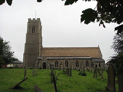
Coltishall Address: Church Street street in Broadland
Coltishall is a village on the River Bure, west of Wroxham, in the English county of Norfolk. The village is located within the Norfolk Broads.Wiki
Attractions near Coltishall
Amazon Locker-Brad,Amazon Counter-Esso Coltishall Service Stn,Central Garage Coltishall,Pure Pilates Norwich,Well,Norwich Kitchen,Turnpike Business Center,Barbara Shearing Osteopath Coltishall,Esso,Damn & Blast Creative,John Chivers Services,Forget Me Not - Dress Agency,Just Financial Planning,The Norfolk Boutique,Attention 2 Detail, Coltishall, Norwich,No.77 Café,Stalham Antique Gallery,Mayan Furniture,The Norfolk Mead Hotel,No 77 Caf ColtishallHow to get to popular attractions in Broadland with public transportation
Lucy Cavendish College, Cambridge,Newnham College, Cambridge,Outwell, King'S Lynn And West Norfolk,Holiday Inn Ipswich - Orwell, Ipswich,Murray Edwards College, Cambridge,Holiday Inn Norwich City, Norwich,Sir Harry Smith Community College, Fenland,Wickham Market, Suffolk Coastal,Goals Soccer Centre, Norwich,Burwash Manor, South Cambridgeshire,Norfolk Lavender, King'S Lynn And West Norfolk,RAF Mildenhall Child Development Programs (CDC), Forest Heath,Wensum Lodge - Norfolk County Council Adult Education, Norwich,The FDC, Norwich,Scotsdales Garden Centre, South Cambridgeshire,Hamerton Zoo Park, Huntingdonshire,Holiday Inn Norwich - North, Norwich,Nowton Park, St Edmundsbury,Sutton Hoo, Suffolk Coastal,Hunstanton Beach, King'S Lynn And West NorfolkGet around Broadland by public transport!
Travelling around Broadland has never been so easy. See step by step directions as you travel to any attraction, street or major public transport station. View bus and train timetables, arrival times, service alerts and detailed routes on a map, so you know exactly how to get to anywhere in Broadland.
When travelling to any destination around Broadland use Moovit's Live Directions with Get Off Notifications to know exactly where and how far to walk, how long to wait for your line , and how many stops are left. Moovit will alert you when it’s time to get off — no need to constantly re-check whether yours is the next stop.
Wondering how to use public transport in Broadland or how to pay for public transport in Broadland? Moovit public transport app can help you navigate your way with public transport easily, and at minimum cost. It includes public transport fees, ticket prices, and costs. Looking for a map of Broadland public transport lines? Moovit public transport app shows all public transport maps in Broadland with all bus or train routes and stops on an interactive map.
Broadland has 2 transport type(s), including: bus or train, operated by several transport agencies, including National Rail, Ambassador Travel, Harwich Harbour Ferry, Stephensons of Essex, Villager Minibus Sharnbrook, The Voluntary Network, Dews Coaches, Lord's Travel, Felixstowe Ferry Boat Yard, Hadleigh Community Transport, Beestons, Fenland Association for Community Transport, First Norfolk & Suffolk, National Rail and Mulleys Motorways