Directions to Coltishall (Broadland) with public transport
The following transport lines have routes that pass near Coltishall
How to get to Coltishall by bus?
Click on the bus route to see step by step directions with maps, line arrival times and updated time schedules.
Bus stations near Coltishall in Broadland
- Common, Coltishall, 7 min walk,
- Westbourne Road, Coltishall, 12 min walk,
- Kings Head, Coltishall, 16 min walk,
Train stations near Coltishall in Broadland
- Hxm, 61 min walk,
Bus lines to Coltishall in Broadland
- X55, North Walsham,
- 3, Wroxham,
- 70A, Horstead,
- 80, Dereham,
What are the nearest stations to Coltishall?
The nearest stations to Coltishall are:
- Common, Coltishall is 349 meters away, 7 min walk.
- Westbourne Road, Coltishall is 713 meters away, 12 min walk.
- Kings Head, Coltishall is 1072 meters away, 16 min walk.
- Hxm is 4799 meters away, 61 min walk.
Which bus line stops near Coltishall?
X55
What’s the nearest bus stop to Coltishall in Broadland?
The nearest bus stop to Coltishall in Broadland is Common, Coltishall. It’s a 7 min walk away.
What time is the first train to Coltishall in Broadland?
The GREATER ANGLIA is the first train that goes to Coltishall in Broadland. It stops nearby at 08:54.
What time is the last train to Coltishall in Broadland?
The GREATER ANGLIA is the last train that goes to Coltishall in Broadland. It stops nearby at 22:23.
What time is the first bus to Coltishall in Broadland?
The X55 is the first bus that goes to Coltishall in Broadland. It stops nearby at 07:48.
What time is the last bus to Coltishall in Broadland?
The X55 is the last bus that goes to Coltishall in Broadland. It stops nearby at 19:05.
See Coltishall, Broadland, on the map
Public Transit to Coltishall in Broadland
Wondering how to get to Coltishall in Broadland, United Kingdom? Moovit helps you find the best way to get to Coltishall with step-by-step directions from the nearest public transit station.
Moovit provides free maps and live directions to help you navigate through your city. View schedules, routes, timetables, and find out how long does it take to get to Coltishall in real time.
Looking for the nearest stop or station to Coltishall? Check out this list of stops closest to your destination: Common; Westbourne Road; Kings Head; Hxm.
Bus: X55, 3, 70A, 80.Train: GREATER ANGLIA.
Want to see if there’s another route that gets you there at an earlier time? Moovit helps you find alternative routes or times. Get directions from and directions to Coltishall easily from the Moovit App or Website.
We make riding to Coltishall easy, which is why over 1.5 million users, including users in Broadland, trust Moovit as the best app for public transit. You don’t need to download an individual bus app or train app, Moovit is your all-in-one transit app that helps you find the best bus time or train time available.
For information on prices of bus, costs and ride fares to Coltishall, please check the Moovit app.
Use the app to navigate to popular places including to the airport, hospital, stadium, grocery store, mall, coffee shop, school, college, and university.
Location: Broadland, East Anglia
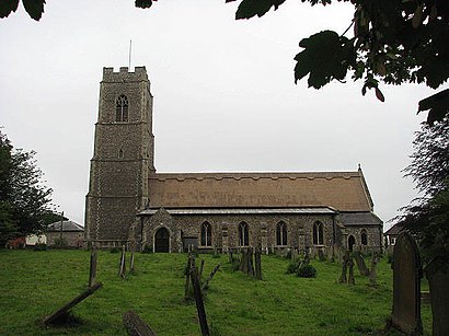
Coltishall is a village on the River Bure, west of Wroxham, in the English county of Norfolk. The village is located within the Norfolk Broads.Wiki
Attractions near Coltishall
Woodman,Star Struck Entertainment Norwich,Safe Security Assured for Everyone,Un Cafe,Coltishall Station,Ahl Roofing,Towpath Talk,Karin Dewing,Summer Sup Paddle Board Hire,Simon Jane Properties,Hautbois Residential & Activities Centre,Rising Sun Public House,Barn Owl Properties,LOTUS Thai Massage,The Limes,Tackle Boys Limited,Girlguiding an,The Barn,Humble Crust,STB Getley Trading LimitedHow to get to popular attractions in Broadland with public transportation
Newnham College, Cambridge,Cambridge Leisure, Cambridge,Sportspark, Norwich,Felixstowe Sea Front, Suffolk Coastal,The Range, South Norfolk,Cambridge University Press, Cambridge,DC10, South Cambridgeshire,Roys Of Wroxham, North Norfolk,Ely Railway Station (ELY), East Cambridgeshire,Sainsbury's, Ipswich,Ipswich harbour, Ipswich,Hunstanton Beach, King'S Lynn And West Norfolk,The Glass House (Wetherspoon), Norwich,Highball Climbing Centre, Norwich,Royal Papworth Hospital, Cambridge,Cringleford, South Norfolk,Norfolk & Norwich Millennium Library, Norwich,Cambridge Regional College (CRC), South Cambridgeshire,Kings Lynn Railway Station (KLN), King'S Lynn And West Norfolk,Milsoms, Kesgrave Hall, Suffolk CoastalGet around East Anglia by public transport!
Travelling around East Anglia has never been so easy. See step by step directions as you travel to any attraction, street or major public transport station. View bus and train timetables, arrival times, service alerts and detailed routes on a map, so you know exactly how to get to anywhere in East Anglia.
When travelling to any destination around East Anglia use Moovit's Live Directions with Get Off Notifications to know exactly where and how far to walk, how long to wait for your line , and how many stops are left. Moovit will alert you when it’s time to get off — no need to constantly re-check whether yours is the next stop.
Wondering how to use public transport in East Anglia or how to pay for public transport in East Anglia? Moovit public transport app can help you navigate your way with public transport easily, and at minimum cost. It includes public transport fees, ticket prices, and costs. Looking for a map of East Anglia public transport lines? Moovit public transport app shows all public transport maps in East Anglia with all Bus, Train and Ferry routes and stops on an interactive map.
East Anglia has 3 transport type(s), including: Bus, Train and Ferry, operated by several transport agencies, including National Rail, Ambassador Travel, Harwich Harbour Ferry, Stephensons of Essex, Villager Minibus Sharnbrook, The Voluntary Network, Dews Coaches, Lord's Travel, Felixstowe Ferry Boat Yard, Hadleigh Community Transport, Beestons, Fenland Association for Community Transport, First Norfolk & Suffolk, Mulleys Motorways, Halesworth Area Community Transport