Directions to Como Station with public transportation
The following transport lines have routes that pass near Como Station
How to get to Como Station by bus?
Click on the bus route to see step by step directions with maps, line arrival times and updated time schedules.
How to get to Como Station by train?
Click on the train route to see step by step directions with maps, line arrival times and updated time schedules.
Train stations near Como Station
- Como, 2 min walk,
Bus stops near Como Station
- Bulumin St At Mulyan St, 11 min walk,
- Green Point Rd Opp Scylla Rd, 17 min walk,
Bus routes to Como Station
- S326, Jannali Station,
- 967, Jannali High School,
- S096, Oyster Bay to Jannali HS & St Pats,
- S097, Georges River Rd at Fourth Ave, Jannali to St Patricks PS via Oyster Bay,
- S308, Endeavour Sports HS to Como Rd Oyster Bay Oval, Oyster Bay,
- S312, Jannali HS to Oyster Bay PS,
- S314, Green Point Rd at Riverview Rd, Oyster Bay to Sylvania HS,
- S325, St Patricks College to Oyster Bay,
- 968, Bonnet Bay to Miranda via Kareela,
What are the nearest stations to Como Station?
The nearest stations to Como Station are:
- Como is 91 meters away, 2 min walk.
- Bulumin St At Mulyan St is 791 meters away, 11 min walk.
- Green Point Rd Opp Scylla Rd is 1212 meters away, 17 min walk.
Which bus line stops near Como Station?
43T4
Which train line stops near Como Station?
T4
What’s the nearest train station to Como Station?
The nearest train station to Como Station is Como. It’s a 2 min walk away.
What’s the nearest bus stop to Como Station?
The nearest bus stop to Como Station is Bulumin St At Mulyan St. It’s a 11 min walk away.
See Como Station on the map
Public Transportation to Como Station
Wondering how to get to Como Station, Australia? Moovit helps you find the best way to get to Como Station with step-by-step directions from the nearest public transit station.
Moovit provides free maps and live directions to help you navigate through your city. View schedules, routes, timetables, and find out how long does it take to get to Como Station in real time.
Looking for the nearest stop or station to Como Station? Check out this list of stops closest to your destination: Como; Bulumin St At Mulyan St; Green Point Rd Opp Scylla Rd.
Bus: 43T4, S326, 967, S096, S097, S308, S312, S314.Train: T4.
Want to see if there’s another route that gets you there at an earlier time? Moovit helps you find alternative routes or times. Get directions from and directions to Como Station easily from the Moovit App or Website.
We make riding to Como Station easy, which is why over 1.5 million users, including users in Como, trust Moovit as the best app for public transit. You don’t need to download an individual bus app or train app, Moovit is your all-in-one transit app that helps you find the best bus time or train time available.
For information on prices of train and bus, costs and ride fares to Como Station, please check the Moovit app.
Use the app to navigate to popular places including to the airport, hospital, stadium, grocery store, mall, coffee shop, school, college, and university.
Como Station Address: Como Pde. street in Como
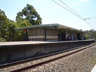
Como railway station is located on the Illawarra line, serving the Sydney suburb of Como. It is served by Sydney Trains T4 line services.Wiki
Attractions near Como Station
Railway Road,Power Room / Signaling Room,Como,Como,Como Markets,Ted Cary Butcher,Mels House,Power Room / Signaling Room,Carina Bay,Cremona St,35 Cremona Road,Historic Como Hotel,Scylla Bay Oval,Como Jannali J.R.L.F.C,Honeysuckle Creek Reserve,Green Point Observatory,Scouts Hall,Crave,Nabi Hair By Jenny,revolution @ comoHow to get to popular attractions in Como with public transportation
Westfield Warringah Mall, Brookvale,Newcastle Airport (NTL), Williamtown,Parramatta, Parramatta,Rouse Hill Town Centre, Rouse Hill,Pancakes on the Rocks, Sydney,Heritage Belgian Beer Cafe, The Rocks (Sydney - NSW),Glenfield Station, Glenfield (NSW),Gosford Station (Main Concourse), Gosford,Westpoint Shopping Centre, Blacktown,The Baxter Inn, Sydney,The Sheaf, Double Bay,Castle Towers, Castle Hill (NSW),Kogarah Station, Kogarah,Westfield Warringah Mall, Brookvale,Central, Haymarket,Epping Station (Concourse), Epping (NSW),Darling Harbour,Charlestown, Charlestown (NSW),UNSW, Kensington (NSW),University of Wollongong, KeiravilleGet around Sydney by public transport!
Travelling around Sydney has never been so easy. See step by step directions as you travel to any attraction, street or major public transport station. View bus and train timetables, arrival times, service alerts and detailed routes on a map, so you know exactly how to get to anywhere in Sydney.
When travelling to any destination around Sydney use Moovit's Live Directions with Get Off Notifications to know exactly where and how far to walk, how long to wait for your line , and how many stops are left. Moovit will alert you when it’s time to get off — no need to constantly re-check whether yours is the next stop.
Wondering how to use public transport in Sydney or how to pay for public transport in Sydney? Moovit public transport app can help you navigate your way with public transport easily, and at minimum cost. It includes public transport fees, ticket prices, and costs. Looking for a map of Sydney public transport lines? Moovit public transport app shows all public transport maps in Sydney with all Bus, Train, Metro, Light rail and Ferry routes and stops on an interactive map.
Sydney has 5 transport type(s), including: Bus, Train, Metro, Light rail and Ferry, operated by several transport agencies, including Sydney Metro, Sydney Trains, Sydney Light Rail, Sydney Ferries, Intercity Trains, Intercity Train, NSW TrainLink, CDC NSW R14, U-Go Mobility, Keolis Downer Northern Beaches, Manly Fast Ferry, Transdev John Holland Buses, Busways, Busways North West, Dysons Buslines