Convent Street, Nottingham stop - Sunday schedule
| Line | Direction | Time |
|---|---|---|
| 40X | City Hospital | 07:33 |
| 39 | Thorneywood | 07:37 |
| 39 | Thorneywood | 08:22 |
| 40X | City Hospital | 08:33 |
| 39 | Thorneywood | 09:07 |
| 42 | Thorneywood | 09:37 |
| 40X | City Hospital | 09:38 |
| 39 | Thorneywood | 09:50 |
| 41 | Thorneywood | 09:53 |
| 41 | Thorneywood | 10:08 |
| 39 | Thorneywood | 10:20 |
| 41 | Thorneywood | 10:23 |
| 39 | Thorneywood | 10:35 |
| 42 | Thorneywood | 10:37 |
| 40X | City Hospital | 10:38 |
| 39 | Thorneywood | 10:50 |
| 41 | Thorneywood | 10:53 |
| 39 | Thorneywood | 11:05 |
| 41 | Thorneywood | 11:08 |
| 39 | Thorneywood | 11:20 |
| 41 | Thorneywood | 11:23 |
| 39 | Thorneywood | 11:35 |
| 42 | Thorneywood | 11:37 |
| 40X | City Hospital | 11:38 |
| 39 | Thorneywood | 11:50 |
Directions to Convent Street, Nottingham stop with public transport
The following transport lines have routes that pass near Convent Street, Nottingham
 Bus: 141, 28, 34, 4, 5.
- Train: EAST MIDLANDS RAILWAY.
- Light rail: TRAM.
How to get to Convent Street, Nottingham stop by bus?
Click on the bus route to see step by step directions with maps, line arrival times and updated time schedules.
How to get to Convent Street, Nottingham stop by train?
Click on the train route to see step by step directions with maps, line arrival times and updated time schedules.
Bus stops near Convent Street, Nottingham stop
- Curzon Street, St Anns (Sa08), 2 min walk,
- Curzon Street, St Anns (Sa09), 2 min walk,
- Victoria Centre, Nottingham, 4 min walk,
- East Street, Nottingham, 4 min walk,
- George Street, Nottingham, 5 min walk,
- Lincoln Street, Nottingham, 5 min walk,
Light Rail stations near Convent Street, Nottingham station
- Royal Centre Tram Stop, Nottingham, 26 min walk,
Bus lines to Convent Street, Nottingham stop
- 40, Nottingham,
- 40X, Nottingham,
- 41, Nottingham,
- 42, Thorneywood,
- 40B, Mapperley,
- 39, Thorneywood,
- 43, Nottingham,
- 44, Gedling,
- 44A, Nottingham,
- 5, Edwalton,
- 5A, Edwalton,
- 6, Nottingham,
- 7, Nottingham,
- 8, Nottingham,
- 9, Compton Acres,
- 9B, West Bridgford,
- 24, Carlton - Nottingham,
- 25, Carlton - Nottingham,
- 26, Nottingham - Southwell,
- N26, Nottingham - Southwell,
What are the nearest stations to Convent Street, Nottingham?
The nearest stations to Convent Street, Nottingham are:
- Curzon Street, St Anns (Sa08) is 66 meters away, 2 min walk.
- Curzon Street, St Anns (Sa09) is 104 meters away, 2 min walk.
- Victoria Centre, Nottingham is 231 meters away, 4 min walk.
- East Street, Nottingham is 288 meters away, 4 min walk.
- George Street, Nottingham is 309 meters away, 5 min walk.
- Lincoln Street, Nottingham is 328 meters away, 5 min walk.
- Royal Centre Tram Stop, Nottingham is 1945 meters away, 26 min walk.
Which bus lines stop near Convent Street, Nottingham?
These bus lines stop near Convent Street, Nottingham: 141, 28, 34, 4, 5, PRO, RAINBOW ONE.
Which train line stops near Convent Street, Nottingham?
EAST MIDLANDS RAILWAY (Nottingham)
Which light rail line stops near Convent Street, Nottingham?
TRAM (Phoenix Park)
What’s the nearest light rail station to Convent Street, Nottingham?
The nearest light rail station to Convent Street, Nottingham is Royal Centre Tram Stop, Nottingham. It’s a 26 min walk away.
What’s the nearest bus station to Convent Street, Nottingham?
The nearest bus stations to Convent Street, Nottingham are Curzon Street, St Anns (Sa08) and Curzon Street, St Anns (Sa09). The closest one is a 2 min walk away.
What time is the first light rail to Convent Street, Nottingham?
The TRAM is the first light rail that goes to Convent Street, Nottingham. It stops nearby at 05:21.
What time is the last light rail to Convent Street, Nottingham?
The TRAM is the last light rail that goes to Convent Street, Nottingham. It stops nearby at 01:39.
What time is the first bus to Convent Street, Nottingham?
The N34 is the first bus that goes to Convent Street, Nottingham. It stops nearby at 03:44.
What time is the last bus to Convent Street, Nottingham?
The N34 is the last bus that goes to Convent Street, Nottingham. It stops nearby at 02:45.
See Convent Street, Nottingham stop on the map
Public transport to Convent Street, Nottingham stop (ID: ntmatgpw)
Looking for directions to Convent Street, Nottingham in Nottingham, United Kingdom?
Download the Moovit App to find the current schedule and step-by-step directions for Bus, Train or Light rail routes that pass through Convent Street, Nottingham.
Looking for the nearest stops closest to Convent Street, Nottingham ? Check out this list of closest stops to your destination: Curzon Street; Curzon Street; Victoria Centre; East Street; George Street; Lincoln Street; Royal Centre Tram Stop.
Bus: 141, 28, 34, 4, 5, PRO, RAINBOW ONE, 40, 40X, 41, 42, 40B, 39, 43, 44, 44A, 5A, 6, 7, 8, 24, 25, 26, N26, 27.Train: EAST MIDLANDS RAILWAY.Light rail: TRAM.
We make riding on public transit to Convent Street, Nottingham easy, which is why over 1.5 million users, including users in Nottingham trust Moovit as the best app for public transit.
Use the app to navigate to popular places including to the airport, hospital, stadium, grocery store, mall, coffee shop, school, college, and university.
Convent Street, Nottingham stop’s code is ntmatgpw
The first line to this stop is 40X, at 07:33, and the last line is 39 at 00:07.
King Edward Court, Nottingham, England, United Kingdom
This stop serves Nottingham City Transport’s lines
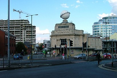
The Palais is a nightclub and event space located on Upper Parliament Street in Nottingham, England.Wiki
- Curzon Street, St Anns (Sa08),
- Curzon Street, St Anns (Sa09),
- Victoria Centre, Nottingham,
- East Street, Nottingham,
- George Street, Nottingham,
- Lincoln Street, Nottingham
Bus stops near Convent Street, Nottingham stop
- Royal Centre Tram Stop, Nottingham
Light Rail station near Convent Street, Nottingham station
- Tesco, Oak Tree,
- Thorpe Way, Grove Park,
- Crewe And Harpur, Swarkestone,
- Railway, Swannington,
- Doncaster,
- Loxley Centre, Werrington,
- Frinton Road, Broxtowe Estate (Br14),
- Hamilton Tesco, Hamilton,
- University East Drive, Nottingham University Main Campus (Un41),
- The Workhouse, Southwell,
- (Rushden) Skinners Hill Layby, Rushden,
- St Peters Street, Derby,
- Worcester Road, Woodthorpe,
- Kings Walk, Berry Hill Quarry,
- Willowcroft Road, Spondon,
- Bloomfield Street, Derby,
- Bosworth College, Desford,
- Danetre Hospital, Daventry,
- Belton Garden Centre, Belton,
- Toton Lane, Stapleford
Popular public transport stations in Nottingham
Get around Nottingham by public transport!
Travelling around Nottingham has never been so easy. See step by step directions as you travel to any attraction, street or major public transport station. View bus and train timetables, arrival times, service alerts and detailed routes on a map, so you know exactly how to get to anywhere in Nottingham.
When travelling to any destination around Nottingham use Moovit's Live Directions with Get Off Notifications to know exactly where and how far to walk, how long to wait for your line , and how many stops are left. Moovit will alert you when it’s time to get off — no need to constantly re-check whether yours is the next stop.
Wondering how to use public transport in Nottingham or how to pay for public transport in Nottingham? Moovit public transport app can help you navigate your way with public transport easily, and at minimum cost. It includes public transport fees, ticket prices, and costs. Looking for a map of Nottingham public transport lines? Moovit public transport app shows all public transport maps in Nottingham with all Bus, Train and Light rail routes and stops on an interactive map.
East Midlands has 3 transport type(s), including: Bus, Train and Light rail, operated by several transport agencies, including National Rail, Ashbourne Community Transport, Delaine Buses, Arriva Midlands, Centrebus, Central Connect, Our Centre, Stagecoach East Midlands, North Lincolnshire Council, CommMiniBus, Roberts Travel Group, Hawkes Coaches, Lawson's of Corby, Soar Valley Community Bus and Ashley Travel