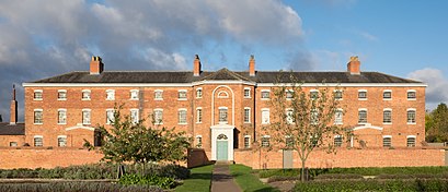
The Workhouse, Southwell stop - Wednesday schedule
| Line | Direction | Time |
|---|---|---|
| 965 | Southwell | 08:36 |
| 29 | Mansfield | 09:38 |
| 300 | Lowdham | 11:05 |
| 29 | Mansfield | 11:38 |
| 29 | Mansfield | 13:38 |
| 300 | Lowdham | 14:05 |
| 29 | Southwell | 19:34 |
See The Workhouse, Southwell, East Midlands, on the map
Directions to The Workhouse, Southwell (East Midlands) with public transport
The following transport lines have routes that pass near The Workhouse, Southwell
 Bus:
Bus: - Train:
How to get to The Workhouse, Southwell by bus?
Click on the bus route to see step by step directions with maps, line arrival times and updated time schedules.
How to get to The Workhouse, Southwell by train?
Click on the train route to see step by step directions with maps, line arrival times and updated time schedules.
Bus stations near The Workhouse, Southwell in East Midlands
- Chimes Meadow, Southwell,4 min walk,
- Easthorpe, Southwell,4 min walk,
- Fiskerton Road, Southwell,8 min walk,
- Station Road, Southwell,11 min walk,
Bus lines to The Workhouse, Southwell in East Midlands
- 26,Nottingham-Southwell,
- N26,NightBus Nottingham-Southwell,
- 300,Lowdham - Southwell - Newark,
- 965,Winkburn,
- 29,Southwell,
- 28,Newark,
- 363,Mansfield,
What are the nearest stations to The Workhouse, Southwell?
The nearest stations to The Workhouse, Southwell are:
- Chimes Meadow, Southwell is 271 meters away, 4 min walk.
- Easthorpe, Southwell is 291 meters away, 4 min walk.
- Fiskerton Road, Southwell is 548 meters away, 8 min walk.
- Station Road, Southwell is 800 meters away, 11 min walk.
Which bus lines stop near The Workhouse, Southwell?
These bus lines stop near The Workhouse, Southwell: 26, 29.
Which train line stops near The Workhouse, Southwell?
EAST MIDLANDS RAILWAY
What’s the nearest bus stop to The Workhouse, Southwell in East Midlands?
The nearest bus stops to The Workhouse, Southwell in East Midlands are Chimes Meadow, Southwell and Easthorpe, Southwell. The closest one is a 4 min walk away.
What time is the first bus to The Workhouse, Southwell in East Midlands?
The 26 is the first bus that goes to The Workhouse, Southwell in East Midlands. It stops nearby at 05:38.
What time is the last bus to The Workhouse, Southwell in East Midlands?
The 26 is the last bus that goes to The Workhouse, Southwell in East Midlands. It stops nearby at 00:06.
See The Workhouse, Southwell, East Midlands, on the map
Public transport to The Workhouse, Southwell stop (ID: ntsamaja) in East Midlands
Looking for directions to The Workhouse, Southwell in East Midlands, United Kingdom?
Download the Moovit App to find the current schedule and step-by-step directions for Bus or Train routes that pass through The Workhouse, Southwell.
Looking for the nearest stops closest to The Workhouse, Southwell ? Check out this list of closest stops to your destination: Chimes Meadow; Easthorpe; Fiskerton Road; Station Road.
Bus:Train:
We make riding on public transit to The Workhouse, Southwell easy, which is why over 1.5 million users, including users in East Midlands trust Moovit as the best app for public transit.
Use the app to navigate to popular places including to the airport, hospital, stadium, grocery store, mall, coffee shop, school, college, and university.
The Workhouse, Southwell stop’s code is ntsamaja
The first line to this stop is 965, at 08:36, and the last line is 29 at 19:34.
This stop serves Stagecoach East Midlands and CT4N’s lines
Bus stops near The Workhouse, Southwell
Chimes Meadow, Southwell,Easthorpe, Southwell,Fiskerton Road, Southwell,Station Road, SouthwellPopular public transport stations in East Midlands
Eden Hall, Elston,Elvaston Castle Gates, Thulston,Badger Box, Annesley,Louth Hospital, Louth,Queens Drive Park & Ride, Queens Drive (Li12),Police Headquarters, Nettleham,Wilkinson Avenue, Beeston,Costco, Thurmaston,Carlton Centre, Lincoln,Trentbarton Garage, Langley Mill,Boston Street, Nottingham,Morrisons Supermarket, Chapel En Le Frith,Building 100, East Mids Airport,William Knibb Centre, Kettering,Smedley Street, Matlock,DHL Cargo West, East Mids Airport,Dorket Head Farm, Dorket Head,Smedley Street West, Matlock,John Leggott College, Scunthorpe,Canal Street, NottinghamGet around East Midlands by public transport!
Travelling around East Midlands has never been so easy. See step by step directions as you travel to any attraction, street or major public transport station. View bus and train timetables, arrival times, service alerts and detailed routes on a map, so you know exactly how to get to anywhere in East Midlands.
When travelling to any destination around East Midlands use Moovit's Live Directions with Get Off Notifications to know exactly where and how far to walk, how long to wait for your line , and how many stops are left. Moovit will alert you when it’s time to get off — no need to constantly re-check whether yours is the next stop.
Wondering how to use public transport in East Midlands or how to pay for public transport in East Midlands? Moovit public transport app can help you navigate your way with public transport easily, and at minimum cost. It includes public transport fees, ticket prices, and costs. Looking for a map of East Midlands public transport lines? Moovit public transport app shows all public transport maps in East Midlands with all bus or train routes and stops on an interactive map.
East Midlands has 2 transport type(s), including: bus or train, operated by several transport agencies, including National Rail, Ashbourne Community Transport, Delaine Buses, Arriva Midlands, Centrebus, Our Centre, Hulleys of Baslow, D & G Bus, Stagecoach East Midlands, North Lincolnshire Council, National Rail, Roberts Coaches, Lawson's of Corby, Hawkes Coaches and East Yorkshire