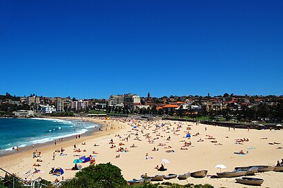
See Coogee on the map
Directions to Coogee with public transportation
The following transport lines have routes that pass near Coogee
 Bus:
Bus: - Train:
How to get to Coogee by bus?
Click on the bus route to see step by step directions with maps, line arrival times and updated time schedules.
How to get to Coogee by train?
Click on the train route to see step by step directions with maps, line arrival times and updated time schedules.
Bus stations near Coogee
- Arden St at Coogee Bay Rd,4 min walk,
- Arden St at Carr St,5 min walk,
- Arden St opp Coogee Bay Rd,5 min walk,
- St Brigid's Primary School, Coogee Bay Rd,6 min walk,
- Arden St before Dolphin St,7 min walk,
Light Rail stations near Coogee
- Unsw High Street Light Rail,27 min walk,
Bus routes to Coogee
- 313,Coogee Beach,
- 350,Domestic Airport,
- 373,Randwick Junction,
- 373X,City Museum,
- 718E,Watsons Bay,
- 719E,Sydney French School,
- 370,Coogee Beach,
- 374,Central Eddy Ave,
- 374X,Coogee North Arden St,
- 619E,St. Brigids PS,
- 362,Coogee North Arden St,
What are the nearest stations to Coogee?
The nearest stations to Coogee are:
- Arden St at Coogee Bay Rd is 248 meters away, 4 min walk.
- Arden St at Carr St is 321 meters away, 5 min walk.
- Arden St opp Coogee Bay Rd is 323 meters away, 5 min walk.
- St Brigid's Primary School, Coogee Bay Rd is 413 meters away, 6 min walk.
- Arden St before Dolphin St is 458 meters away, 7 min walk.
- Unsw High Street Light Rail is 2107 meters away, 27 min walk.
Which bus lines stop near Coogee?
These bus lines stop near Coogee: 353, 370, 372, 373, M50.
Which train lines stop near Coogee?
These train lines stop near Coogee: SCO, T4.
What’s the nearest light rail station to Coogee?
The nearest light rail station to Coogee is Unsw High Street Light Rail. It’s a 27 min walk away.
What’s the nearest bus stop to Coogee?
The nearest bus stop to Coogee is Arden St at Coogee Bay Rd. It’s a 4 min walk away.
See Coogee on the map
Public Transportation to Coogee
Wondering how to get to Coogee, Australia? Moovit helps you find the best way to get to Coogee with step-by-step directions from the nearest public transit station.
Moovit provides free maps and live directions to help you navigate through your city. View schedules, routes, timetables, and find out how long does it take to get to Coogee in real time.
Looking for the nearest stop or station to Coogee? Check out this list of stops closest to your destination: Arden St at Coogee Bay Rd; Arden St at Carr St; Arden St opp Coogee Bay Rd; St Brigid's Primary School; Arden St before Dolphin St; Unsw High Street Light Rail.
Bus:Train:
Want to see if there’s another route that gets you there at an earlier time? Moovit helps you find alternative routes or times. Get directions from and directions to Coogee easily from the Moovit App or Website.
We make riding to Coogee easy, which is why over 1.5 million users, including users in Coogee, trust Moovit as the best app for public transit. You don’t need to download an individual bus app or train app, Moovit is your all-in-one transit app that helps you find the best bus time or train time available.
For information on prices of bus, train and light rail, costs and ride fares to Coogee, please check the Moovit app.
Use the app to navigate to popular places including to the airport, hospital, stadium, grocery store, mall, coffee shop, school, college, and university.
Coogee Address: Vicar Street street in Coogee
Popular routes to Coogee
Popular routes from Coogee
Attractions near Coogee
21 Vicar St,23-25 Vicar St,Dive Hotel (Dive Hotel Coogee),Vicar St,Crowne Plaza Sydney Coogee Beach,Ezymart,Scenic World,The Brasserie-Coogee Bay Hotel,Coogee Cares and Coogee Lions Club,Bazura,Crowne Plaza,Sloan & Kemp Consultants,The Coogee Bay Hotel,Mogo Mogo,217-221 Coogee Bay Rd,Coogee Bay Hotel (Selina's, Coogee Bay Hotel),Coogee Bay Hotel Conference & Function Centre,55-57 Carr St,Coogee Bay Cellars,Milky Lane Coogee BeachHow to get to popular attractions in Coogee with public transportation
Westfield Mt Druitt, Mount Druitt,Rose Of Australia Hotel, Erskineville,Manly Beach, Manly (NSW),Mortdale Station, Mortdale,MarketPlace Leichhardt, Leichhardt (NSW),Munich Brauhaus, The Rocks (Sydney - NSW),Epping Station (Concourse), Epping (NSW),Wollongong Station, Wollongong,Broadway Shopping Centre, Glebe (NSW),Parramatta, Parramatta,Concord Hospital, Concord West,MarketPlace Leichhardt, Leichhardt (NSW),The Kirribilli Hotel, Kirribilli,Coogee Pavilion, Coogee (NSW),Sydney, Sydney,Macarthur Station, Campbelltown (NSW),Terrigal Beach, Terrigal,Manly, Manly (NSW),Lidcombe Station (Concourse), Lidcombe,The Orient Hotel, The Rocks (Sydney - NSW)Get around Coogee by public transport!
Travelling around Coogee has never been so easy. See step by step directions as you travel to any attraction, street or major public transport station. View bus and train timetables, arrival times, service alerts and detailed routes on a map, so you know exactly how to get to anywhere in Coogee.
When travelling to any destination around Coogee use Moovit's Live Directions with Get Off Notifications to know exactly where and how far to walk, how long to wait for your line , and how many stops are left. Moovit will alert you when it’s time to get off — no need to constantly re-check whether yours is the next stop.
Wondering how to use public transport in Coogee or how to pay for public transport in Coogee? Moovit public transport app can help you navigate your way with public transport easily, and at minimum cost. It includes public transport fees, ticket prices, and costs. Looking for a map of Coogee public transport lines? Moovit public transport app shows all public transport maps in Coogee with all bus, train or light rail routes and stops on an interactive map.
Coogee has 3 transport type(s), including: bus, train or light rail, operated by several transport agencies, including Sydney Metro, Sydney Trains, Sydney Light Rail, Sydney Ferries, Intercity Trains, Intercity Train, NSW TrainLink, CDC NSW R14, U-Go Mobility, Keolis Downer Northern Beaches, Manly Fast Ferry, Transdev John Holland Buses, Busways, Busways North West and Dysons Buslines