Directions to Coronet Bay with public transportation
The following transport lines have routes that pass near Coronet Bay
How to get to Coronet Bay by bus?
Click on the bus route to see step by step directions with maps, line arrival times and updated time schedules.
Bus stations near Coronet Bay
- Norsemens Rd/Gellibrand St (Coronet Bay),1 min walk,
- Bantering Bay Rd/Gellibrand St (Coronet Bay),5 min walk,
Bus routes to Coronet Bay
- GRANTVILLE - CORONET BAY VIA GRANTVILLE,Grantville,
- WONTHAGGI - CORONET BAY/CORINELLA VIA CORINELLA, ANDERSON,Wonthaggi,
What are the nearest stations to Coronet Bay?
The nearest stations to Coronet Bay are:
- Norsemens Rd/Gellibrand St (Coronet Bay) is 13 meters away, 1 min walk.
- Bantering Bay Rd/Gellibrand St (Coronet Bay) is 314 meters away, 5 min walk.
Which bus line stops near Coronet Bay?
GRANTVILLE - CORONET BAY VIA GRANTVILLE
What’s the nearest bus stop to Coronet Bay?
The nearest bus stop to Coronet Bay is Norsemens Rd/Gellibrand St (Coronet Bay). It’s a 1 min walk away.
What time is the first bus to Coronet Bay?
The GRANTVILLE - CORONET BAY VIA GRANTVILLE is the first bus that goes to Coronet Bay. It stops nearby at 18:16.
What time is the last bus to Coronet Bay?
The GRANTVILLE - CORONET BAY VIA GRANTVILLE is the last bus that goes to Coronet Bay. It stops nearby at 19:54.
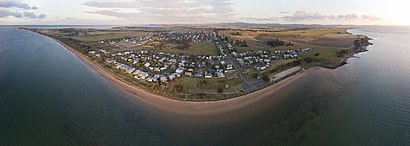
See Coronet Bay on the map
Public Transportation to Coronet Bay
Wondering how to get to Coronet Bay, Australia? Moovit helps you find the best way to get to Coronet Bay with step-by-step directions from the nearest public transit station.
Moovit provides free maps and live directions to help you navigate through your city. View schedules, routes, timetables, and find out how long does it take to get to Coronet Bay in real time.
Looking for the nearest stop or station to Coronet Bay? Check out this list of stops closest to your destination: Norsemens Rd/Gellibrand St (Coronet Bay); Bantering Bay Rd/Gellibrand St (Coronet Bay).
Bus:GRANTVILLE - CORONET BAY VIA GRANTVILLEWONTHAGGI - CORONET BAY/CORINELLA VIA CORINELLA, ANDERSON
Want to see if there’s another route that gets you there at an earlier time? Moovit helps you find alternative routes or times. Get directions from and directions to Coronet Bay easily from the Moovit App or Website.
We make riding to Coronet Bay easy, which is why over 1.5 million users, including users in Melbourne, trust Moovit as the best app for public transit. You don’t need to download an individual bus app or train app, Moovit is your all-in-one transit app that helps you find the best bus time or train time available.
For information on prices of bus and train, costs and ride fares to Coronet Bay, please check the Moovit app.
Use the app to navigate to popular places including to the airport, hospital, stadium, grocery store, mall, coffee shop, school, college, and university.
Location: Melbourne
Popular routes to Coronet Bay
Attractions near Coronet Bay
Gaurab,Coronet Bay BMX Track,Coronet Bay Recreation Reserve,Baden Johnson,Coast To Coast Cleaning Victoria,Atrealty Bass Coast,Aussie Greenscapes,Ishtar Holistic Wellness,Coronet Bay Pharmacy,Jet Fencing & Gates,The Colonnades Estate,The Bay Escape Coronet Bay,Cutty Sark Cottage,Beauty 4 Body,Telstra Payphone,Coronet Bay Pharmacy,Foreshore Reserve Playground,A-Bindingpress,Makobuilt,Unique Custom HomesHow to get to popular attractions in Melbourne with public transportation
Old Melbourne Gaol, Melbourne,Rowville Secondary College (Eastern Campus), Rowville,Melbourne Cricket Ground (MCG) (MCG), East Melbourne,Grazeland, Spotswood,Melbourne Sports And Aquatic Centre, Albert Park,Wellington Street / Johnston Street, Collingwood,Peninsula Private Hospital, Frankston,Grattan Street, Parkville,Westfield Southland, Cheltenham,KP Services Pty LTD AS Trustee for KF Prendergast Family Trust No 1, Blackburn,Hawksburn Station,SkyBus Terminal, Melbourne,Seaworks Maritime Precinct, Williamstown,Crown Metropol, Southbank,Werribee Park Mansion, Werribee South,Lolly Station, Blackburn,159 Grey Street, East Melbourne,Epworth Hospital, Waurn Ponds - Bal,Gladstone Park Shopping Centre, Gladstone Park,Knox Private Hospital, WantirnaGet around Melbourne by public transport!
Travelling around Melbourne has never been so easy. See step by step directions as you travel to any attraction, street or major public transport station. View bus and train timetables, arrival times, service alerts and detailed routes on a map, so you know exactly how to get to anywhere in Melbourne.
When travelling to any destination around Melbourne use Moovit's Live Directions with Get Off Notifications to know exactly where and how far to walk, how long to wait for your line , and how many stops are left. Moovit will alert you when it’s time to get off — no need to constantly re-check whether yours is the next stop.
Wondering how to use public transport in Melbourne or how to pay for public transport in Melbourne? Moovit public transport app can help you navigate your way with public transport easily, and at minimum cost. It includes public transport fees, ticket prices, and costs. Looking for a map of Melbourne public transport lines? Moovit public transport app shows all public transport maps in Melbourne with all bus or train routes and stops on an interactive map.
Melbourne has 2 transport type(s), including: bus or train, operated by several transport agencies, including PTV Metropolitan Trains, PTV Metropolitan Bus, Yarra Trams, PTV Regional Bus, SkyBus, Interstate Services, V/Line and V/Line (Coach)