The Most Popular Urban Mobility App in Coseley East.
All local mobility options in one app
| Line | Direction | Time |
|---|---|---|
| 229 | Dudley | 06:49 |
| 229 | Dudley | 07:45 |
| 229 | Dudley | 08:15 |
| 229 | Dudley | 08:50 |
| 229 | Dudley | 09:20 |
| 229 | Dudley | 09:50 |
| 229 | Dudley | 10:20 |
| 229 | Dudley | 10:50 |
| 229 | Dudley | 11:20 |
| 229 | Dudley | 11:50 |
| 229 | Dudley | 12:20 |
| 229 | Dudley | 12:50 |
| 229 | Dudley | 13:20 |
| 229 | Dudley | 13:50 |
| 229 | Dudley | 14:20 |
| 229 | Dudley | 14:50 |
| 229 | Dudley | 15:20 |
| 229 | Dudley | 15:50 |
| 229 | Dudley | 16:20 |
| 229 | Dudley | 16:50 |
| 229 | Dudley | 17:26 |
| 229 | Dudley | 18:00 |
| 229 | Dudley | 18:28 |
| 229 | Dudley | 18:59 |
| 229 | Dudley | 19:59 |
The following transport lines have routes that pass near Coseley Station
Click on the Bus route to see step by step directions with maps, line arrival times and updated time schedules.
Click on the Train route to see step by step directions with maps, line arrival times and updated time schedules.
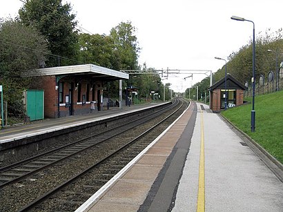
The nearest stations to Coseley Station are:
These Bus lines stop near Coseley Station: 11A, 81, X8
These Train lines stop near Coseley Station: WEST MIDLANDS RAILWAY
The nearest bus stop to Coseley Station in Coseley East is Coseley Station. It’s a 1 min walk away.
The METRO is the first Light rail that goes to Coseley Station in Coseley East. It stops nearby at 07:41.
The METRO is the last Light rail that goes to Coseley Station in Coseley East. It stops nearby at 00:14.
The WEST MIDLANDS RAILWAY is the first Train that goes to Coseley Station in Coseley East. It stops nearby at 08:18.
The WEST MIDLANDS RAILWAY is the last Train that goes to Coseley Station in Coseley East. It stops nearby at 00:04.
The X8 is the first Bus that goes to Coseley Station in Coseley East. It stops nearby at 06:05.
The X8 is the last Bus that goes to Coseley Station in Coseley East. It stops nearby at 00:28.
The Bus fare to Coseley Station costs about £2.40.
The Train fare to Coseley Station costs about £3.00 - £7.80.
Looking for directions to Coseley Station in Coseley East, United Kingdom?
Download the Moovit App to find the current schedule and step-by-step directions for Bus or Train routes that pass through Coseley Station.
Looking for the nearest stops closest to Coseley Station ? Check out this list of closest stops to your destination: Coseley Station; Tunnel St; Harvington Rd; Roseville Square; Loxdale; Tipton.
Bus:Train:
We make riding on public transit to Coseley Station easy, which is why over 1.5 million users, including users in Coseley East trust Moovit as the best app for public transit.
Use the app to navigate to popular places including to the airport, hospital, stadium, grocery store, mall, coffee shop, school, college, and university.
Coseley Station stop’s code is nwmtgajm
The first line to this stop is 229, at 06:49, and the last line is 229 at 22:59.
This stop serves Diamond Bus’s lines