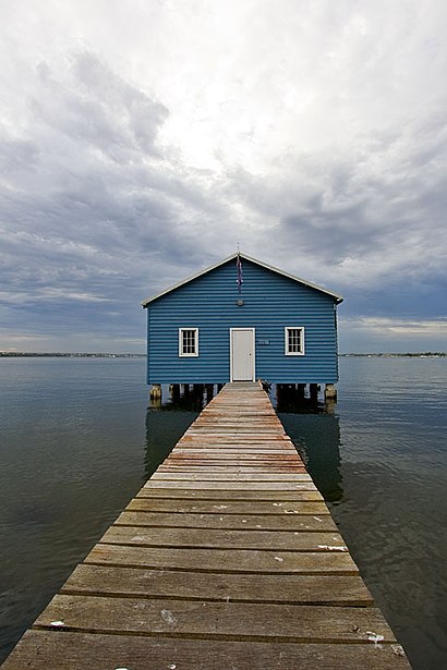
See Crawley, Western Australia on the map
Directions to Crawley, Western Australia with public transportation
The following transport lines have routes that pass near Crawley, Western Australia
 Bus:
Bus: - Train:
How to get to Crawley, Western Australia by bus?
Click on the bus route to see step by step directions with maps, line arrival times and updated time schedules.
How to get to Crawley, Western Australia by train?
Click on the train route to see step by step directions with maps, line arrival times and updated time schedules.
Bus stations near Crawley, Western Australia
- Broadway Before Caporn St,4 min walk,
- Broadway Caporn Street Cat Id 124,5 min walk,
- Bruce St Before Princess Rd,5 min walk,
- Fairway Before Princess Rd,7 min walk,
Train stations near Crawley, Western Australia
- Karrakatta Stn,40 min walk,
Bus routes to Crawley, Western Australia
- 24,Claremont Stn,
- 96,Leederville Stn,
- ELIZABETH QUAY BUS STN - HACKETT DR UWA BUSINESS SCHOOL CAT ID 123,Crawley,
- 23,Claremont Stn,
- 97,Crawley,
What are the nearest stations to Crawley, Western Australia?
The nearest stations to Crawley, Western Australia are:
- Broadway Before Caporn St is 240 meters away, 4 min walk.
- Broadway Caporn Street Cat Id 124 is 330 meters away, 5 min walk.
- Bruce St Before Princess Rd is 349 meters away, 5 min walk.
- Fairway Before Princess Rd is 504 meters away, 7 min walk.
- Karrakatta Stn is 3096 meters away, 40 min walk.
Which bus lines stop near Crawley, Western Australia?
These bus lines stop near Crawley, Western Australia: 24, 96, 97.
Which train lines stop near Crawley, Western Australia?
These train lines stop near Crawley, Western Australia: AIRPORT LINE, FREMANTLE LINE.
What’s the nearest bus stop to Crawley, Western Australia?
The nearest bus stop to Crawley, Western Australia is Broadway Before Caporn St. It’s a 4 min walk away.
What time is the first train to Crawley, Western Australia?
The FREMANTLE LINE is the first train that goes to Crawley, Western Australia. It stops nearby at 05:26.
What time is the last train to Crawley, Western Australia?
The FREMANTLE LINE is the last train that goes to Crawley, Western Australia. It stops nearby at 00:18.
What time is the first bus to Crawley, Western Australia?
The ELIZABETH QUAY BUS STN - HACKETT DR UWA BUSINESS SCHOOL CAT ID 123 is the first bus that goes to Crawley, Western Australia. It stops nearby at 05:02.
What time is the last bus to Crawley, Western Australia?
The 24 is the last bus that goes to Crawley, Western Australia. It stops nearby at 00:02.
How much is the train fare to Crawley, Western Australia?
The train fare to Crawley, Western Australia costs about $2.07 - $4.59.
How much is the bus fare to Crawley, Western Australia?
The bus fare to Crawley, Western Australia costs about $2.07 - $4.59.
See Crawley, Western Australia on the map
Public Transportation to Crawley, Western Australia
Wondering how to get to Crawley, Western Australia, Australia? Moovit helps you find the best way to get to Crawley, Western Australia with step-by-step directions from the nearest public transit station.
Moovit provides free maps and live directions to help you navigate through your city. View schedules, routes, timetables, and find out how long does it take to get to Crawley, Western Australia in real time.
Looking for the nearest stop or station to Crawley, Western Australia? Check out this list of stops closest to your destination: Broadway Before Caporn St; Broadway Caporn Street Cat Id 124; Bruce St Before Princess Rd; Fairway Before Princess Rd; Karrakatta Stn.
Bus:Train:
Want to see if there’s another route that gets you there at an earlier time? Moovit helps you find alternative routes or times. Get directions from and directions to Crawley, Western Australia easily from the Moovit App or Website.
We make riding to Crawley, Western Australia easy, which is why over 1.5 million users, including users in Crawley, trust Moovit as the best app for public transit. You don’t need to download an individual bus app or train app, Moovit is your all-in-one transit app that helps you find the best bus time or train time available.
For information on prices of bus and train, costs and ride fares to Crawley, Western Australia, please check the Moovit app.
Use the app to navigate to popular places including to the airport, hospital, stadium, grocery store, mall, coffee shop, school, college, and university.
Location: Crawley, Perth
Attractions near Crawley, Western Australia
Wine Tours Swan Valley,150 Broadway,Park Avenue,Steve's,Pelican Point Apartments,Spark Plus Australia Pty,Liquidity,Polaris Consulting Wa,JP Equity Partners,Niche R I B Mep Marine,Harcourts Elite Avenew Sales Nedlands,The Accu Exchange,Nexus Minerals,Steves Bar and Cafe,Michelle Kerr-Best Real Estate Agent in Nedlands,Giaconda Vineyard and Winery,The Share Trading Site,Broadway on the Bay,Re-Vision Group,Christmas Trees CoHow to get to popular attractions in Crawley with public transportation
Shoalwater Bay, Shoalwater,Riverton, Riverton,Coolbellup Shopping Centre, Coolbellup,Piney Lakes Reserve, Booragoon,Comet Bay College, Secret Harbour,Tiamo Cafe Restaurant, Crawley,Canning Bridge, Como,Curtin University Bus Station, Bentley,Penguin Island Ferry, Shoalwater,Miss Maud, Perth,Galleria, Morley,Woolworths Miami, Falcon,The Quarie Bar And Brasserie, Hammond Park,Perth Zoo, South Perth,Coco's Restaurant & Bar, South Perth,Mandurah Beach,Grosvenor Hotel, Perth,Carine Open Space, Carine,Tafe - Thornlie Campus, Thornlie,Commonwealth Bank, East PerthGet around Crawley by public transport!
Travelling around Crawley has never been so easy. See step by step directions as you travel to any attraction, street or major public transport station. View bus and train timetables, arrival times, service alerts and detailed routes on a map, so you know exactly how to get to anywhere in Crawley.
When travelling to any destination around Crawley use Moovit's Live Directions with Get Off Notifications to know exactly where and how far to walk, how long to wait for your line , and how many stops are left. Moovit will alert you when it’s time to get off — no need to constantly re-check whether yours is the next stop.
Wondering how to use public transport in Crawley or how to pay for public transport in Crawley? Moovit public transport app can help you navigate your way with public transport easily, and at minimum cost. It includes public transport fees, ticket prices, and costs. Looking for a map of Crawley public transport lines? Moovit public transport app shows all public transport maps in Crawley with all bus or train routes and stops on an interactive map.
Crawley has 2 transport type(s), including: bus or train, operated by several transport agencies, including Transperth Rail, Transwa, Transperth Ferry, Transperth, TransBusselton, TransAlbany, TransGoldfields, TransEsperance, TransGeraldton, TransCarnarvon, TransHedland, TransKarratha, Transwa, TransBunbury and Mandurah Bus Charter