Crescent Theatre stop - Wednesday schedule
| Line | Direction | Time |
|---|---|---|
| 126 | Ednam Rd | 05:50 |
| 126 | Ednam Rd | 06:20 |
| 126 | Ednam Rd | 06:40 |
| 126 | Ednam Rd | 07:01 |
| 126 | Ednam Rd | 07:21 |
| 126 | Ednam Rd | 07:42 |
| 126 | Ednam Rd | 08:03 |
| 126 | Ednam Rd | 08:22 |
| 126 | Ednam Rd | 08:42 |
| 126 | Ednam Rd | 09:02 |
| 126 | Ednam Rd | 09:21 |
| 126 | Ednam Rd | 09:41 |
| 126 | Ednam Rd | 10:01 |
| 126 | Ednam Rd | 10:21 |
| 126 | Ednam Rd | 10:41 |
| 126 | Ednam Rd | 11:01 |
| 126 | Ednam Rd | 11:21 |
| 126 | Ednam Rd | 11:41 |
| 126 | Ednam Rd | 12:01 |
| 126 | Ednam Rd | 12:21 |
| 126 | Ednam Rd | 12:41 |
| 126 | Ednam Rd | 13:01 |
| 126 | Ednam Rd | 13:22 |
| 126 | Ednam Rd | 13:42 |
| 126 | Ednam Rd | 14:02 |
Directions to Crescent Theatre stop (West Midlands) with public transport
The following transport lines have routes that pass near Crescent Theatre
How to get to Crescent Theatre stop by bus?
Click on the bus route to see step by step directions with maps, line arrival times and updated time schedules.
How to get to Crescent Theatre stop by train?
Click on the train route to see step by step directions with maps, line arrival times and updated time schedules.
Bus stops near Crescent Theatre stop in West Midlands
- Grosvenor St West, 1 min walk,
- Sheepcote St, 4 min walk,
Light Rail stations near Crescent Theatre station in West Midlands
- Five Ways (Midland Metro Stop), 25 min walk,
Bus lines to Crescent Theatre stop in West Midlands
- 126, Ednam Rd,
- X8, St. Peter's - Ladywood,
- 9, Ladywood - Wollaston And Stourbridge Town,
- X10, Ladywood - Brierley Hill,
- 12, Ladywood - St. James's,
- 12A, St. James's - Ladywood,
- 13, Ladywood - Oldbury,
- 13A, Blackheath - Ladywood,
- 23, Bartley Green - Ladywood,
- 24, Ladywood - Quinton,
- 822, Bartley Green - Ladywood,
- 829, North Edgbaston - Ladywood,
What are the nearest stations to Crescent Theatre?
The nearest stations to Crescent Theatre are:
- Grosvenor St West is 53 meters away, 1 min walk.
- Sheepcote St is 260 meters away, 4 min walk.
- Five Ways (Midland Metro Stop) is 1903 meters away, 25 min walk.
Which bus lines stop near Crescent Theatre?
These bus lines stop near Crescent Theatre: 126, 23, 24, 8C.
Which train line stops near Crescent Theatre?
WEST MIDLANDS RAILWAY (Birmingham Snow Hill)
What’s the nearest light rail station to Crescent Theatre in West Midlands?
The nearest light rail station to Crescent Theatre in West Midlands is Five Ways (Midland Metro Stop). It’s a 25 min walk away.
What’s the nearest bus station to Crescent Theatre in West Midlands?
The nearest bus station to Crescent Theatre in West Midlands is Grosvenor St West. It’s a 1 min walk away.
What time is the first light rail to Crescent Theatre in West Midlands?
The METRO is the first light rail that goes to Crescent Theatre in West Midlands. It stops nearby at 07:51.
What time is the last light rail to Crescent Theatre in West Midlands?
The METRO is the last light rail that goes to Crescent Theatre in West Midlands. It stops nearby at 00:06.
What time is the first bus to Crescent Theatre in West Midlands?
The 23 is the first bus that goes to Crescent Theatre in West Midlands. It stops nearby at 06:24.
What time is the last bus to Crescent Theatre in West Midlands?
The 9 is the last bus that goes to Crescent Theatre in West Midlands. It stops nearby at 01:20.
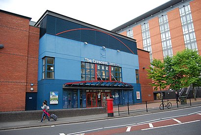
Crescent Theatre station
 Taken by Anonymous
See Crescent Theatre stop, West Midlands, on the map
Public transport to Crescent Theatre stop (ID: nwmwtpmg) in West Midlands
Looking for directions to Crescent Theatre in West Midlands, United Kingdom?
Download the Moovit App to find the current schedule and step-by-step directions for Bus or Train routes that pass through Crescent Theatre.
Looking for the nearest stops closest to Crescent Theatre ? Check out this list of closest stops to your destination: Grosvenor St West; Sheepcote St; Five Ways (Midland Metro Stop).
Bus: 126, 23, 24, 8C, X8, 9, X10, 12, 12A.Train: WEST MIDLANDS RAILWAY.
We make riding on public transit to Crescent Theatre easy, which is why over 1.5 million users, including users in West Midlands trust Moovit as the best app for public transit.
Use the app to navigate to popular places including to the airport, hospital, stadium, grocery store, mall, coffee shop, school, college, and university.
Crescent Theatre stop’s code is nwmwtpmg
The first line to this stop is 126, at 05:50, and the last line is 126 at 00:11.
Sheepcote Street, Birmingham, England, United Kingdom
This stop serves National Express West Midlands’s lines
Light Rail station near Crescent Theatre station
Popular public transport stations in West Midlands
Get around West Midlands by public transport!
Travelling around West Midlands has never been so easy. See step by step directions as you travel to any attraction, street or major public transport station. View bus and train timetables, arrival times, service alerts and detailed routes on a map, so you know exactly how to get to anywhere in West Midlands.
When travelling to any destination around West Midlands use Moovit's Live Directions with Get Off Notifications to know exactly where and how far to walk, how long to wait for your line , and how many stops are left. Moovit will alert you when it’s time to get off — no need to constantly re-check whether yours is the next stop.
Wondering how to use public transport in West Midlands or how to pay for public transport in West Midlands? Moovit public transport app can help you navigate your way with public transport easily, and at minimum cost. It includes public transport fees, ticket prices, and costs. Looking for a map of West Midlands public transport lines? Moovit public transport app shows all public transport maps in West Midlands with all Bus, Train and Light rail routes and stops on an interactive map.
West Midlands has 3 transport type(s), including: Bus, Train and Light rail, operated by several transport agencies, including National Express West Midlands, National Express Coventry, National Express, Diamond Bus, Arriva Midlands, Stagecoach Midlands, West Midlands Metro, Stagecoach West, Stagecoach South Wales, First Potteries, First Worcestershire, LandFlight, trentbarton, D & G Bus and Flexibus