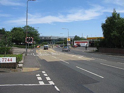
See Crewe Toll, Edinburgh, on the map
Directions to Crewe Toll (Edinburgh) with public transport
The following transport lines have routes that pass near Crewe Toll
Bus:
Train:
How to get to Crewe Toll by Bus?
Click on the Bus route to see step by step directions with maps, line arrival times and updated time schedules.
How to get to Crewe Toll by Train?
Click on the Train route to see step by step directions with maps, line arrival times and updated time schedules.
Bus stations near Crewe Toll in Edinburgh
- Crewe Toll, Crewe Toll Roundabout,1 min walk,
Light rail stations near Crewe Toll in Edinburgh
- West End - Princes Street (Edinburgh Trams), West End,9 min walk,
Train stations near Crewe Toll in Edinburgh
- Haymarket,37 min walk,
Bus lines to Crewe Toll in Edinburgh
- 16,Livingston - Edinburgh Western General Hospital,
- 19,Granton - Eastfield,
- 22,Gyle Centre - Granton Harbour,
- 24,Edinburgh Royal Infirmary - West Granton,
- 29,Gorebridge - Silverknowes,
- 37,Penicuik or Gowkley Moss - Silverknowes,
- N37,Silverknowes - Penicuik,
- X37,Penicuik Deanburn - Western Harbour,
- 38,Edinburgh Royal Infirmary - West Granton,
- 21,Wester Hailes,
- 27,Edinburgh,
What are the nearest stations to Crewe Toll?
The nearest stations to Crewe Toll are:
- Crewe Toll, Crewe Toll Roundabout is 59 meters away, 1 min walk.
- West End - Princes Street (Edinburgh Trams), West End is 619 meters away, 9 min walk.
- Haymarket is 2858 meters away, 37 min walk.
Which Bus lines stop near Crewe Toll?
These Bus lines stop near Crewe Toll: 19, 21, 24, 27, 37, 38
Which Train lines stop near Crewe Toll?
These Train lines stop near Crewe Toll: SCOTRAIL
What’s the nearest light rail station to Crewe Toll in Edinburgh?
The nearest light rail station to Crewe Toll in Edinburgh is West End - Princes Street (Edinburgh Trams), West End. It’s a 9 min walk away.
What’s the nearest bus stop to Crewe Toll in Edinburgh?
The nearest bus stop to Crewe Toll in Edinburgh is Crewe Toll, Crewe Toll Roundabout. It’s a 1 min walk away.
What time is the first Light rail to Crewe Toll in Edinburgh?
The T50 is the first Light rail that goes to Crewe Toll in Edinburgh. It stops nearby at 04:41.
What time is the last Light rail to Crewe Toll in Edinburgh?
The T50 is the last Light rail that goes to Crewe Toll in Edinburgh. It stops nearby at 00:19.
What time is the first Train to Crewe Toll in Edinburgh?
The SCOTRAIL is the first Train that goes to Crewe Toll in Edinburgh. It stops nearby at 08:04.
What time is the last Train to Crewe Toll in Edinburgh?
The SCOTRAIL is the last Train that goes to Crewe Toll in Edinburgh. It stops nearby at 00:12.
What time is the first Bus to Crewe Toll in Edinburgh?
The N37 is the first Bus that goes to Crewe Toll in Edinburgh. It stops nearby at 03:03.
What time is the last Bus to Crewe Toll in Edinburgh?
The N37 is the last Bus that goes to Crewe Toll in Edinburgh. It stops nearby at 02:50.
See Crewe Toll, Edinburgh, on the map

Public Transit to Crewe Toll in Edinburgh
Wondering how to get to Crewe Toll in Edinburgh, United Kingdom? Moovit helps you find the best way to get to Crewe Toll with step-by-step directions from the nearest public transit station.
Moovit provides free maps and live directions to help you navigate through your city. View schedules, routes, timetables, and find out how long does it take to get to Crewe Toll in real time.
Looking for the nearest stop or station to Crewe Toll? Check out this list of stops closest to your destination: Crewe Toll; West End - Princes Street (Edinburgh Trams); Haymarket.
Bus:Train:
Want to see if there’s another route that gets you there at an earlier time? Moovit helps you find alternative routes or times. Get directions from and directions to Crewe Toll easily from the Moovit App or Website.
We make riding to Crewe Toll easy, which is why over 1.5 million users, including users in Edinburgh, trust Moovit as the best app for public transit. You don’t need to download an individual bus app or train app, Moovit is your all-in-one transit app that helps you find the best bus time or train time available.
For information on prices of Bus and Train, costs and ride fares to Crewe Toll, please check the Moovit app.
Use the app to navigate to popular places including to the airport, hospital, stadium, grocery store, mall, coffee shop, school, college, and university.
Location: Edinburgh, Scotland

Attractions near Crewe Toll
- Amazon Locker-Temple
- Ferry Road (ferry & Crewe Toll Roundabout)
- Carol Mair
- Crewe Toll Roundabout
- Village Gym
- Village Hotel Edinburgh
- Village Hotel
- Leonardo Company Phase 2
- Crewe Toll, Edinburgh
- State Street Bank & WM Co
- The World Markets Company Public Limited Company
- R J Everson
- TSB
- Leonardo
- Eh5 2xs
- Stork Photography
- EH4 2NY
- Kimmerghame Drive
- Gancelli
- Crewe Road South
How to get to popular attractions in Edinburgh with public transportation
- Kirkcaldy Bus Station, Kirkcaldy And Dysart
- New Gorbals, Glasgow
- Marks & Spencer, Edinburgh
- Asda, Edinburgh
- Aberdeen International Airport (ABZ), Dyce
- North Berwick, North Berwick
- Bearsden, Bearsden
- Bellshill, Bellshill
- The Queens Arms, Edinburgh
- McEwan Square, Edinburgh
- The Sir John Moore (Wetherspoon), Glasgow
- Edinburgh Christmas Market, Edinburgh
- The Guildford Arms, Edinburgh
- Tesco, Stirling
- Perth Railway Station (PTH), Perth
- East Kilbride Shopping Centre, East Kilbride
- CodeBase, Edinburgh
- Soar at intu Braehead, Renfrew
- Pleasance Courtyard, Edinburgh
- Altens Industrial Estate, Aberdeen