See Crookes Valley Park, Sheffield, on the map
Directions to Crookes Valley Park (Sheffield) with public transport
The following transport lines have routes that pass near Crookes Valley Park
 Bus:
Bus: - Train:
- Light rail:
How to get to Crookes Valley Park by bus?
Click on the bus route to see step by step directions with maps, line arrival times and updated time schedules.
How to get to Crookes Valley Park by train?
Click on the train route to see step by step directions with maps, line arrival times and updated time schedules.
Bus stations near Crookes Valley Park in Sheffield
- Barber Road/Crookesmoor Road,3 min walk,
- Winter Street/Mushroom Lane,5 min walk,
- Crookesmoor Road/Crookes Valley Road,5 min walk,
- Western Bank/Damer Street,7 min walk,
- Western Bank/Brook Hill,10 min walk,
Light Rail stations near Crookes Valley Park in Sheffield
- Netherthorpe Road,15 min walk,
- Netherthorpe Road (South Yorkshire Supertram),15 min walk,
Bus lines to Crookes Valley Park in Sheffield
- 95,Walkley,
- 95A,Meadowhall,
- 10,Manor Top,
- 10A,Manor Top,
- 51,Charnock,
- 52,Hillsborough,
- 52A,Hillsborough,
- 257,Bakewell,
- H1,Fir Vale,
- 120,Halfway,
- 181,Sheffield Centre,
What are the nearest stations to Crookes Valley Park?
The nearest stations to Crookes Valley Park are:
- Barber Road/Crookesmoor Road is 226 meters away, 3 min walk.
- Winter Street/Mushroom Lane is 313 meters away, 5 min walk.
- Crookesmoor Road/Crookes Valley Road is 341 meters away, 5 min walk.
- Western Bank/Damer Street is 423 meters away, 7 min walk.
- Western Bank/Brook Hill is 656 meters away, 10 min walk.
- Netherthorpe Road is 1115 meters away, 15 min walk.
- Netherthorpe Road (South Yorkshire Supertram) is 1115 meters away, 15 min walk.
Which bus lines stop near Crookes Valley Park?
These bus lines stop near Crookes Valley Park: 10A, 52, 52A, 6, 95, 95A.
Which train line stops near Crookes Valley Park?
NORTHERN
Which light rail line stops near Crookes Valley Park?
YELL
What’s the nearest light rail station to Crookes Valley Park in Sheffield?
The nearest light rail stations to Crookes Valley Park in Sheffield are Netherthorpe Road and Netherthorpe Road (South Yorkshire Supertram). The closest one is a 15 min walk away.
What’s the nearest bus stop to Crookes Valley Park in Sheffield?
The nearest bus stop to Crookes Valley Park in Sheffield is Barber Road/Crookesmoor Road. It’s a 3 min walk away.
What time is the first light rail to Crookes Valley Park in Sheffield?
The YELL is the first light rail that goes to Crookes Valley Park in Sheffield. It stops nearby at 05:31.
What time is the last light rail to Crookes Valley Park in Sheffield?
The YELL is the last light rail that goes to Crookes Valley Park in Sheffield. It stops nearby at 00:17.
What time is the first bus to Crookes Valley Park in Sheffield?
The 52A is the first bus that goes to Crookes Valley Park in Sheffield. It stops nearby at 04:54.
What time is the last bus to Crookes Valley Park in Sheffield?
The 52 is the last bus that goes to Crookes Valley Park in Sheffield. It stops nearby at 00:07.
See Crookes Valley Park, Sheffield, on the map
Public Transit to Crookes Valley Park in Sheffield
Wondering how to get to Crookes Valley Park in Sheffield, United Kingdom? Moovit helps you find the best way to get to Crookes Valley Park with step-by-step directions from the nearest public transit station.
Moovit provides free maps and live directions to help you navigate through your city. View schedules, routes, timetables, and find out how long does it take to get to Crookes Valley Park in real time.
Looking for the nearest stop or station to Crookes Valley Park? Check out this list of stops closest to your destination: Barber Road/Crookesmoor Road; Winter Street/Mushroom Lane; Crookesmoor Road/Crookes Valley Road; Western Bank/Damer Street; Western Bank/Brook Hill; Netherthorpe Road; Netherthorpe Road (South Yorkshire Supertram).
Bus:Train:Light rail:
Want to see if there’s another route that gets you there at an earlier time? Moovit helps you find alternative routes or times. Get directions from and directions to Crookes Valley Park easily from the Moovit App or Website.
We make riding to Crookes Valley Park easy, which is why over 1.5 million users, including users in Sheffield, trust Moovit as the best app for public transit. You don’t need to download an individual bus app or train app, Moovit is your all-in-one transit app that helps you find the best bus time or train time available.
For information on prices of bus, train and light rail, costs and ride fares to Crookes Valley Park, please check the Moovit app.
Use the app to navigate to popular places including to the airport, hospital, stadium, grocery store, mall, coffee shop, school, college, and university.
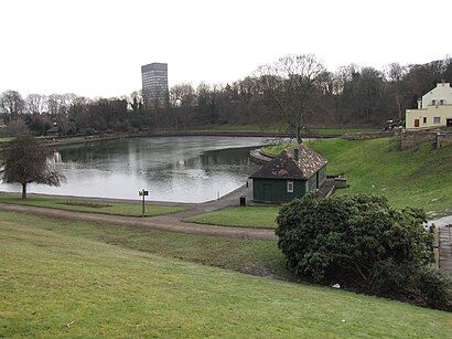
Crookes Valley Park Address: Harcourt Road street in Sheffield
Attractions near Crookes Valley Park
Crookes Valley Park Bowls Club,Goodwin Sports Centre,Weston Park, Sheffield,Cofield Swimming Pool,Weston Park Museum,Weston Park,Weston Park Museum Cafe,Elmfield Building,Bartolomé House,Integritas Marketing,Bartolome House, School of Law,Foundry, Sheffield University,Hillside House Student Accommodation,Fone Fix,Ozmen Local,Firth Court,Dental Practice Unit,Childrens Hospital, Sheffield,S10 2TH,Sheffield Children's HospitalHow to get to popular attractions in Sheffield with public transportation
Doncaster Sheffield International Airport, Finningley,Copley Data Centre, Halifax,The 72 Bus - Bradford To Leeds, Leeds,Oxley Residences, Leeds,Cottingley Towers, Leeds,The Bankers Draft (Wetherspoon), Sheffield,Robin Hood Airport (DSA), Finningley,Chapel Allerton Hospital, Leeds,University Of Leeds (West Campus), Leeds,St James's Hospital A&E, Leeds,Heckmondwike, Heckmondwike,University Of Bradford, Bradford,The Cuthbert Broderick (Wetherspoon), Leeds,Middlewood Tram Stop, Sheffield,Fly Dsa Arena, Sheffield,Market Square, Shipley,Notre Dame High School, Sheffield,Castle Square Tram Stop, Sheffield,Parkgate, Rotherham,Princes Quay Shopping Centre, HullGet around Sheffield by public transport!
Travelling around Sheffield has never been so easy. See step by step directions as you travel to any attraction, street or major public transport station. View bus and train timetables, arrival times, service alerts and detailed routes on a map, so you know exactly how to get to anywhere in Sheffield.
When travelling to any destination around Sheffield use Moovit's Live Directions with Get Off Notifications to know exactly where and how far to walk, how long to wait for your line , and how many stops are left. Moovit will alert you when it’s time to get off — no need to constantly re-check whether yours is the next stop.
Wondering how to use public transport in Sheffield or how to pay for public transport in Sheffield? Moovit public transport app can help you navigate your way with public transport easily, and at minimum cost. It includes public transport fees, ticket prices, and costs. Looking for a map of Sheffield public transport lines? Moovit public transport app shows all public transport maps in Sheffield with all bus, train or light rail routes and stops on an interactive map.
Sheffield has 3 transport type(s), including: bus, train or light rail, operated by several transport agencies, including First Leeds, First South Yorkshire, First York, Arriva Yorkshire, Stagecoach Yorkshire, National Rail, First Bradford, First Halifax, Calder Valley & Huddersfield, East Yorkshire, The Keighley Bus Company, South Yorkshire Future Tram, The Harrogate Bus Company, National Rail, TM Travel and Coastliner