Directions to Crown Square (Derbyshire Dales) with public transport
The following transport lines have routes that pass near Crown Square
How to get to Crown Square by bus?
Click on the bus route to see step by step directions with maps, line arrival times and updated time schedules.
How to get to Crown Square by train?
Click on the train route to see step by step directions with maps, line arrival times and updated time schedules.
Bus stops near Crown Square in Derbyshire Dales
- Bakewell Road, Matlock, 2 min walk,
- Causeway Lane, Matlock, 2 min walk,
- Bakewell Road Bus Station, Matlock, 2 min walk,
- Imperial Road, Matlock, 2 min walk,
- Matlock, 3 min walk,
Bus lines to Crown Square in Derbyshire Dales
- 169, Elton,
- 470, Matlock,
- X17, Matlock - Sheffield,
- 63, Chesterfield - Clay Cross - Matlock,
- 141, Matlock - Ripley,
- 143, Matlock - East Midlands Designer Outlet,
- 143A, Matlock - East Midlands Designer Outlet,
- 158, Matlock - Bonsall,
- 159, Matlock - Matlock,
- LS|SIXES, Wirksworth - Matlock Bath - Matlock,
- TRANSPEAK, Derby - Matlock - Buxton,
- X17, Wirksworth - Matlock,
- 6.1|SIXES, Derby - Bakewell,
- 110, Ashbourne - Matlock,
- 111, Ashbourne - Matlock,
- 157, Matlock - Matlock,
- 160, Matlock - Chatsworth House,
- 471, Darley Dale - Highfields School,
- 140, Matlock,
- 172, Matlock,
What are the nearest stations to Crown Square?
The nearest stations to Crown Square are:
- Bakewell Road, Matlock is 86 meters away, 2 min walk.
- Causeway Lane, Matlock is 100 meters away, 2 min walk.
- Bakewell Road Bus Station, Matlock is 114 meters away, 2 min walk.
- Imperial Road, Matlock is 149 meters away, 2 min walk.
- Matlock is 214 meters away, 3 min walk.
Which bus lines stop near Crown Square?
These bus lines stop near Crown Square: 6.1|SIXES, X17.
Which train line stops near Crown Square?
EAST MIDLANDS RAILWAY
What’s the nearest bus stop to Crown Square in Derbyshire Dales?
The nearest bus stops to Crown Square in Derbyshire Dales are Bakewell Road, Matlock, Causeway Lane, Matlock, Bakewell Road Bus Station, Matlock and Imperial Road, Matlock. The closest one is a 2 min walk away.
What time is the first train to Crown Square in Derbyshire Dales?
The EAST MIDLANDS RAILWAY is the first train that goes to Crown Square in Derbyshire Dales. It stops nearby at 08:28.
What time is the last train to Crown Square in Derbyshire Dales?
The EAST MIDLANDS RAILWAY is the last train that goes to Crown Square in Derbyshire Dales. It stops nearby at 22:56.
What time is the first bus to Crown Square in Derbyshire Dales?
The 6.1|SIXES is the first bus that goes to Crown Square in Derbyshire Dales. It stops nearby at 08:35.
What time is the last bus to Crown Square in Derbyshire Dales?
The 6.1|SIXES is the last bus that goes to Crown Square in Derbyshire Dales. It stops nearby at 20:11.
See Crown Square, Derbyshire Dales, on the map
Public Transit to Crown Square in Derbyshire Dales
How to get to Crown Square in Derbyshire Dales, United Kingdom?
It’s easy with Moovit. Type in your street address and Moovit’s route finder will locate the fastest way to get you there! Not sure where to get off on the street? Download the Moovit App to find live directions (including where to get off on Crown Square), see timetables and get the estimated arrival times for your favourite bus or train lines.
Looking for the nearest stop or station to Crown Square? Check out this list of closest stops available to your destination: Bakewell Road; Causeway Lane; Bakewell Road Bus Station; Imperial Road; Matlock.
Bus: 6.1|SIXES, X17, 169, 470, 63, 141, 143, 143A, LS|SIXES, TRANSPEAK, 110, 140, 172, EAST MIDLANDS RAILWAY.Train: EAST MIDLANDS RAILWAY.
Download the Moovit App to see the current schedule and routes available for Derbyshire Dales. No need to install a special bus app to check the bus time or a train app to get train time. Moovit is the only all-in-one transport app that helps you get where you need to go.
We make riding on public transit to Crown Square easy, which is why over 1.5 million users, including users in Derbyshire Dales trust Moovit as the best app for public transport.
Use the app to navigate to popular places including to the airport, hospital, stadium, grocery store, mall, coffee shop, school, college, and university.
Location: Derbyshire Dales, East Midlands
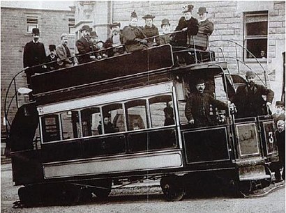
Matlock Cable Tramway was a cable tramway that served the town of Matlock, Derbyshire, UK between 28 March 1893 and 30 September 1927.Wiki
Streets near Crown Square, Derbyshire Dales
Get around Derbyshire Dales's Streets by public transport!
Navigate to any street, avenue, or square with public transport using the app. We mapped all the streets and their public transport stations in Derbyshire Dales. Whether it's a small street, a central street, or a main street, use the app to get from any street to any street in Derbyshire Dales. Use our Live Directions to ride and walk through the streets of Derbyshire Dales with easy-to-use step-by-step directions.
Travelling around Derbyshire Dales has never been so easy. See step by step directions as you travel to any attraction, street or major public transport station. View bus and train timetables, arrival times, service alerts and detailed routes on a map, so you know exactly how to get to anywhere in Derbyshire Dales.
When travelling to any destination around Derbyshire Dales use Moovit's Live Directions with Get Off Notifications to know exactly where and how far to walk, how long to wait for your line , and how many stops are left. Moovit will alert you when it’s time to get off — no need to constantly re-check whether yours is the next stop.
Wondering how to use public transport in Derbyshire Dales or how to pay for public transport in Derbyshire Dales? Moovit public transport app can help you navigate your way with public transport easily, and at minimum cost. It includes public transport fees, ticket prices, and costs. Looking for a map of Derbyshire Dales public transport lines? Moovit public transport app shows all public transport maps in Derbyshire Dales with all bus or train routes and stops on an interactive map.
Derbyshire Dales has 2 transport type(s), including: bus or train, operated by several transport agencies, including National Rail, Ashbourne Community Transport, Delaine Buses, Arriva Midlands, Centrebus, Our Centre, Hulleys of Baslow, D & G Bus, Stagecoach East Midlands, Central Connect, North Lincolnshire Council, National Rail, Roberts Coaches, Lawson's of Corby and Hawkes Coaches