How to get to Cuba Build Design by bus?
Click on the bus route to see step by step directions with maps, line arrival times and updated time schedules.
From Marden Senior College, Marden
50 minFrom Wayville Showgrounds Train Station, Goodwood
51 minFrom RAH, Adelaide
26 minFrom Adelaide Gaol, Adelaide
32 minFrom Adelaide Dental Hospital, Adelaide
29 minFrom Harmony Unite Pty Lt, Torrensville
37 minFrom Adelaide Himeji Japanese Garden, Adelaide
37 minFrom Cedar College, Northgate
86 minFrom tree climb, Adelaide
48 minFrom Tram Stop 6 South Road, Black Forest
50 min
How to get to Cuba Build Design by train?
Click on the train route to see step by step directions with maps, line arrival times and updated time schedules.
Bus stops near Cuba Build Design in Albert Park
Train station near Cuba Build Design in Albert Park
- Woodville, 21 min walk,VIEW
Bus lines to Cuba Build Design in Albert Park
- J7, West Lakes Centre Interchange to Marion Centre Interchange,VIEW
- J7M, West Lakes Centre Interchange / Marion Centre Interchange to Camden Park,VIEW
- 155, West Lakes Centre Interchange to City,VIEW
- 157, Largs Bay to City,VIEW
- J8, West Lakes,VIEW
- AO17, Adelaide Oval,VIEW
- 150, Osborne (and Aus Sub Corp),VIEW
- 150B, Largs Bay,VIEW
- 150P, Port Adelaide,VIEW
- 371, Seaton Clockwise loop,VIEW
- 372, Seaton Anti-Clockwise loop,VIEW
What are the nearest stations to Cuba Build Design?
The nearest stations to Cuba Build Design are:
- Stop 28 West Lakes Blvd - West side is 87 meters away, 3 min walk.
- Stop 28C Cheltenham Pde - West side is 325 meters away, 5 min walk.
- Stop 25 Port Rd - North side is 378 meters away, 6 min walk.
- Stop 26 Port Rd - South West side is 589 meters away, 8 min walk.
- Stop Hail N Ride Osborne St / Botting St is 698 meters away, 10 min walk.
- Woodville is 1640 meters away, 21 min walk.
Which bus lines stop near Cuba Build Design?
These bus lines stop near Cuba Build Design: 150, 157.
Which train lines stop near Cuba Build Design?
These train lines stop near Cuba Build Design: OUTHA, PTDOCK.
What’s the nearest train station to Cuba Build Design in Albert Park?
The nearest train station to Cuba Build Design in Albert Park is Woodville. It’s a 21 min walk away.
What’s the nearest bus station to Cuba Build Design in Albert Park?
The nearest bus station to Cuba Build Design in Albert Park is Stop 28 West Lakes Blvd - West side. It’s a 3 min walk away.
What time is the first train to Cuba Build Design in Albert Park?
The OUTHA is the first train that goes to Cuba Build Design in Albert Park. It stops nearby at 06:24.
What time is the last train to Cuba Build Design in Albert Park?
The OUTHA is the last train that goes to Cuba Build Design in Albert Park. It stops nearby at 01:26.
What time is the first bus to Cuba Build Design in Albert Park?
The 150 is the first bus that goes to Cuba Build Design in Albert Park. It stops nearby at 07:55.
What time is the last bus to Cuba Build Design in Albert Park?
The 155 is the last bus that goes to Cuba Build Design in Albert Park. It stops nearby at 23:27.
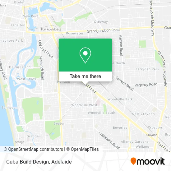
See Cuba Build Design, Albert Park, on the map
Public Transit to Cuba Build Design in Albert Park
Wondering how to get to Cuba Build Design in Albert Park? Moovit helps you find the best way to get to Cuba Build Design with step-by-step directions from the nearest public transit station.
Moovit provides free maps and live directions to help you navigate through your city. View schedules, routes, timetables, and find out how long does it take to get to Cuba Build Design in real time.
Looking for the nearest stop or station to Cuba Build Design? Check out this list of stops closest to your destination: Stop 28 West Lakes Blvd - West side; Stop 28C Cheltenham Pde - West side; Stop 25 Port Rd - North side; Stop 26 Port Rd - South West side; Stop Hail N Ride Osborne St / Botting St; Woodville.
Bus: 150, 157, J7, J7M, 155, J8, AO17, 150B, 150P, 371, 372.Train: OUTHA, PTDOCK, GRNG, OSBORN.
Want to see if there’s another route that gets you there at an earlier time? Moovit helps you find alternative routes or times. Get directions from and directions to Cuba Build Design easily from the Moovit App or Website.
We make riding to Cuba Build Design easy, which is why over 1.5 million users, including users in Albert Park, trust Moovit as the best app for public transit. You don’t need to download an individual bus app or train app, Moovit is your all-in-one transit app that helps you find the best bus time or train time available.
For information on prices of bus, train and light rail, costs and ride fares to Cuba Build Design, please check the Moovit app.
Use the app to navigate to popular places including to the airport, hospital, stadium, grocery store, mall, coffee shop, school, college, and university.
Cuba Build Design Address: 954-956 Port Rd Albert Park SA 5014 street in Albert Park
- TW Ingham & Sons,
- Norwood Fibrous Plaster Works,
- Adelaide Stacking & Racking,
- Bulls Transport Pty Ltd,
- CMI Toyota Port Road,
- CMI Toyota,
- Cmi Portside,
- Mobile Skips Woodville,
- HUMMER sa,
- Amazon Locker-Robinson,
- National Storage Cheltenham Adelaide,
- Mould Removal Adelaide,
- Bunnings,
- Uniquely U,
- Bunnings Warehouse,
- Spotlight Albert park,
- Two Fat Chooks,
- Tecnoeka Australia Pty,
- Inertia Health Group,
- ABC Trade Outlet
Places Near Cuba Build Design (Albert Park)
- Calvary Adelaide Hospital, Adelaide,
- Flinders Private Hospital, Bedford Park,
- Adelaide Zoo, Adelaide,
- Regency TAFE, Regency Park,
- Westfield Tea Tree Plaza, Modbury,
- Adelaide Central Market, Adelaide,
- A Trip A Trip A Trip P, Port Noarlunga,
- Lyell McEwin Hospital, Elizabeth Vale,
- Puff and Present Emporium, Glenelg North,
- Chinatown, Adelaide,
- IKEA, Adelaide Airport,
- Marion Shopping Centre, Oaklands Park,
- Womens and Childrens Hospital, North Adelaide,
- Westfield West Lakes, West Lakes,
- Flinders Medical Centre, Bedford Park,
- St Andrews Hospital, Adelaide,
- Westfield Marion Shopping Centre, Oaklands Park,
- Semaphore Beach, Semaphore,
- Morphettville Racecourse, Morphettville,
- Flinders Medical Centre (Hospital), Bedford Park
How to get to popular places in Adelaide with public transport
Get around Albert Park by public transport!
Travelling around Albert Park has never been so easy. See step by step directions as you travel to any attraction, street or major public transport station. View bus and train timetables, arrival times, service alerts and detailed routes on a map, so you know exactly how to get to anywhere in Albert Park.
When travelling to any destination around Albert Park use Moovit's Live Directions with Get Off Notifications to know exactly where and how far to walk, how long to wait for your line , and how many stops are left. Moovit will alert you when it’s time to get off — no need to constantly re-check whether yours is the next stop.
Wondering how to use public transport in Albert Park or how to pay for public transport in Albert Park? Moovit public transport app can help you navigate your way with public transport easily, and at minimum cost. It includes public transport fees, ticket prices, and costs. Looking for a map of Albert Park public transport lines? Moovit public transport app shows all public transport maps in Albert Park with all Bus, Train, Light rail and Ferry routes and stops on an interactive map.
Adelaide has 4 transport type(s), including: Bus, Train, Light rail and Ferry, operated by several transport agencies, including Adelaide Metro (Busways), SouthLink, Torrens Transit, Adelaide Metro Train and Adelaide Metro (Rail Commissioner Tram)