Directions to Darwin Botanic Gardens station (The Gardens) with public transport
The following transport lines have routes that pass near Darwin Botanic Gardens
How to get to Darwin Botanic Gardens station by bus?
Click on the bus route to see step by step directions with maps, line arrival times and updated time schedules.
Bus stops near Darwin Botanic Gardens in The Gardens
- Margaret Street, 6 min walk,
- Stuart Hwy After King St, 7 min walk,
- Gilruth Ave Opp Casino, 15 min walk,
Bus lines to Darwin Botanic Gardens station in The Gardens
- 7, Stuart Park, Bayview,
- OL1, Orbital 1,
- OL2, Orbital 2,
- 5, Darwin Interchange To Casuarina Interchange,
- 6, Museum Fannie Bay Parap,
- 8, Palmerston Via St Marys School,
- 10, Casuarina Via Bagot Rd,
- 21, Darwin Hospital Precinct Express,
- 22, Leanyer Express,
- 25, Darwin Interchange Semi Express,
- 4, Darwin Via Nightcliff/Parap/Museum,
What are the nearest stations to Darwin Botanic Gardens?
The nearest stations to Darwin Botanic Gardens are:
- Margaret Street is 389 meters away, 6 min walk.
- Stuart Hwy After King St is 452 meters away, 7 min walk.
- Gilruth Ave Opp Casino is 1117 meters away, 15 min walk.
Which bus lines stop near Darwin Botanic Gardens?
These bus lines stop near Darwin Botanic Gardens: 10, 4.
What’s the nearest bus stop to Darwin Botanic Gardens in The Gardens?
The nearest bus stop to Darwin Botanic Gardens in The Gardens is Margaret Street. It’s a 6 min walk away.
What time is the first bus to Darwin Botanic Gardens in The Gardens?
The 10 is the first bus that goes to Darwin Botanic Gardens in The Gardens. It stops nearby at 07:01.
What time is the last bus to Darwin Botanic Gardens in The Gardens?
The 8 is the last bus that goes to Darwin Botanic Gardens in The Gardens. It stops nearby at 20:07.
See Darwin Botanic Gardens, The Gardens, on the map
Public Transit to Darwin Botanic Gardens in The Gardens
Wondering how to get to Darwin Botanic Gardens in The Gardens, Australia? Moovit helps you find the best way to get to Darwin Botanic Gardens with step-by-step directions from the nearest public transit station.
Moovit provides free maps and live directions to help you navigate through your city. View schedules, routes, timetables, and find out how long does it take to get to Darwin Botanic Gardens in real time.
Looking for the nearest stop or station to Darwin Botanic Gardens? Check out this list of stops closest to your destination: Margaret Street; Stuart Hwy After King St; Gilruth Ave Opp Casino.
Bus: 10, 4, 7, OL1, OL2, 5, 6, 8.
Want to see if there’s another route that gets you there at an earlier time? Moovit helps you find alternative routes or times. Get directions from and directions to Darwin Botanic Gardens easily from the Moovit App or Website.
We make riding to Darwin Botanic Gardens easy, which is why over 1.5 million users, including users in The Gardens, trust Moovit as the best app for public transit. You don’t need to download an individual bus app or train app, Moovit is your all-in-one transit app that helps you find the best bus time or train time available.
For information on prices of bus, costs and ride fares to Darwin Botanic Gardens, please check the Moovit app.
Use the app to navigate to popular places including to the airport, hospital, stadium, grocery store, mall, coffee shop, school, college, and university.
Darwin Botanic Gardens Address: Gardens Rd. street in The Gardens
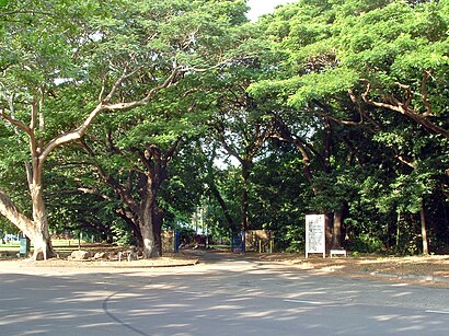
The George Brown Darwin Botanic Gardens is a botanical garden located 2 km north of the CBD of Darwin, Northern Territory, Australia.Wiki
Directions to Darwin Botanic Gardens station (The Gardens) with public transport
How to get to popular places in Darwin with public transport
Get around The Gardens by public transport!
Travelling around The Gardens has never been so easy. See step by step directions as you travel to any attraction, street or major public transport station. View bus and train timetables, arrival times, service alerts and detailed routes on a map, so you know exactly how to get to anywhere in The Gardens.
When travelling to any destination around The Gardens use Moovit's Live Directions with Get Off Notifications to know exactly where and how far to walk, how long to wait for your line , and how many stops are left. Moovit will alert you when it’s time to get off — no need to constantly re-check whether yours is the next stop.
Wondering how to use public transport in The Gardens or how to pay for public transport in The Gardens? Moovit public transport app can help you navigate your way with public transport easily, and at minimum cost. It includes public transport fees, ticket prices, and costs. Looking for a map of The Gardens public transport lines? Moovit public transport app shows all public transport maps in The Gardens with all bus routes and stops on an interactive map.
Darwin has 1 transport type(s), including: bus, operated by several transport agencies, including Department of Transport