See Deagon on the map
Directions to Deagon with public transportation
The following transport lines have routes that pass near Deagon
 Bus:
Bus: - Train:
How to get to Deagon by bus?
Click on the bus route to see step by step directions with maps, line arrival times and updated time schedules.
How to get to Deagon by train?
Click on the train route to see step by step directions with maps, line arrival times and updated time schedules.
Bus stations near Deagon
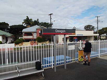
- Deagon Station - Albury St,1 min walk,
- Adams St Near Finnie Rd,2 min walk,
- Board St at Deagon Racecourse, Stop 29,8 min walk,
Train stations near Deagon
- North Boondall Station,15 min walk,
Bus routes to Deagon
- R348,Shorncliffe Station,
- 314,Sandgate Station,
- 310,Brighton, Hornibrook Hwy,
- 326,Toombul Interchange,
- 335,Sandgate Station,
- N310,Sandgate,
What are the nearest stations to Deagon?
The nearest stations to Deagon are:
- Deagon Station - Albury St is 44 meters away, 1 min walk.
- Adams St Near Finnie Rd is 97 meters away, 2 min walk.
- Board St at Deagon Racecourse, Stop 29 is 569 meters away, 8 min walk.
- North Boondall Station is 1141 meters away, 15 min walk.
Which bus lines stop near Deagon?
These bus lines stop near Deagon: 310, 335, 690.
Which train lines stop near Deagon?
These train lines stop near Deagon: CLEV, SHOR.
What’s the nearest train station to Deagon?
The nearest train station to Deagon is North Boondall Station. It’s a 15 min walk away.
What’s the nearest bus stop to Deagon?
The nearest bus stop to Deagon is Deagon Station - Albury St. It’s a 1 min walk away.
What time is the first train to Deagon?
The SHOR is the first train that goes to Deagon. It stops nearby at 05:09.
What time is the last train to Deagon?
The CLEV is the last train that goes to Deagon. It stops nearby at 19:50.
What time is the first bus to Deagon?
The 335 is the first bus that goes to Deagon. It stops nearby at 05:42.
What time is the last bus to Deagon?
The R348 is the last bus that goes to Deagon. It stops nearby at 01:07.
How much is the bus fare to Deagon?
The bus fare to Deagon costs about $2.84 - $4.34.
How much is the train fare to Deagon?
The train fare to Deagon costs about $2.84 - $6.63.
See Deagon on the map
Public Transportation to Deagon
Wondering how to get to Deagon, Australia? Moovit helps you find the best way to get to Deagon with step-by-step directions from the nearest public transit station.
Moovit provides free maps and live directions to help you navigate through your city. View schedules, routes, timetables, and find out how long does it take to get to Deagon in real time.
Looking for the nearest stop or station to Deagon? Check out this list of stops closest to your destination: Deagon Station - Albury St; Adams St Near Finnie Rd; Board St at Deagon Racecourse; North Boondall Station.
Bus:Train:
Want to see if there’s another route that gets you there at an earlier time? Moovit helps you find alternative routes or times. Get directions from and directions to Deagon easily from the Moovit App or Website.
We make riding to Deagon easy, which is why over 1.5 million users, including users in Brisbane, trust Moovit as the best app for public transit. You don’t need to download an individual bus app or train app, Moovit is your all-in-one transit app that helps you find the best bus time or train time available.
For information on prices of bus and train, costs and ride fares to Deagon, please check the Moovit app.
Use the app to navigate to popular places including to the airport, hospital, stadium, grocery store, mall, coffee shop, school, college, and university.
Location: Brisbane
Deagon is an outer northern suburb in the City of Brisbane, Queensland, Australia. In the 2021 census, Deagon had a population of 3,773 people.Wiki
Popular routes to Deagon
Popular routes from Deagon
Attractions near Deagon
Kwan Um School of Zen Australia,Track Star Cafe,Western Sunset Pty LTD Trading AS Alltime,Faceid Australia,Cheapo Bond Carpet Cleaning Pest Control Group,Civicnet,Moneyquest Chermside,Atomic Bronze Tan & Beauty,Moroccantan,Mint Hair by Amy Jayne,Stax of Fitness,Everything Body Co,Flipster,Etched Artworks,Deagon Wetlands,Deagon Dress UPS,Smarterlife Evolution,Ape,Loftus Street Park,Madmacs CoffeeHow to get to popular attractions in Brisbane with public transportation
Noosa Heads, Noosa Heads,Sea World, Main Beach,Surfers Paradise,Southbank Cineplex, South Brisbane,Logan Hyperdome, Shailer Park,Macleay Island,Belmont Tavern, Belmont,UQ Chancellors's Place, St Lucia,Rochedale State High School, Rochedale,Toombul Shopping Centre, Nundah,Queen Street, City,Oxford 152, Bulimba,Myer Centre, City,Tower Of Terror II, Coomera,Cultural Centre Platform 2, South Brisbane,New Farm Park Ferry Terminal,Carindale, Carindale,Broadwater Parklands, Southport,Lutwyche City, Lutwyche,Forest Lake, Forest LakeGet around Brisbane by public transport!
Travelling around Brisbane has never been so easy. See step by step directions as you travel to any attraction, street or major public transport station. View bus and train timetables, arrival times, service alerts and detailed routes on a map, so you know exactly how to get to anywhere in Brisbane.
When travelling to any destination around Brisbane use Moovit's Live Directions with Get Off Notifications to know exactly where and how far to walk, how long to wait for your line , and how many stops are left. Moovit will alert you when it’s time to get off — no need to constantly re-check whether yours is the next stop.
Wondering how to use public transport in Brisbane or how to pay for public transport in Brisbane? Moovit public transport app can help you navigate your way with public transport easily, and at minimum cost. It includes public transport fees, ticket prices, and costs. Looking for a map of Brisbane public transport lines? Moovit public transport app shows all public transport maps in Brisbane with all bus or train routes and stops on an interactive map.
Brisbane has 2 transport type(s), including: bus or train, operated by several transport agencies, including TransLink SEQ, TransLink, TransLink, TransLink, Christensens Bus and Coach, North Stradbroke Island Buses and Griffith Uni Intercampus bus