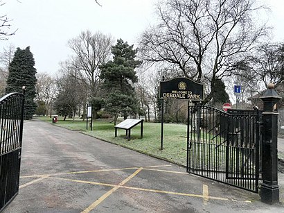
Directions to Debdale Park (Manchester) with public transport
The following transport lines have routes that pass near Debdale Park
 Bus:
Bus: - Train:
- Light rail:
How to get to Debdale Park by bus?
Click on the bus route to see step by step directions with maps, line arrival times and updated time schedules.
How to get to Debdale Park by train?
Click on the train route to see step by step directions with maps, line arrival times and updated time schedules.
How to get to Debdale Park by light rail?
Click on the light rail route to see step by step directions with maps, line arrival times and updated time schedules.
Bus stations near Debdale Park in Manchester
- Far Lane,1 min walk,
- Wellington Street,3 min walk,
- Gorton Labour Club,7 min walk,
- Gorton Post Office,7 min walk,
- Sacred Heart Church,9 min walk,
Light Rail stations near Debdale Park in Manchester
- Edge Lane (Manchester Metrolink),21 min walk,
Train stations near Debdale Park in Manchester
- Fairfield,47 min walk,
Bus lines to Debdale Park in Manchester
- 7,Gorton,
- 201,Hyde,
- 201N,Manchester City Centre,
- 202,Hyde,
- 203,Ardwick,
- 205,Dane Bank,
- 705,Abbey Hey,
- 706,Levenshulme,
- 705,Kingston,
- 150,Abbey Hey,
- 171,East Didsbury,
- 172,Newton Heath,
- 688,Ryder Brow,
- 713,Belle Vue,
- 725,Belle Vue,
- 53,Cheetham Hill,
- 727,Ardwick,
- 748,Burnage,
What are the nearest stations to Debdale Park?
The nearest stations to Debdale Park are:
- Far Lane is 40 meters away, 1 min walk.
- Wellington Street is 173 meters away, 3 min walk.
- Gorton Labour Club is 482 meters away, 7 min walk.
- Gorton Post Office is 538 meters away, 7 min walk.
- Sacred Heart Church is 645 meters away, 9 min walk.
- Edge Lane (Manchester Metrolink) is 1588 meters away, 21 min walk.
- Fairfield is 3613 meters away, 47 min walk.
Which bus lines stop near Debdale Park?
These bus lines stop near Debdale Park: 201, 202, 203, 53, 7.
Which train line stops near Debdale Park?
NORTHERN
Which light rail line stops near Debdale Park?
BLUE LINE
What’s the nearest light rail station to Debdale Park in Manchester?
The nearest light rail station to Debdale Park in Manchester is Edge Lane (Manchester Metrolink). It’s a 21 min walk away.
What’s the nearest bus stop to Debdale Park in Manchester?
The nearest bus stop to Debdale Park in Manchester is Far Lane. It’s a 1 min walk away.
What time is the first light rail to Debdale Park in Manchester?
The BLUE LINE is the first light rail that goes to Debdale Park in Manchester. It stops nearby at 05:35.
What time is the last light rail to Debdale Park in Manchester?
The BLUE LINE is the last light rail that goes to Debdale Park in Manchester. It stops nearby at 00:37.
What time is the first train to Debdale Park in Manchester?
The NORTHERN is the first train that goes to Debdale Park in Manchester. It stops nearby at 06:37.
What time is the last train to Debdale Park in Manchester?
The NORTHERN is the last train that goes to Debdale Park in Manchester. It stops nearby at 21:30.
What time is the first bus to Debdale Park in Manchester?
The 203 is the first bus that goes to Debdale Park in Manchester. It stops nearby at 04:16.
What time is the last bus to Debdale Park in Manchester?
The 203 is the last bus that goes to Debdale Park in Manchester. It stops nearby at 00:09.
See Debdale Park, Manchester, on the map
Public Transit to Debdale Park in Manchester
Wondering how to get to Debdale Park in Manchester, United Kingdom? Moovit helps you find the best way to get to Debdale Park with step-by-step directions from the nearest public transit station.
Moovit provides free maps and live directions to help you navigate through your city. View schedules, routes, timetables, and find out how long does it take to get to Debdale Park in real time.
Looking for the nearest stop or station to Debdale Park? Check out this list of stops closest to your destination: Far Lane; Wellington Street; Gorton Labour Club; Gorton Post Office; Sacred Heart Church; Edge Lane (Manchester Metrolink); Fairfield.
Bus:Train:Light rail:
Want to see if there’s another route that gets you there at an earlier time? Moovit helps you find alternative routes or times. Get directions from and directions to Debdale Park easily from the Moovit App or Website.
We make riding to Debdale Park easy, which is why over 1.5 million users, including users in Manchester, trust Moovit as the best app for public transit. You don’t need to download an individual bus app or train app, Moovit is your all-in-one transit app that helps you find the best bus time or train time available.
For information on prices of bus, light rail and train, costs and ride fares to Debdale Park, please check the Moovit app.
Use the app to navigate to popular places including to the airport, hospital, stadium, grocery store, mall, coffee shop, school, college, and university.
Debdale Park Address: Hyde Road street in Manchester
Attractions near Debdale Park
The Waggon & Horses,Hyde Road (Gorton),Gorton,Male Strippers for Ladies,Lucky Wines,PureGym Manchester Debdale Park,Builders Gorton,MHHG,Pure Gym Debdale,Holiday Inn Express Manchester - East,Olaoluwa African Shop,Quality Hands,Holiday Inn Express Manchester East an IHG Hotel,TESCO extra,Holiday Inn Express,Abitoy Company Limited,M18 7et,Formerly the Bandstand Pub - Demolished After Fire In 2018,Debdale Eco Centre,Kuttanad TasteHow to get to popular attractions in Manchester with public transportation
Manchester Aquatics Centre, Manchester,Old Swan, Liverpool,Anchorage Metrolink Station, Salford,Stepping Hill Hospital, Stockport,Primark, Preston,City Centre - Liverpool Road, Manchester,Sapporo Teppanyaki, Manchester,Sefton Park, Liverpool,Goodison Park, Liverpool,Deansgate, Manchester,North Manchester General Hospital, Manchester,Piccadilly, Manchester,Loreto College, Trafford Bar,Priestley College, Warrington,Hopwood Hall College Middleton, Middleton,Birkenhead Bus Depot, Birkenhead,Manchester Academy, Manchester,Manchester Royal Infirmary, Manchester,Salford Royal Nhs Foundation Trust, Salford,Withington Library, ManchesterGet around Manchester by public transport!
Travelling around Manchester has never been so easy. See step by step directions as you travel to any attraction, street or major public transport station. View bus and train timetables, arrival times, service alerts and detailed routes on a map, so you know exactly how to get to anywhere in Manchester.
When travelling to any destination around Manchester use Moovit's Live Directions with Get Off Notifications to know exactly where and how far to walk, how long to wait for your line , and how many stops are left. Moovit will alert you when it’s time to get off — no need to constantly re-check whether yours is the next stop.
Wondering how to use public transport in Manchester or how to pay for public transport in Manchester? Moovit public transport app can help you navigate your way with public transport easily, and at minimum cost. It includes public transport fees, ticket prices, and costs. Looking for a map of Manchester public transport lines? Moovit public transport app shows all public transport maps in Manchester with all bus, light rail or train routes and stops on an interactive map.
Manchester has 3 transport type(s), including: bus, light rail or train, operated by several transport agencies, including Stagecoach Manchester, Arriva North West, Diamond Bus North West, Stagecoach Merseyside and South Lancashire, Stagecoach Cumbria and North Lancashire, First Greater Manchester, First Halifax, National Express, Warrington's Own Buses, First Potteries, Rosso, Blackpool Transport, The Blackburn Bus Company, The Burnley Bus Company and Vision Bus