Directions to Deepfields (Spring Vale) with public transport
The following transport lines have routes that pass near Deepfields
How to get to Deepfields by bus?
Click on the bus route to see step by step directions with maps, line arrival times and updated time schedules.
How to get to Deepfields by train?
Click on the train route to see step by step directions with maps, line arrival times and updated time schedules.
Bus stations near Deepfields in Spring Vale
- Hinchcliffe Avenue, 3 min walk,
- Meadow Lane, 5 min walk,
- Black Country Route, 6 min walk,
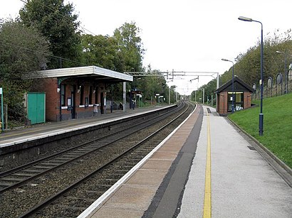
Train stations near Deepfields in Spring Vale
- Coseley, 40 min walk,
Bus lines to Deepfields in Spring Vale
- 229, Dudley,
- 8, Stourbridge,
- X8, Birmingham,
- 223, Bilston,
What are the nearest stations to Deepfields?
The nearest stations to Deepfields are:
- Hinchcliffe Avenue is 117 meters away, 3 min walk.
- Meadow Lane is 274 meters away, 5 min walk.
- Black Country Route is 335 meters away, 6 min walk.
- Coseley is 3101 meters away, 40 min walk.
Which bus lines stop near Deepfields?
These bus lines stop near Deepfields: 229, 8, X8.
Which train line stops near Deepfields?
WEST MIDLANDS RAILWAY
What’s the nearest bus stop to Deepfields in Spring Vale?
The nearest bus stop to Deepfields in Spring Vale is Hinchcliffe Avenue. It’s a 3 min walk away.
What time is the first train to Deepfields in Spring Vale?
The WEST MIDLANDS RAILWAY is the first train that goes to Deepfields in Spring Vale. It stops nearby at 05:35.
What time is the last train to Deepfields in Spring Vale?
The WEST MIDLANDS RAILWAY is the last train that goes to Deepfields in Spring Vale. It stops nearby at 00:16.
What time is the first bus to Deepfields in Spring Vale?
The X8 is the first bus that goes to Deepfields in Spring Vale. It stops nearby at 04:43.
What time is the last bus to Deepfields in Spring Vale?
The X8 is the last bus that goes to Deepfields in Spring Vale. It stops nearby at 00:25.
See Deepfields, Spring Vale, on the map
Public Transit to Deepfields in Spring Vale
Wondering how to get to Deepfields in Spring Vale, United Kingdom? Moovit helps you find the best way to get to Deepfields with step-by-step directions from the nearest public transit station.
Moovit provides free maps and live directions to help you navigate through your city. View schedules, routes, timetables, and find out how long does it take to get to Deepfields in real time.
Looking for the nearest stop or station to Deepfields? Check out this list of stops closest to your destination: Hinchcliffe Avenue; Meadow Lane; Black Country Route; Coseley.
Bus: 229, 8, X8, 223.Train: WEST MIDLANDS RAILWAY.
Want to see if there’s another route that gets you there at an earlier time? Moovit helps you find alternative routes or times. Get directions from and directions to Deepfields easily from the Moovit App or Website.
We make riding to Deepfields easy, which is why over 1.5 million users, including users in Spring Vale, trust Moovit as the best app for public transit. You don’t need to download an individual bus app or train app, Moovit is your all-in-one transit app that helps you find the best bus time or train time available.
For information on prices of bus, train and light rail, costs and ride fares to Deepfields, please check the Moovit app.
Use the app to navigate to popular places including to the airport, hospital, stadium, grocery store, mall, coffee shop, school, college, and university.
Deepfields Address: Meadow Lane street in Spring Vale
Attractions near Deepfields
Forgeco,Equicar,Waterside Motor Services,Metal Spraying Uk,Coseley Substation,Tanmill,DW Windows,Anchor Lane Recycling Centre,19 Biddings Lane,Dewsbury & Proud,J T Matthews Roofing Centre,Midland van Hire,Wv14 9pl,Corporate Office Furniture by the Designer Office,Sankey Laminations Limited,Barnshaws,Quality Office Sup,Seafood Crush,The Breakfast Box,D B Sloperij and Valet CentreHow to get to popular attractions in Spring Vale with public transportation
Hilton Birmingham Metropole, Bickenhill,Bull Street, Ladywood,The Sixth Form College, Solihull, St. Alphege,Odeon Cinema, Etruria And Hanley,Walsall, St. Matthew's,Fox And Goose, End,Kingstanding Circle, Oscott,Birmingham Heartlands Hospital, Heartlands,Dudley, St. James's,Stourbridge Interchange, Wollaston And Stourbridge Town,Cotteridge, Bournville & Cotteridge,Solihull, St. Alphege,Hanley, Etruria And Hanley,West Bromwich Bus Station, West Bromwich Central,Saint Paul's Bus Station, St. Matthew's,University Of Wolverhampton, St. Peter's,Barford, Budbrooke,Star City, Nechells,Touchwood Shopping Mall, St. Alphege,Harborne Academy, EdgbastonGet around West Midlands by public transport!
Travelling around West Midlands has never been so easy. See step by step directions as you travel to any attraction, street or major public transport station. View bus and train timetables, arrival times, service alerts and detailed routes on a map, so you know exactly how to get to anywhere in West Midlands.
When travelling to any destination around West Midlands use Moovit's Live Directions with Get Off Notifications to know exactly where and how far to walk, how long to wait for your line , and how many stops are left. Moovit will alert you when it’s time to get off — no need to constantly re-check whether yours is the next stop.
Wondering how to use public transport in West Midlands or how to pay for public transport in West Midlands? Moovit public transport app can help you navigate your way with public transport easily, and at minimum cost. It includes public transport fees, ticket prices, and costs. Looking for a map of West Midlands public transport lines? Moovit public transport app shows all public transport maps in West Midlands with all Bus, Train and Light rail routes and stops on an interactive map.
West Midlands has 3 transport type(s), including: Bus, Train and Light rail, operated by several transport agencies, including National Express West Midlands, National Express Coventry, National Express, Diamond Bus, Arriva Midlands, Stagecoach Midlands, West Midlands Metro, Stagecoach West, Stagecoach South Wales, First Potteries, First Worcestershire, LandFlight, trentbarton, D & G Bus, Flexibus