See Derby Industrial Museum on the map
Directions to Derby Industrial Museum with public transportation
The following transport lines have routes that pass near Derby Industrial Museum
 Bus:
Bus: - Train:
How to get to Derby Industrial Museum by bus?
Click on the bus route to see step by step directions with maps, line arrival times and updated time schedules.
How to get to Derby Industrial Museum by train?
Click on the train route to see step by step directions with maps, line arrival times and updated time schedules.
Bus stations near Derby Industrial Museum
- Queen Street, Derby (C6),3 min walk,
- Full Street, Derby (C4),4 min walk,
- Derwent Street, Derby (C7),4 min walk,
- Derwent Street, Derby (C9),5 min walk,
Bus routes to Derby Industrial Museum
- ALLESTREE,Derby - University - Allestree,
- 6E|SIXES,Derby - Duffield - Belper - Heage - Ripley,
- 6X|SIXES,Derby - Duffield - Belper - Belper Estates,
- 6.0|SIXES,Derby - Duffield - Belper,
- 6.1|SIXES,Derby - Bakewell,
- 6.2|SIXES,Derby - Duffield - Belper - Heage - Ripley,
- 6.3|SIXES,Derby - Duffield - Belper - Heage - Ripley,
- 114,Derby - Weston Underwood - Hulland Ward - Ashbourne,
- 239,Derby - Darley Abbey - St Benedicts School,
- MICKLEOVER,Derby - Mickleover - Derby,
- SWIFT,Derby - Uttoxeter,
- VILLAGER,Derby - Etwall - Hilton - Hatton - Tutbury - Burton,
- U1,Derby - University of Derby (Kedleston Road Site),
- V3,Derby - Findern - Willington - Repton - Burton upon Trent,
- 8,Derby - Mackworth Estate (Circular),
- 8A,Derby City Centre - Mackworth Estate,
- X38,Derby - Burton-upon-Trent,
- 59,Derby - Shipley View,
- 71,Derby - Belper,
- COMET,Derby - Ripley - Alfreton - Clay Cross - Chesterfield,
What are the nearest stations to Derby Industrial Museum?
The nearest stations to Derby Industrial Museum are:
- Queen Street, Derby (C6) is 203 meters away, 3 min walk.
- Full Street, Derby (C4) is 230 meters away, 4 min walk.
- Derwent Street, Derby (C7) is 266 meters away, 4 min walk.
- Derwent Street, Derby (C9) is 318 meters away, 5 min walk.
Which bus lines stop near Derby Industrial Museum?
These bus lines stop near Derby Industrial Museum: 6, 6.3, 7.1, 9A, BLACK CAT, INDIGO, SKYLINK LEICESTER DERBY.
Which train lines stop near Derby Industrial Museum?
These train lines stop near Derby Industrial Museum: CROSSCOUNTRY, EAST MIDLANDS TRAINS.
What’s the nearest bus stop to Derby Industrial Museum?
The nearest bus stop to Derby Industrial Museum is Queen Street, Derby (C6). It’s a 3 min walk away.
See Derby Industrial Museum on the map
Public Transportation to Derby Industrial Museum
Wondering how to get to Derby Industrial Museum, United Kingdom? Moovit helps you find the best way to get to Derby Industrial Museum with step-by-step directions from the nearest public transit station.
Moovit provides free maps and live directions to help you navigate through your city. View schedules, routes, timetables, and find out how long does it take to get to Derby Industrial Museum in real time.
Looking for the nearest stop or station to Derby Industrial Museum? Check out this list of stops closest to your destination: Queen Street; Full Street; Derwent Street; Derwent Street.
Bus:Train:
Want to see if there’s another route that gets you there at an earlier time? Moovit helps you find alternative routes or times. Get directions from and directions to Derby Industrial Museum easily from the Moovit App or Website.
We make riding to Derby Industrial Museum easy, which is why over 1.5 million users, including users in Derby, trust Moovit as the best app for public transit. You don’t need to download an individual bus app or train app, Moovit is your all-in-one transit app that helps you find the best bus time or train time available.
For information on prices of bus and train, costs and ride fares to Derby Industrial Museum, please check the Moovit app.
Use the app to navigate to popular places including to the airport, hospital, stadium, grocery store, mall, coffee shop, school, college, and university.
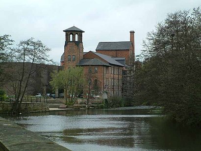
Derby Industrial Museum Address: Derby Derby street in Derby
Attractions near Derby Industrial Museum
Silk Mill Lane,The Silk Mill,The Silk Mill - Derby Industrial Museum,Derby Silk Mill,Derby Makers,Silk Mill Sub-Station,Derby Cathedral Green,A Bridge,Cathedral Green,Apartments 1-26,Bonnie Prince Charlie,Riverside Apartment,De1 2eb,De1 2ej,Sowter Rd / St Michaels Lane Secure Car Park,19 Full Street,Silk Mill Ale & Cider House,Old Silk Mill,Mha,Christchurch CourtHow to get to popular attractions in Derby with public transportation
Bilborough College, Nottingham,E.ON (Bilborough), Nottingham,University Of Derby, Derby,Donut Roundabout Car Park, Chesterfield,Chequered Flag (Hungry Horse), Corby,Lakeside Arts Centre, Nottingham,Soar Valley Way, Leicester,Nettleham, West Lindsey,Royal Derby Hospital, Derby,British Gas Museum, Leicester,Ibis Hotel, Northampton,Wingerworth, North East Derbyshire,Ratcliffe Power Station, Rushcliffe,Holiday Inn Express Peterborough, Peterborough,Sutton-In-Ashfield, Ashfield,Burton Latimer, Kettering,Kingsway Hospital, Derby,Experian Embankment House, Nottingham,Nottingham Council House, Nottingham,The Observatory (Wetherspoon), ErewashGet around Derby by public transport!
Travelling around Derby has never been so easy. See step by step directions as you travel to any attraction, street or major public transport station. View bus and train timetables, arrival times, service alerts and detailed routes on a map, so you know exactly how to get to anywhere in Derby.
When travelling to any destination around Derby use Moovit's Live Directions with Get Off Notifications to know exactly where and how far to walk, how long to wait for your line , and how many stops are left. Moovit will alert you when it’s time to get off — no need to constantly re-check whether yours is the next stop.
Wondering how to use public transport in Derby or how to pay for public transport in Derby? Moovit public transport app can help you navigate your way with public transport easily, and at minimum cost. It includes public transport fees, ticket prices, and costs. Looking for a map of Derby public transport lines? Moovit public transport app shows all public transport maps in Derby with all bus or train routes and stops on an interactive map.
Derby has 2 transport type(s), including: bus or train, operated by several transport agencies, including National Rail, Ashbourne Community Transport, Delaine Buses, Arriva Midlands, Centrebus, Our Centre, Hulleys of Baslow, D & G Bus, Stagecoach East Midlands, North Lincolnshire Council, National Rail, Roberts Coaches, Lawson's of Corby, Hawkes Coaches and East Yorkshire